Since my post 20 2013, we looked forward to the dismantling of the’iPad 3G to discover its communication components (3G, GPS). From the first delivery, Our Friends iFixit rushed to the "beast" for total dissection.
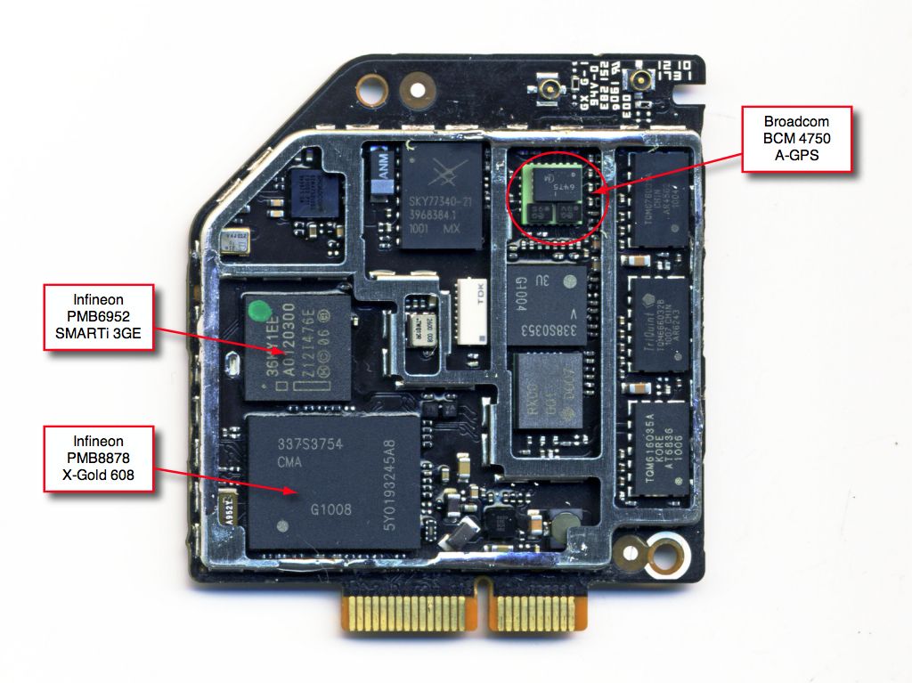
A separate communication board
The 3G model differs from the WiFi model by adding a second board that supports different chipsets dedicated to communication : GPRS, 3G, GPS, power amplifiers and filters, etc,. This explains the absence of GPS in WiFi model, as not directly attached to the motherboard.
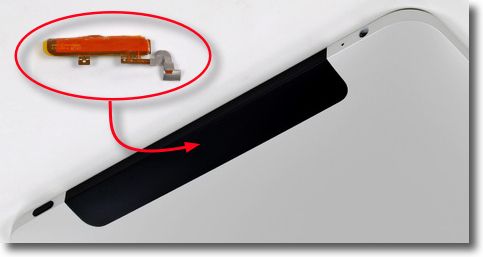
Antennas grouped
A black cover features the 3G model. This cache contains the three antennas (WiFi / Bluetooth, GPS, 3G) standing as possible outside of the unit.
Components used
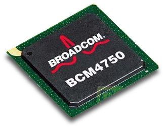
GPS
- The Broadcom chipset is the A-GPS BCM4750, not the Infineon XPOSYS which we would expect.
- The antenna is quite large and properly placed. We can expect a much better reception than the iPhone.
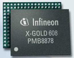
HSDPA / WCDMA / EDGE / GPRS
- Infineon PMB8878 « X-Gold 608 ". This processor is a modem "dual mode" integrated protocol High Speed Downlink Packet Access protocol to equip the latest generation mobile (3G ). It allows download speeds up to 7.2 Mbit/s. Same processor as the iPhone 3GS.
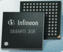
3G
- Infineon PMB6592 « SMARTi 3GE ». Transceiver "dual-mode" quad-band GSM / EDGE and six-band W-CDMA.
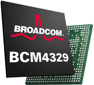
WiFi / Bluetooth
- Chipset Braodcom BCM4329 integrates a complete IEEE 802.11a/b/g/n system (The iPhone is equipped with BCM4325 does not support the latest 802.11n) and Bluetooth 2.1 EDR. It is installed on the motherboard.
First comments on the use of GPS
From the first tests in the USA, it seems that the iPad has a GPS receiver significantly outperforms the iPhone.
Although the iPad is slower to launch the iPhone 3GS to lock GPS position, it then offers a much greater precision and stability. It seems able to keep real-time monitoring the progress of a vehicle, allowing an application of routeing guidance, such Navigon (test conducted by a contributor to the forum macrumors), correctly anticipate changes in direction. While the iPhone occasionally falls, and then struggle in following the progress of the vehicle, repositioning stepwise, not to mention a few times where the position is completely lost.
It may already be reassured to the performance of the built-in A-GPS, and augurs well for the party that developers can draw, taking advantage of the next OS functions 4.0, for the design of their navigation applications. The posting imminent iNavX 3.0 will allow the first tests in the USA.
I just have to check the ability of the antenna, which seems consistent size, to capture the satellite signals from the chart table inside the boat.
I will not fail to mention here in French reviews forum macsailing.net forum on this, pending a personal test as soon as I get a device for my own usage.
[Updated 4/05/2010] By disabling any cellular connection (GPRS/3G) and WiFi, should not be more 40 seconds GPS alone to fix a correct dead on position with an accuracy of about 5 meters high, and then maintain a stable and accurate course.
—
Related article : iPhone built-in GPS : some details.


Hello,
For further Laurent comment, peut-on imaginer le mac du bord comme « serveur Wi-Fi » de navigation, connected on NMEA box and retrieving information from the bus (Central Data, Radar, ASN,..).
The iPad is independent (position and charting) but would receive the NMEA data from MacENC…
Thank you in advance for your reply.
Absolutely. We can now fully connect all instruments NMEA OUT available (Navigation Central Data, AIS, GPS, aso.) via a multiplexer connected to the Mac via USB, and use the MacENC TCP / IP server feature to return data in WiFi to iNavX on iPad and/or iPhone, connected as TCP / IP receiver. This works perfectly.
The only constraint, is that you invest in a Mac + MacENC and iPad (or iPhone) + iNavX. What need can justify the cost ?
Francis,
Thank you for your reply…
Obviously, onboard computer equipment is still subject to this common sense. And I was among those who believe that their place is not fundamentally essential to our board.
However, when the professional equipment can, time for a cruise on a weekend or a few weeks, join the board when it takes the meaning.
If it were only navigation, the good old MLR GPS mapping and paper will always keep its charm, all around this huge map that we take care of unfolding after breakfast on the saloon table or cockpit (following the navigation)… where the pleasure of skipper, a knowing finger, est de montrer la route à suivre jusqu’à ce « petit mouillage sympathique » qui garantira à l’équipage des souvenirs magnifiques de ces quelques jours passés ensemble…
But objectively, à l’heure ou le traceur permet de garder la tête « hors du bateau », to devote precious time to approach difficult to observe… we gain security. If the hardware allows board to take his music more, manage photos, inform concerned parents after a few days at sea, de calmer les enfants devant « Mowgli » qui sont toujours très excités quand il faut affaler le spi, two, by 30 knots… or, to find its way, groundhandling, to ship, sailfish, doctor, the dentist or the nearest jeweler.
Summary, I agree with the idea that investment is certainly disproportionate in relation to the only aid to navigation…
Hello,
Thank you for all that follow in detail and we do enjoy.
Regarding the GPS IPAD, do you think it will be possible to connect a VHF via NMEA to benefit from the advantages of DSC in full ?
Frankly I do not think. Le connecteur « Dock » de l’iPad n’accepte, yet, as input accessories (USB or SD Card). Nothing is expected to export data. It was not until OS 4.0 to see if Apple implements this opportunity for developers. Again I doubt it.