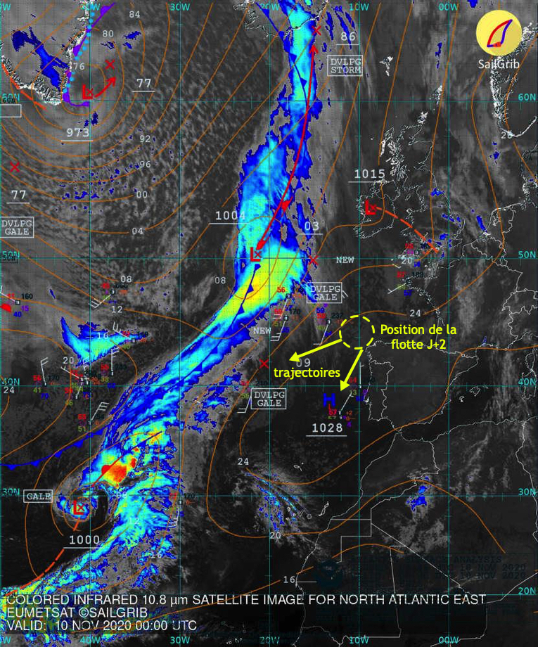
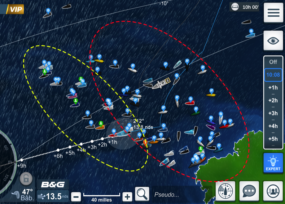
On the second day of racing in this Vendée Globe 2020, we can say that the weather conditions that the skippers will experience on the descent to the Doldrums will be particularly tough. After a departure by a young lady, a first not very active cold front which passed without a hitch, the loners will cross a second much more violent front in the night and morning from Tuesday to Wednesday, for the group going to the West, and in the evening for the group spent between the DST (¹) la France.
But these conditions to come are quite different for Virtual Regatta players andfor sailors…
What makes the big difference between solitaires and players is that Virtual Regatta does not take into account, nor the state of the sea, nor the currents. This already partly explains on D + 2 the gap between the group of players and that of sailors.
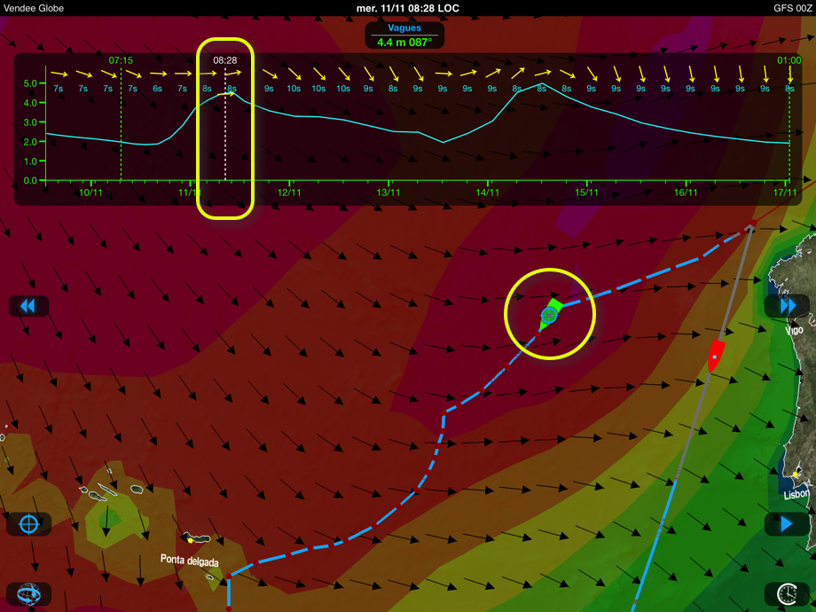
Regarding routing, even using the same GFS 1 ° weather models for racing and for playing, runners' performances are necessarily impacted by the state of the sea, surface currents due to wind, and to a lesser extent ocean currents. And this sea state will be particularly hard to negotiate in the hours to come (²).
This also explains that, at polars of equivalent speed, regular gamers can always stay at 100% efficiency of the fleece integrated into Virtual Regatta, without worrying about the waves that do not reach our screens. But the same will certainly not be the case for browsers. On the one hand, because they will have to leave the theoretical routes for many reasons : save material, minimize dangerous maneuvers such as jibes in heavy seas, optimize their trajectories, etc,, and on the other hand, manage the race over the long term, which requires managing risk taking.
With Weather4D in cruising navigation, you can set a wave height constraint in a routing, for comfort and safety. Race, it is the skipper who is the sole judge of crossing or avoiding, when he can, a dangerous sea area.
After this first obstacle to overcome, another even more dangerous awaits them. To be continued…
–––
(¹) Ddevice of Sseparation of Trafic (absolute exclusion zone for runners)
(²) see Yann Amice's detailed analysis this Tuesday on the West France page of the Vendée Globe.
–––


Bien merci pour ces information très utilisées. Je navigue très proche de vous sous le nom Amalia 🙂
Cordially.
Martin
Really interesting your comments….thank you!
THANK YOU very interesting , as always I appreciate your analysis
Thank you for this analysis.
On the other hand, it seems to me that the polars we have take into account the state of the sea.
How to explain if not that with 20 knots of wind and 110 ° TWA polars indicate 21 knots of speed whereas in real on flat seas the imocas exceed the 30 knots ?
The polars in VR are generic and averaged. Nothing to do with the actual fleeces available to competitors.