 What I had been planning for a long time has finally happened : iNavX lost Navionics cartography ! It seemed obvious that the historic contract which allowed iNavX to have privileged access to Navionics cartography, since the origin of the application designed by Richard Ray in 2009, was threatened. Since then things have changed a lot : purchase of the application by NavX Studio (¹), acquisition of Navionics by Garmin (²), generalization of the annual chart subscription policy (³)…
For French users still numerous, partly thanks to the French version, but above all thanks to Navionics charts covering all of Europe in great detail, without needing to renew subscriptions, it sounds the death knell. Current iNavX developers just announced the integration of vector charts Global C-Map, but with a major limitation : live use only, therefore requiring a permanent internet connection :
Coverage includes and is not limited to : USA, North America, Caribbean, South America, Europe, Asia Pacific, Australia and Africa.
C-MAP World Chart delivers high-res vector charts for global coverage in one easy-to-use chart. Delivered as an Online Chart, the C-MAP World Chart is a worldwide vector chart that navigators have benefited for years. The chart sources are based on ENC and additionnal sources published by hydrographic offices. The C-MAP World Chart is updated quarterly and requires a data connection [via Internet].
The result is that, offline cellular, no more charts are available for Europe (except Germanic coasts and surroundings). And it is highly unlikely that C-Map will allow downloading of the charts., because that would come in competition with their own application which offers this function with an annual "Premium" subscription .
Therefore, what future for iNavX in Europe for offshore sailors ?
[PS] If you don't want to lose the downloaded maps, the account must be deactivated before any update.
[Update on 11 September 2021]
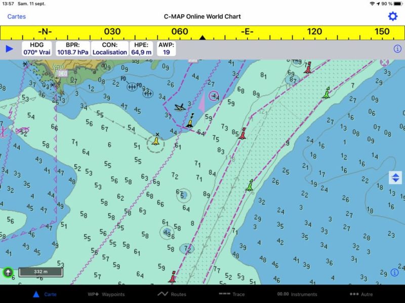
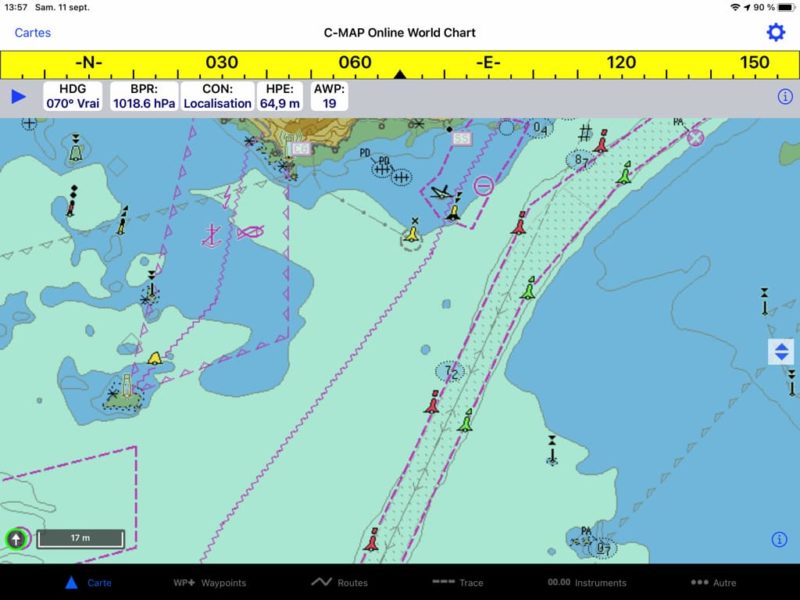
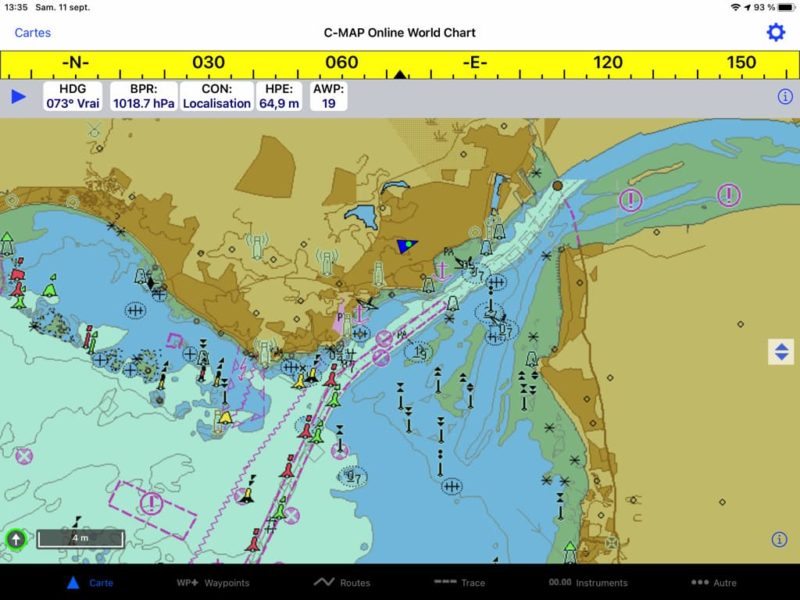
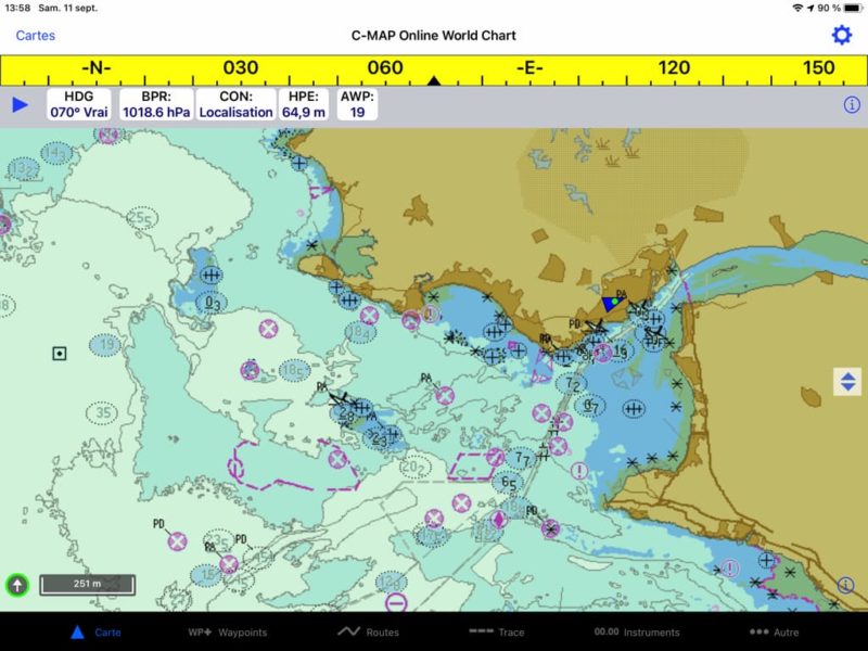
With the sudden price drop (50%) I got the C-Map subscription. I'm glad I did. I could see that in the current state of the display, charts are unusable. No additional information is displayed on the chart : no text (place names and marks, light characteristics, light sectors,…). In addition, the probes disappear at certain scales when zooming out, as well as most of navaids. No C-Map specific display option for information layers is available in Chart view settings, unlike what was offered with Navionics. It seems that it is a work done in emergency... !
–––
(¹) iNavX undergoes a change of ownership
(²) The stakeholders of electronic charting
(³) Digital charts : purchase or subscription [Update] ?
–––


About this new C-Map product, you mention the obligation of a connection for navigation in Europe, except for the German coasts. What about the Caribbean and Central America? ( Guatemala) ?
With C - Map, what is valid for Europe is also valid for the rest of the world. The German publisher Delius Klasing mainly offers maps of the waterways and inland waterways of Germany.
A priori. With the latest update. C-MAP charts can be downloaded, for use without internet connection. To check anyway
Indeed the download function is now activated. But given the size of the files, these are raster maps "tiled" from ENCs, no vector maps. You can download areas of approximately 2 Go maxi, but the download time is prohibitive.
Hello Francis
Well done for everything you do
If I do the last update of INavX, will my Navionics charts still work ?
I downloaded them all and everything is still working fine.
Cordially
Bernard
With the latest update of iNavx, do we risk losing the Navionics catalog that we downloaded?
Or we can continue to use the maps without updating.
I imagine this is the chosen solution, but I prefer to seek advice before doing this update.
Thank you in advance, I'm not alone waiting for the answer.
Good wind
For my part I updated but had disconnected my account. My downloaded maps are still in place. But beware : old Navionics Gold (43XG, 46XG, etc,) are frankly out of date.
Thanks for the answer Francis, I did the same work and it worked well.
Thank you Francis. Update of my card loss announcement. I contacted iNavx support (Jim) very responsive . It follows that :
1) I was able to recover all my navionics cards ( Europe, Caribbean and especially Australia / Pacific)
2) indeed there is an offer at -50% on the C-MAP subscription (that I have not yet subscribed)
3) in the near future, it will be possible to use C-MAP offline, by downloading the necessary zones beforehand
4) Jim also assured me that I could continue to use my Navionics, without limitation of time, even if there will be no more updates
To follow
I discovered with dismay this publication following the disappearance of all my Navionics charts in the iNavX app that I have been using for years, offline on iPad.
1) Is it possible to retrieve all iNavX waypoints to integrate them either in navionics or W4D ?
2) iNavX therefore only becomes usable with internet access ?
Thank you
1) Yes, with the Transfers function of iNavX > AirDrop we send all wp in Weather4D. When opening W4D, you are asked to choose a category, the best is to create a new one, for example "import" or "inavx" and select it. We can then dispatch the wp to other categories. See Site Management in the Manual.
2) For France and Europe yes, outside Germany. Unless C-Map later authorizes the download. See other comments.