 We hoped for a while GRIB.US, is from Theyr it came. The English company Kona Ltd., owner meteorology website theyr.com has launched its application GribView 2.0, for Windows and OS X.
The software is free to download from their website. A first level of GRIB data, from the GFS model at low resolution of NOAA (*), is available for free upon registration and validation of this. Files can be received by email, for use in other applications (MacENC or GPSNavX, in example) or loaded directly into the software viewer.
Other data at higher resolution, from WRF-NMM model (*) are available by paid subscription. However, a trial period 30 days can be subscribed to for free.
Interface
English only, interface is organized as Navimail 2 (Is it a coincidence ?). One side panels offer a dual choice Request/Viewer and the various parameters associated. Three display modes are proposed : spherical, equi-rectangular and Mercator. Finally a banner on the right side shows the exact data to the location of the mouse pointer. The combined display data is very similar to U-Grib, files from the same organization (NOAA), and the zoom level defines the number of grid points on the screen. Large scale, the amount of data is quite small, and increases as the zoom to achieve the resolution of the file (grid of 1 or 0.5 °).
Comparative
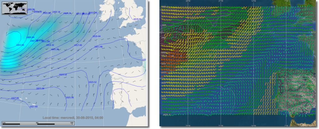
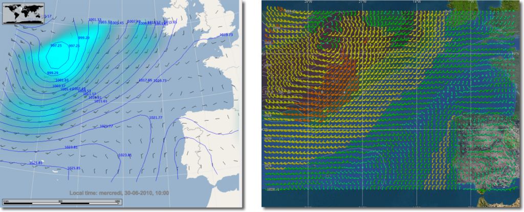
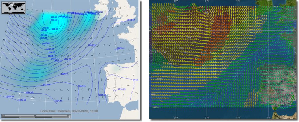
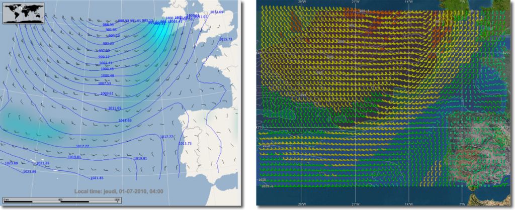
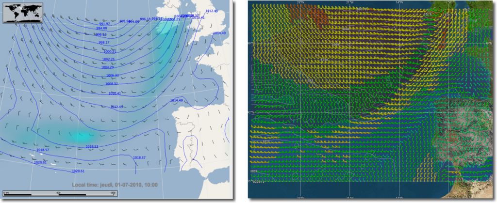
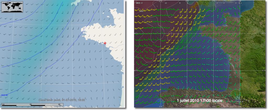
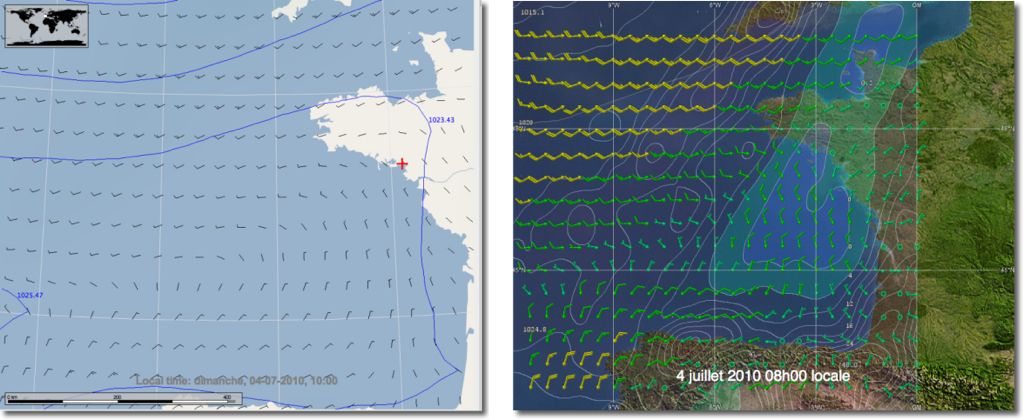
You will find below a series of forecasts by run of 6 hours range, downloaded at the same time since GribView 2.0 (GFS model 1) up to Navimail 2 (IFS model 1). The data display is of course much richer in Navimail, with these multiple control functions, but it remains clear of GribView, particularly precipitation it is better to display lonely in Navimail.
To better appreciate viewing, you have below two comparisons of the same files, but at a zoom level covering the near Atlantic. The information in GribView become significantly lower Navimail. But do not forget the important point : a file of this size, covering the entire North Atlantic, GribView downloaded was free, that of Navimail cost about 90 EUR !
GribView 2.0 has every chance to delight macusers waiting to receive their free Mac GRIB. No need to place the software in a U-Grib Windows Virtualization. Remains only to be satisfied with the GFS forecast model, that, although free, is not the most accurate for local area.
—
(*) See Glossary in Technical links for more explanations.



it was very interesting to read blog.francis-fustier.fr
I want to quote your post in my blog. It can?
And you et an account on Twitter?
You are welcome to quote all parts or entire posts as you want. At, I have no Twitter or Facebook account, and don’t plan to have one.
Hello Francis,
I see that you were able to experiment. For me the real interest App. that is, it actually allows you to "read" a grib file (like the application. Ugrib on a PC). Sea anyway, j’utilise MacEnc, but for people who use a mac but do not operate such, just follow my sailing, they can thus get an idea of the weather. I have not tested to see files outside of the Atlantic, but I think it works. You can indeed view a file that you have "imported" otherwise, Ugrib via internet or via a query by example Saildocs :
A : query@saildocs.com
Object : what you want
Text
send GFS:42N,47N,11W,1E|0.5,0.5|6,9,12,15,18,21,24,30,36,48|WIND,PRMSL
I use these queries to the sea through the iridium (Windows NT and Bootcamp). One of the advantages being that you may request short-term tranches of 3h, then sliced 6, 12 or 24.
As for the GFS file, an, they are free, two, they are not so bad in use cruise off, or in the Pacific for example they are often the only available.
I totally agree on the choice of models GRIB : only the experience of users on all seven seas can get a good view of the accuracy of forecasts by the conditions encountered. Between NOAA GFS model, IFS you CEPMMT, NMM du WRF, there's only lived on board who can answer.
For my own, My recent experience of sailing rather coastal and quality of the application made me prefer Navimail associated with the model Arpege. I only regret that these data are too expensive, when they should be serving the public who finance through taxes.
Hello,
Software PolarView (Free to V 1.3) can also download Grib files. It is available on all platforms.
You are quite right to report. Here are a link to the site Polar Navy.