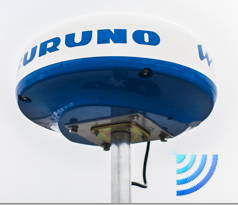
A RADAR screen finally on iPad

Done ! Furuno annouced on 7 th 2014 until Stockholm Boatshow his new radar DRS4WW comes for WiFi – allowing display on iPad and iPhone. Would be available in May in France. The relevant application DRS4W is available for free on all AppStores.

DRS4W is the first radar that features WiFi to, finally, change iPhone and iPad in a real radar display. After satphones connection, Here are the last bastion of marine electronics that falls. More exactly, a leader in marine electronics finally takes into account the irreversible evolution of consumer technology. Read more …
iPad GPS far away from networks

For those who do are not yet fully convinced, despite my assertions in many posts (¹), Here's another example of the accuracy of iPad GPS, cut off from any cellular or terrestrial Wi-Fi network. Already lived in 2011 during a stay in La Reunion (²), this time back from a recent trip to London I brought back the "proofs" below, screenshoted aboard an Airbus A320 : Read more …

Electronic charts : scales and overscale [Update]

A recent email exchange with a Mediterranean user drew my attention to a specific aspect of electronic charting : zoom limitation of a chart. ENC vector charts (¹) are classified in 6 categories depending scale : smallest scales less than 1:1.500.000 for global views to largest scale up to 1:4.000 for harbours and anchorages. (²).

Marine charts international classification

In most cases, ENC S-57 (¹) official charts the most detailed have a scale about 1:4000, thus 1 cm on the chart (screen view) represent 40 meters on the ground. With paper chart, the only way to get more details is… to use a a magnifying glass, that provides, as we know, in no case more accuracy. But it is quite otherwise for electronics charts.

Read more …

Apps de navigation : the (rares) new products in Spring 2014

The least I can say, it’s that the new things don’t jostle. After the frenzy of announcements of 2013, the developers seem to be marking time. It is likely that the proliferation of navigation apps should not promote their profitability, and that the financial return on investment in development and maintenance time should not be obtained by everyone. Navionics charts remains the undisputed leader. By creating its new “Boating” formula to complement and/or replace “Marine” (¹) it revives sales which were probably starting to run out of steam. iNavX remains the best-selling independent application in the USA, and the rest of the world through combination with Navionics cartography, and particularly in France thanks… to the strong promotion to which I contribute. Its developer multiplies very regular updates, which ensures good positioning on the AppStore and user satisfaction, despite the questionable ergonomics of certain functions. Read more …

ZenLoch, The boat loch of the 3rd millennium

After the sextant of the future (¹), presented at the Paris Boat Show last December, here is the loch of the future revisited by a "Professor Calculus", an electronics engineer and genius inventor from Nantes.

The oldest among us will certainly remember this venerable and inexpensive instrument of the old sailing navy : The "boat loch". Quote (²):

The "boat" is a wooden plank, weighted to float vertically and connected to the log line by a crow's foot. On the line we tie knots, spaced in principle 7m72 (or 1/240th of a nautical mile). We put the "boat" in the water and let the line go. we then count, from the first node, how many knots pass through the hand in 15 seconds, which gives the speed in knots.

Read more …

AIS-Wi-Fi transponder less then 590 euros

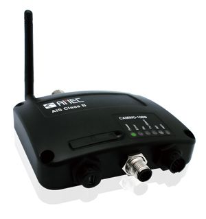
Camino-108WTaiwanese society Alltek Marine Electronics, also known by the acronym AMEC, was specialized since 2006 in the design and device manufacturing AIS. In his presentation, AMEC Announcement to have was founded with the aim to provide the best Marine electronics for navigation, communication and Safety. In the pursuit of this goal, AMEC committed to provide AIS solutions to meet customer expectations for the quality, the Performance, values and Services. His solutions are aimed at to commercial vessels, fishing vessels and Pleasure boats. Read more …

Navionics Boating : Italian at the top of business [Update]

How make the new with the old ? Navionics knows it ! After publishing geographic areas including a navigation application, here is now an application, but without charting. Italian are too much !
Navionics Boating Complements, since January 2014, The App Collection Navy (iPhone) and Marine HD (iPad ). Also available as standard version for iPhone and HD for iPad, Navionics Boating has the same version number 6.0 than others. Navionics point, on the dedicated website page of its website, that Navionics "Boating" does not replace Navionics "Marine" which will continue to be updated. However, it is permissible to wonder for how long, because this new application provides a very bad surprise. Read more …

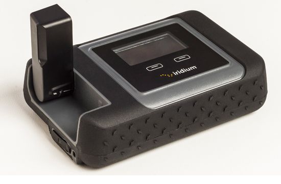
Iridium GO! promises to connect you – nearly – anywhere

Iridium GO!Global satellite company aims at the consumer market with Iridium GO!™ : pack it for camping or world travel.

In all public places where you can wirelessly connect to the Internet today, Wi-Fi isn't ubiquitous yet. And if you are a boater, hiker, pilot, in a campervan or someone who spends a lot of time in nature, The chances of connecting to cyberspace in some remote locations is nearly impossible. It's not just about the data. Try making a cellular phone call in such places !

Read more …

Weather4D still makes greater finesse

With the basic 1.3.3 and PRO versions 1.3.9 delivered last November, Weather4D had replaced the GRIB files fine grid from Great Circle by its own files based on the U.S. model WRF (¹), computed under his own steam. These files cover Europe, Greece, Canaria, Azores, Greater and Lesser Antilles, offer a resolution of 0.1° (6 NM) up to 96 hours by 1 hour steps. The data provided is the same as the GFS model (¹). At the same time, The annual subscription price has been reduced by 60 down to 30 €.

Thanks to the implementation of new means, the next updates that have just been submitted to Apple Store will provide even more details. Olivier Bouyssou explains :

« FYI, App4Nav uses 6 different servers, 2 for the calculation of WRF model and 4 for distributing GRIBs : 2 for the US+Asia region and 2 for Europe. At this time 8000 GRIBs are distributed per day and triple during the season… ”

This now enables to provide, for the French coasts, including Corsica, ultra-fine grid to 0.04 °, that to say 2,4 NM. It also adds to the GFS and WRF files new data evaluating wind gusts. Read more …