From 9 month that NavimetriX is launched, the application receives a major update. After the many functions added over the weeks – have a look on the roadmap published upon launch in the FAQ (¹) – and the adjustments made gradually by attentively listening to user feedback, here is a completely redesigned version of the interface, with a new unified typography and a consistent design system across the entire application. It integrates, at the same time, an analog instrument cluster and many other new features.
A redesigned interface
Full screen map, edge to edge :
- The chart takes up the entire screen, and “chrome” (labels, value bar, dock, aso.) floats on top with glass style. It appears when touched and disappears on its own so as not to hide anything.
- Side drawers are now hidden/displayed by handles (drawer to the left of the tabs, drawer to the right of Settings).
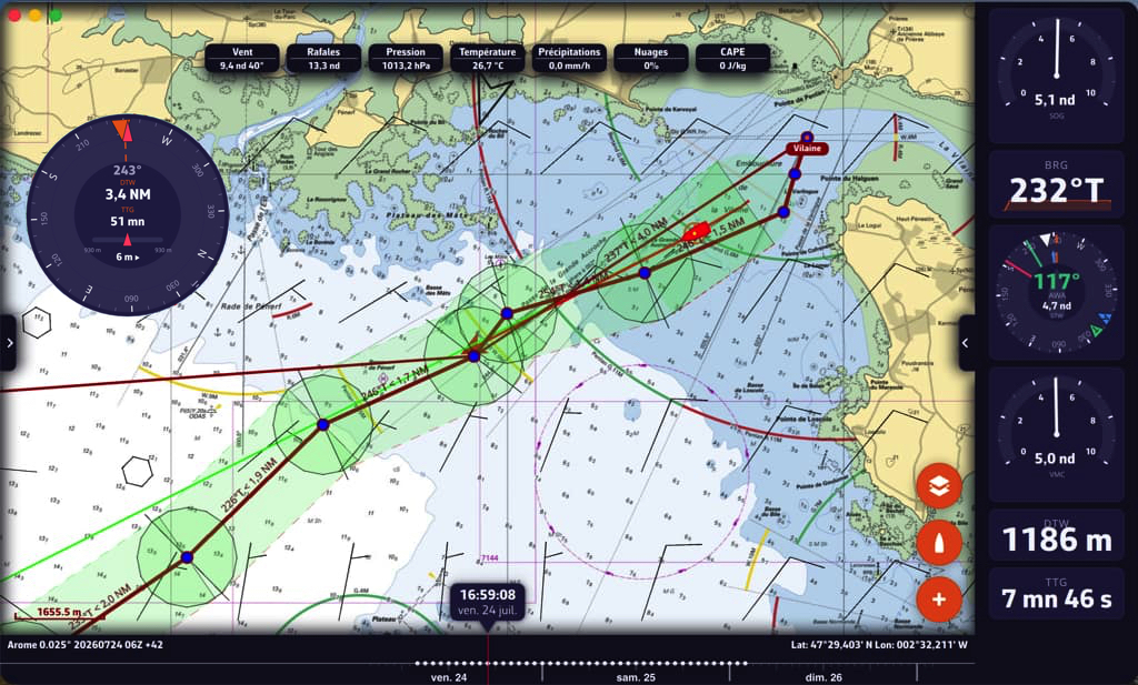
Interface with edge-to-edge chart, floating elements, handles for side drawers and timeline
Night mode
- Navy red night mode, designed to preserve night vision. Night mode tints the entire interface — chart, instruments, banner and timeline — in a discreet navy red. It can be supplemented by fine adjustment of the backlighting of the devices, which will also allow serious battery savings during the night.
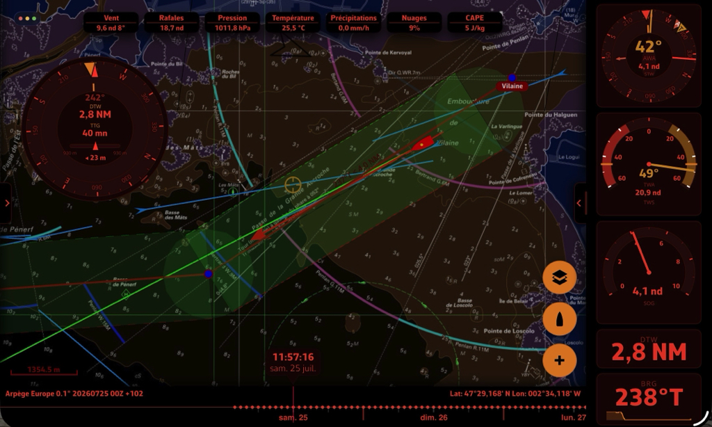
Night mode tints the entire interface — chart, instruments, banner and timeline — in a discreet navy red
Completely redesigned instruments
Completely redesigned instrument panel :
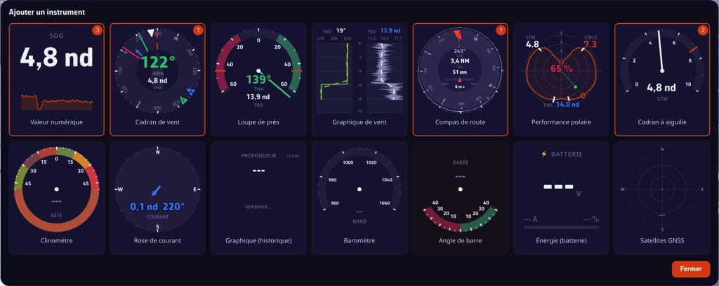
- A unique banner, rearrangeable, with several copies of the same instrument possible, movement by drag and drop in the banner or detached floating on the chart with editable size (ghost image, insertion location, alignment guides).
- 14 types of analog or digital dials, including several new : historical chart, rudder, satellites GNSS, energy / battery parks, polar performance, analog wind dial way SailSteer (B&G), generic needle dial…
- Instrument settings with live preview, resizable dock, and a different configuration in portrait and landscape.
- Floating dials placed on the chart remain visible even if the bar is hidden.
- If an instrument is detached on the chart in portrait mode, it takes its place in the banner in landscape mode.
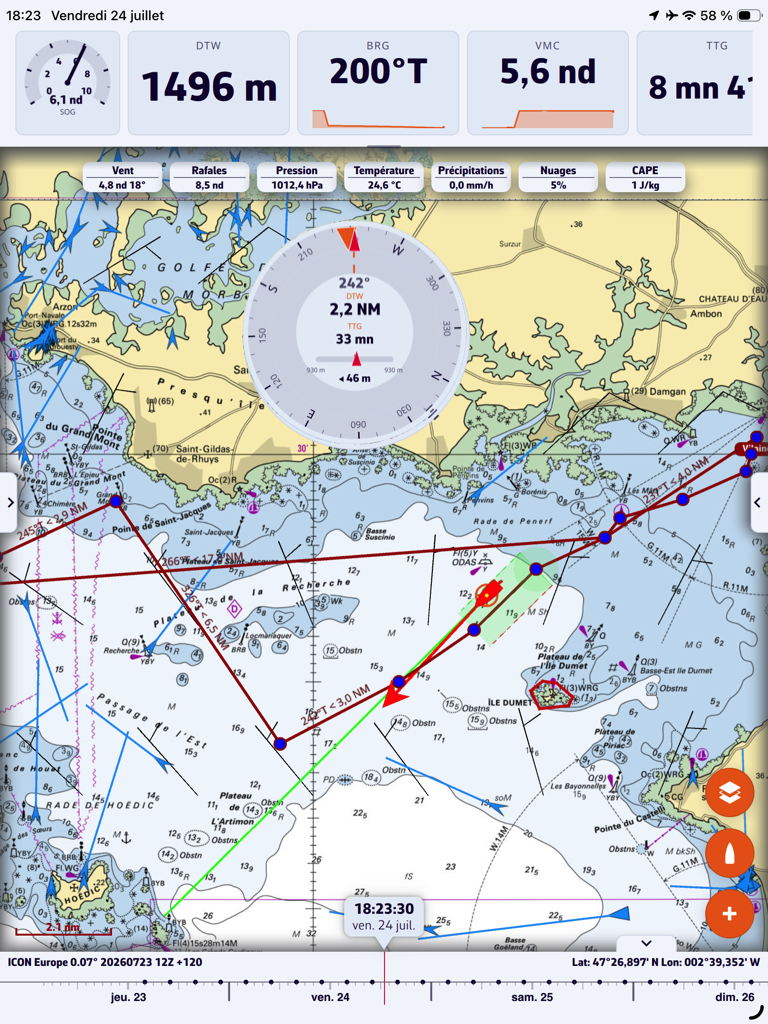
In portrait position on mobile, the instrument panel becomes horizontal.
A more practical timeline
In landscape position on smartphone, the timeline becomes a vertical column on the edge opposite the camera. Fallback animation / deployment, masking by the handle, and integrated date/time label.
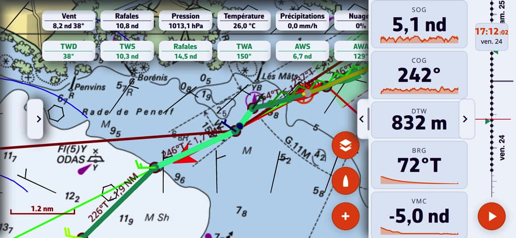
The retractable vertical timeline on the side opposite the camera.
What's new
AIS
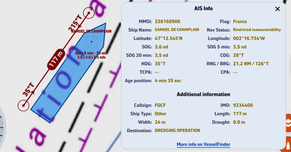
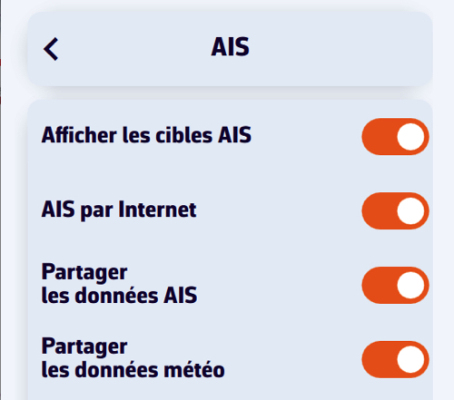 Stations and boats broadcasting weather data are displayed in cyan, visible at all zoom levels and selectable even at low zoom levels (long press : wind, pressure, temperatures, current). Decoding AIS weather observations (binary messages).
- You can now share your own weather data and surrounding AIS data.
- From a certain zoom level, AIS Class A targets are displayed to scale (real size). This makes it possible to locate the exact position of the transmitting antenna in relation to the length of the vessel..
Measures
- Right click (computer) or two-finger long press (touch) on the chart for add a measurement or instrument at the clicked point. One tap/click on the label to close.
- New style of measurement “double bearing” (circles and bearings at both ends).
GRIB
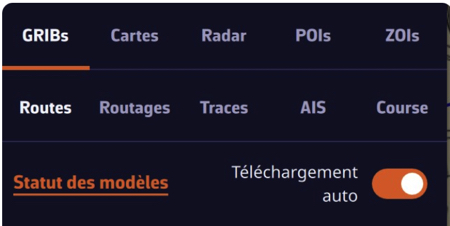 Automatic download of GRIB as soon as a new run is available : no more need to validate each time. Just activate “Auto download” in the GRIBs tab.
- The panel displays the status of each model (ECMWF, Arome, Arpege...) with its run and its deadline.
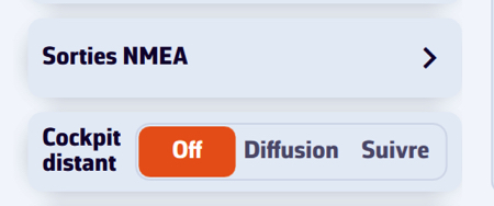 You can follow live the NMEA + AIS from another boat via the network : the application switches to navigation mode and focuses on the boat being followed.
- The setting is in Settings › GPS & NMEA › Distant Cockpit - choose Broadcast to share your own data, or Follow to receive those of another boat.
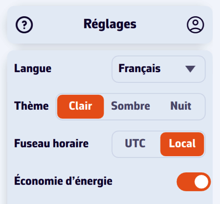 Energy saving mode
- An energy saving mode allows you to reduce the data refresh rate to preserve the battery during long navigations, without freezing the instruments or the chart. Le vent s’affiche en vecteurs/barbules et les courants en flèches, moins énergivores.
And many other fixes : stability, readability of instruments at 2–3 meters, units, and a multitude of finishes.
And then ?
- Integration of global cartography C-MAP DiscoverX imminent !
–––
(¹) What is the application roadmap ?
–––
Is there a downloadable FR user manual? ?
Is there a way to correct the depth displayed by calibrating the depth of the probe because although my hummingbird sounder is calibrated, the value received is not
Currently you have a quick start manual, and the possibility of download the FAQ au format pdf (to be renewed regularly as the application is updated).
Regarding your second question I asked it to the developers.
Very nice interface , can't wait for vector cartography
Very nice work, very complete, very finished…
I just tried again, this time with the new version. My smartphone gets hot every time and the battery level melts like snow in the sun (Samsung S24 almost new). Wouldn't there be a little problem? ?
You probably have too many internet requests going on. Start by turning off any features that aren't immediately useful to you (particle display, tide gauges, rain radar, storm/thunder radar, AIS via internet, aso.). Currently browsing, activate “Energy saving” mode in the first settings.