Predict thunderstorms with Weather4D


In Weather4D (all versions) most weather models provide a data calledCAPE.

Convective Available Potential Energy, in French : Energie potentielle de convection disponible. Behind this abstruse acronym hides a powerful tool for forecasting thunderstorms. The CAPE is measured in joules per kilogram of air (J / Kg) and defines the vertical thrust energy of a hot air particle in a colder atmosphere. In other words, vertical acceleration of the air particle will be directly related to this energy measurement. Read more …

Receive facsimile weather maps with an iPad [Update]

An SSB receiver for leasure boating

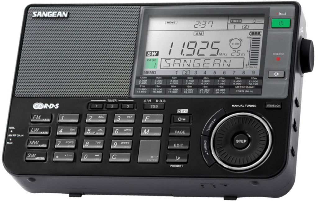
HF Weather Fax to Black Cat Systems is an application for decoding facsimile weather maps on an iPad, an iPhone or Android device. The analysis and forecast maps are provided by radio stations around the World. Broadcast on shortwave, they can easily be received by SSB receivers as found in catalogs for pleasure.
Read more …

Receive graphical weather maps on iPad [Update]

Weather analysis and forecasting maps developed by the NOAA (USA) and the Met Office (UK) cover vast areas over the Wold. They can be obtained sending a request by email to the weather server of british company MailaSail. With the latter, many maps are available in a listing (¹) in which simply click on the links to load the request in a message ready to send. Read more …

Navigation Mac tutorials on your iPad [Update]

A growing number of boaters now uses an iPad at sea. But offshore, when no network connection is available, and therefore no more internet access, how to access different aid or technical instructions regarding the tools used ?

The answer is in the creation of a library of files in PDF format that can be easily stored in the application Apple Books, for free, fortunately. Read more …

VMG / VMC – for Dummies

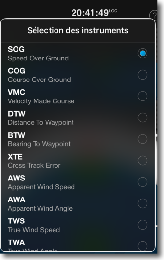
Navigation applications are full of acronyms. This coded and cryptic language was originally developed for electronic navigation instruments, GPS mapping and other chartplotters. These acronyms, in the form of three letters most often, are the contraction of terms defining specific navigation data and according functions. This facilitates on-screen display taking few space. While some of these acronyms are relatively well assimilated by the boater, as SOG for Speed ​​Over Ground (SOG), you can quickly access subtleties that are not always mastered as COG for Course Over Ground, meaning "route runned on the ground", that the word "Course" in English can mean "Route" or "Heading" according to the context. Read more …

Reed's Almanac iPad application is discontinued

In February 2016 I wrote a laudatory article about this digital version of Reed's Nautical Almanac, a wealth of information on the coasts of western Europe. Alas, Bloomsbury editor, which bought Reed's editions a few years ago, has decided otherwise. The end announced earlier this year was conducted in September.

Those who are already owner of the app, with an "all areas" subscription will be able to continue to use it. However all daily information from an internet connection (weather, MetOffice weather maps, tides, aso.) will no longer be updated, nor the permanent nautical and port information. Fortunately the latter are present in memory in the application, and still usable a few years.

Bloomsbury provides only the traditional paper books, accompanied by a perfectly indigestible PDF version.

What a pity!

–––

Weather4D makes its (r)evolution

Hear, hear ye, hardy boaters, new Weather4D applications come up !

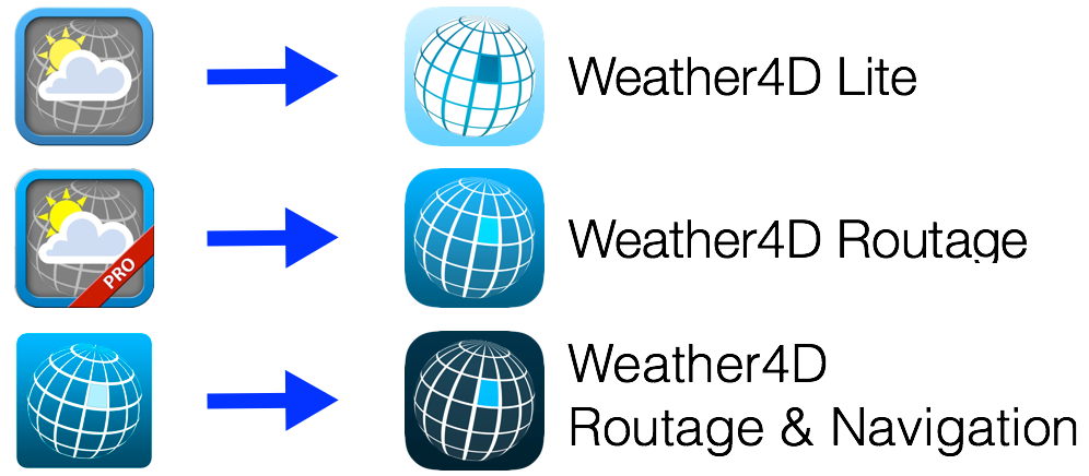
I wrote "the" in the plural. Both historical applications of Sarl APP4NAV,  Weather4D (March 2011) and Weather4D Pro (November 2011 ), change to the user interface of the now famous application Weather4D 2.0, which was the subject of a comprehensive review of its development published in December 2015. In order to make more consistent range, the names of the three applications are harmonized :

Read more …

Guide Escales 2018 – Red card ! [Update-2]

It saddens me to finish the year with a critical article, but the subject deserves. I wrote in December 2016 (*) a genuinely positive assessment of the evolution of the application Guides Escales 2017 - Bloc Marine digital version by Figaro Nautisme editions - compared to 2016. But for edition 2018, is unfortunately go back, supply regress and severe rate increase.

Unlike the print edition you can keep several years in your boat library, the annual update of the application Guides Escales erases all purchased regions the previous year. It is therefore not a purchase but an annual subscription, nuance!. And that's not all…

[Updated 2022] The Stopover Guide has been withdrawn from sale.

Read more …