
For several weeks the general public press has been raving about the occurrence of a “Super” El Niño, which could be “the most intense in the last ten years”, could “make 2027 the hottest year on record », or even “the scenario that is emerging for 2026 could be the most violent ever seen ».
I know the press loves sensationalism and disaster scenarios, but let's keep a cool head in this media heat-up. While predicting the rapid return of an El Niño episode in the second half of the year 2026, some scientists are more measured in their assessment of the probabilities of development of the phenomenon while others, on the other hand, are worried about it. Read more …
Label : weather
Get Weather Forecast with Satphone at Sea V.2.4
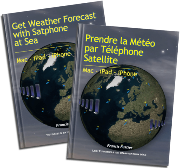 Update 2.4 (01/2026) of the guide Get Weather Forecast with Satphone at Sea version French and English.
- Update of Starlink conditions and services until 30 January 2025.
![]() The version number is no longer implemented on Apple Books, I now add it to the description of the book. It is also present on all page footers.
The version number is no longer implemented on Apple Books, I now add it to the description of the book. It is also present on all page footers.
If the update doesn't appear in Apple Books, delete the book from your device and reload it from AppStore, you will not have to pay it again.
–––
In-situ weather data to support forecasts in NavimetriX
Weather and ocean data In-situ are observational data broadcast in real time, or quasi-real, from different sources : semaphores, ships at sea, fixed or drifting buoys, airports, and also specialized satellites. This data is available as open data to the general public and also for reuse by the economic sphere.. The new NavimetriX application allows you to display this data to complete the forecasts of models distributed in GRIB format. Read more …
Get Weather Forecast with Satphone at Sea [MAY V.2.3]
Update 2.3 (November 2025) of the guide Get Weather Forecast with Satphone at Sea French version.
- Removing Iridium Mail&Web app (*)
- Alternative apps
- Updated Starlink conditions and services as of November 1 2025.
[ADDENDUM] After a long and bitter battle with Apple, the process of updating works has finally been corrected in iTunes Connect and the version 2.3 is finally available for download. However the version number is still not implemented (except on the pages of the book).
Reading : "Climate and weather scientific atlas" The world nature
 The newspaper Le Monde published in November 2024 this great study in his collection « Nature ».
Prefaced by Jean-Louis Etienne, our national explorer that we no longer present, this extremely didactic scientific work allows us to deepen our knowledge of the climate, meteorology, and disturbances they undergo.
Tutorial : Weather in the Mediterranean Update V.1.2
March, the volume 2 from Introduction to Marine Weather – Weather in the Mediterranean, is updated on the iBook Store (Apple Books)
Version 1.2 – Layout improvements and link fixes.
- 88 pages
- 48 screenshots
- 14 videos
Warning : A severe bug still unfixed affects the new process for uploading book updates. The version number is no longer replaced on the iBook Store and remains "Original". On the other hand, the description of the modifications is present. Once again : thank you Apple !
–––
Météo-France in the storm
![]() After NOAA, which has just suffered the wrath of the Trump administration (1), here is the Météo-France institute in turn pinned by the national press. After the newspaper La Dépêche on March 24 th, Le Monde adds on April the 20 th (2) by taking stock of the situation and studying the causes of the recent errors that have occurred several times in the weather forecasts of recent months Read more …
After NOAA, which has just suffered the wrath of the Trump administration (1), here is the Météo-France institute in turn pinned by the national press. After the newspaper La Dépêche on March 24 th, Le Monde adds on April the 20 th (2) by taking stock of the situation and studying the causes of the recent errors that have occurred several times in the weather forecasts of recent months Read more …
Météo-France strengthens its observations in the Mediterranean [Update]
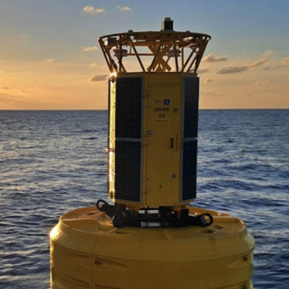 Following the catastrophic weather phenomenon that hit Corsica on 18 August 2022, causing considerable damage, Météo-France has undertaken to deploy additional resources in the western Mediterranean to better predict the occurrence of such phenomenon.
March, the 5 th 2025, Météo-France has launched the fifth in a series of weather buoys anchored off the coast of France northwest of Corsica. This deployment is part of the reinforcement of the sea observation system, initiated in June 2023, and aims to improve local capacity to anticipate extreme weather events before they reach land. Read more …
Tutorial : Weather in the Mediterranean Update V.1.1
 March, the volume 2 from Introduction to Marine Weather – Weather in the Mediterranean, is updated on the iBook Store (Apple Books)
Version 1.1 – Addition of a paragraph on Advanced thunderstorm forecasting data.
- 88 pages
- 48 screenshots
- 14 videos
–––
ECMWF's AIFS Forecasting Model Becomes Operational
![]() Tuesday 25 February 2025, A new version of the deterministic model of the artificial intelligence forecasting system (AIFS) has been published and operationally implemented. This update marks a turning point in ECMWF's history, since AIFS Single v1 is the first AIFS model to be rendered fully operational (¹). Read more …
Tuesday 25 February 2025, A new version of the deterministic model of the artificial intelligence forecasting system (AIFS) has been published and operationally implemented. This update marks a turning point in ECMWF's history, since AIFS Single v1 is the first AIFS model to be rendered fully operational (¹). Read more …