
 The National Oceanic and Atmospheric Administration (NOAA) employs approximately 12 000 people around the world, more than half of whom are scientists and engineers. NOAA Operates 18 satellites and 15 vessels and has a budget of 6,8 billion dollars. Through various services, its job is to study the atmosphere (National Weather Service), study the oceans, fish resources, charting the seas (National Ocean Service), to follow their evolution and predict their future (Office of Oceanic and Atmospheric Research). NOAA's work is critical for aviation, Navy, fishing, climate research and offshore oil and gas exploration, especially when it comes to modelling weather patterns and climate change. Read more …
Category : Meteorology
New tutorial : Weather in the Mediterranean
March, the volume 2 from Introduction to Marine Weather has been published on the iBook Store (Apple Books)

The Mediterranean Sea has a unique configuration in the world. An enclosed maritime area of nearly two thousand nautical miles from west to east, it is only open to the Atlantic by a strait of eight nautical miles. Read more …
Get Weather Forecast with Satphone at Sea [Update V.2.2]
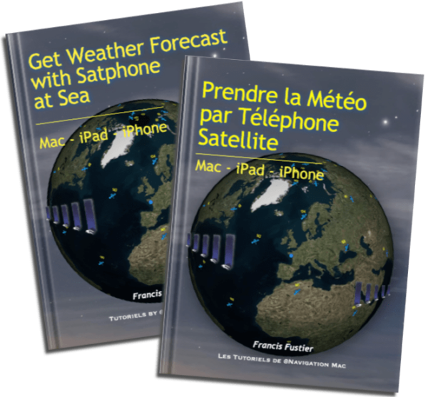 Update 2.2 (February 2025)
- Get Weather Forecast with Satphone at Sea
- Get Weather forecast with Satphone at Sea.
-
- Updated pricing 2025.
- Starlink Services Update.
- Updated connection Go!exec® with Weather4D Routing & Navigation.
-
–––
BBC Radio 4 – The Shipping Forecast celebrates its 100 years old
![]() 2025 marks the 100 years of the broadcast of marine weather forecasts The Shipping Forecast on BBC Radio 4. This emblematic transmission, produced by the UK Met Office on behalf of MCA_media, continues to be a vital safety service for mariners along our coasts.
2025 marks the 100 years of the broadcast of marine weather forecasts The Shipping Forecast on BBC Radio 4. This emblematic transmission, produced by the UK Met Office on behalf of MCA_media, continues to be a vital safety service for mariners along our coasts.
I had written an article at the beginning 2010 (¹) on the gradual disappearance of radio weather forecasts in France, and praised the consistency of the BBC bulletin. Fifteen years later, the marine weather forecast is still broadcast on BBC Radio 4 Long Waves at the same unchanging times. Hats off ! Read more …
If the Gulf Stream ended ?

© Maritime Museum of Tatihou Island 2005
No, these are not the catastrophic rantings of an inveterate collapsologist, but a very serious study reported by the climatologist Stefan Rahmstorf. I give here a French and freely adapted transcription.
The warm currents that reach Europe are now called by climatologists AMOC, in English the "Atlantic Meridional Overturning Circulation". Read more …
After the Pacific, a possible Niña Atlantic
![]() The Pacific Ocean is switching from an El Niño event at the beginning of the year 2024 to a La Niña event expected at the end of this summer. But it seems, for NOAA scientists, that a similar phenomenon is also occurring at this same time in the Atlantic Ocean (¹). Read more …
The Pacific Ocean is switching from an El Niño event at the beginning of the year 2024 to a La Niña event expected at the end of this summer. But it seems, for NOAA scientists, that a similar phenomenon is also occurring at this same time in the Atlantic Ocean (¹). Read more …
After El Niño 2023 here is La Niña 2024
The climatic phenomenon ENSO (El Niño Southern Oscillation) had experienced a new episode El Niño towards the end of spring 2023 in the tropical regions of the Pacific (¹). After reaching a peak between November and December 2023, the phenomenon began to decrease (²). During the second quarter 2024 he returned to a situation called " Neutral ”. But quickly from July a new episode La Niña started, whose climatic consequences are the opposite of the previous episode.
Source : NOAA Climate / ENSO Blog Read more …
Currents and waves at hectometric resolution from Ifremer (Episode 2)
Episode 2 – Illustrations
Forecasts IFREMER (see Episode 1) available in Weather4D are of two kinds :
-
- Current forecasts from the MARS2D model
- Sea state forecasts (combined currents and waves) based on WW3 model
These files concern areas of the Channel and Atlantic whose coverage and resolutions are significantly different. Read more …
Currents and waves at hectometric resolution from Ifremer (Episode 1)
Episode 1 – Description
Since 7 May 2024 the latest versions of Weather4D have been enriched with several new weather and ocean models (¹). Among the latter, ultra-high resolution current and wave forecast models from’Ifremer come in addition to Copernicus models (formerly called MyOcean) for the Channel and Atlantic coasts. These forecasts are provided with hectometric grids, can be reduced up to 190 meters for some models. So Ifremer, what is ? Read more …
GRIB files and time zones
 An incomprehensible malfunction occurred recently for a Weather4D user, sailing in a “lost hole” on the edge of the Indian Ocean, namely the Cocos Islands, challenged me to the point of getting lost in conjectures. A GFS file due ten days ago categorically refused to be displayed in the application with the date, damn !
This unfortunate sailor - for which I would like to thank him - forced me to make a determined search for the cause of the problem.. After much procrastination, explorations of settings that may be faulty, since no other user had reported such a problem to us, the light finally came out ! Read more …