For just over a month the website OpenSkiron which delivers the GRIB files for free OpenWRF is no longer available. These alternative high-resolution files (¹) provide fine grid coverage of the Mediterranean, where the Arome model stops.
Apparently, probably due to their Israeli connections, David Gal's website was the victim of a serious computer attack. Thus, OpenSkiron is expected to be offline for a while. It remains to be hoped that he will be able to resume his activities as quickly as possible.. (²)
David Gal is a scientist attached to The Leon Recanati Institute for Maritime Studies in Haifa.
–––
(¹) Alternative weather models [Update]
(²) Source : forum Yachting & Boating World
–––
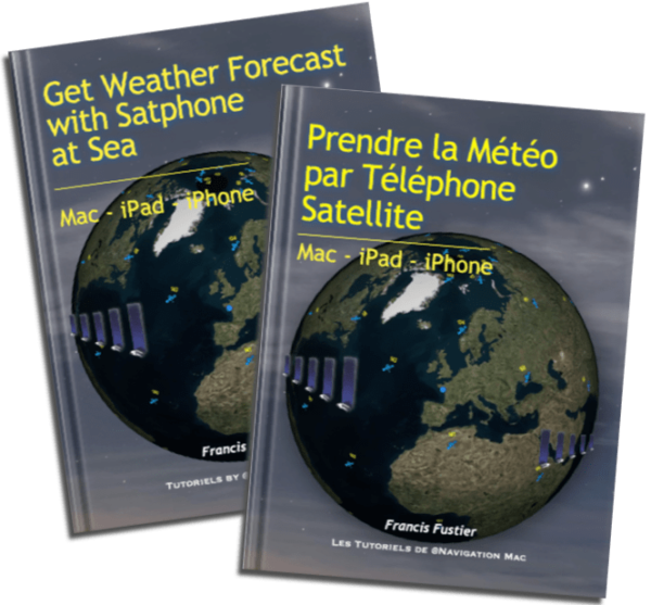 Update 2.4 (01/2026) of the guide Get Weather Forecast with Satphone at Sea version
 Following the catastrophic weather phenomenon that hit Corsica on 18 August 2022, causing considerable damage, Météo-France has undertaken to deploy additional resources in the western Mediterranean to better predict the occurrence of such phenomenon.
 March, the