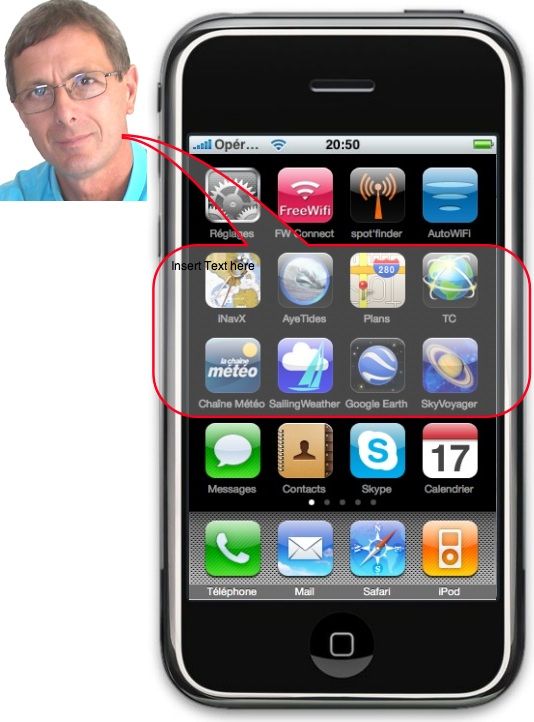
People often ask me advice on navigation apps for iPhone. Which ones to choose ? Here is a selection, of course not exhaustive. These are the ones I kept, after having tested and “trashed” more than one, and that I use fluently. You will first find the essentials : iNavX and AyeTides Of course, then the essentials, finally the complementary. Follow your guide…
iNavX
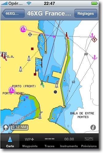
Only one nautical application for access to hundreds of charts covering the world : Navionics Gold , NOAA raster charts, CHS Canada, Discovery hiking maps and more, can be purchased separately from the X-Traverse.com website.
With iNavX you can use the geolocation provided with the iPhone (GPS, cellular) to track your position in real time on the nautical chart. Using the WiFi connection of the iPhone or iPod Touch, iNavX becomes repeater of shipping software that supports NMEA data exchange through TCP / IP as MacENC, GPSGate or MaxSea. This includes GPS data, AIS receivers/transponders, Instruments (Sounder, Log Speedometer, wind transducer, Autopilot, aso). iNavX supports waypoint management, routes, tracks, Queries and display of Grib weather files on the nautical chart. The software allows the sending of tracks and waypoints by email without leaving the application.
AyeTides
This application provides hours and heights of tides and currents for more than 9900 stations, of which more than 180 stations in France, until year 2100. Search for the nearest stations (Geolocation enabled), geographical search, alphabetical search, aso. Remembering favorite stations.
The tides data are displayed in text format as iPhone is handed portrait position, and graphically in landscape position. Sunrise and sunset and moon times, Moon phases, station display in Google Maps. Automatic management of local times and height units according to the countries where the stations are located (meters high, feet, Fathoms).
AyeTides, Once installed, can be called directly from iNavX to provide the stations closest to the vessel's position.
Maps & Google Earth
No need to introduce the application Maps provided in the OS system 3.0 in iPone. It allows me to switch from nautical cartography to land map while keeping my GPS position on the rare occasions when I travel in an amphibious vehicle ! Joking aside, I often position brands of interesting places in Maps so as not to overload iNavX with too many waypoints.
Google Earth allows me to explore the planet in advance. It can also be used to view the positions and tracks sent by mail by friends yachtsmen using iNavX or MacENC. Very useful sometimes to find out a bay, a safety anchorage shown on the chart, when the image definition is sufficient.
Traveling Companion
La Chaine Météo
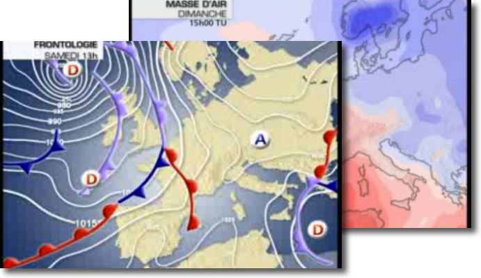
A comprehensive weather forecast for terrestrial, but allows for a very good idea of weather out for coastal. The excellent technical explanations in video are accessible on a 3G network. Earth forecasts at 12 days, City by City, with wind direction and strength, very convenient for coastal navigation.
iSailing Weather
By Weather Online, marine forecasts in the form of GRIB files at 3 days (Winds, Pressures, rain and waves) and text files to 12 days, for configurable and memorable areas covering the Atlantic and Europe. A little long to load, actually, and a user interface that's a bit difficult to read : don't hesitate to use the zoom of the iPhone (Double-tap with three fingers) in GRIB views. This unique marine weather application could use some improvements, for the forecasts resulting from the’UKHO are very good quality.
SkySafari (was Sky Voyager *)
For me the best astronomical app available. Unfortunately not translated into French. Localized by GPS, and if you have the compass (iPhone 3GS) you point your iPhone in any direction and see the stars, even in broad daylight, as they appear above and below your horizon. You can also anticipate by scrolling through the coming hours and minutes to see which stars will appear at dusk around you. Very useful if you want to continue practicing astronomical navigation.
For the discerning enthusiast, clicking on an object allows you to access all the information about the object via the "Info" button, whose azimuth and declination to the tenth of an arcsecond, and photographic shots from NASA library . A gold mine for anyone interested in the stars, during long night crossings. A bit expensive today (it was less so when it was launched) but it is worth its price.
These are the applications that are most useful to me on a daily basis, both on land and at sea. But I am far from having covered the whole issue, Do not hesitate to share your discoveries with me !
[Update September 16 October 2010]
(*) Sky Voyager, taken over by Southern Stars Co down to Carina Software, changes its name by changing publishers. The version 2.0 from February the 14 October 2010, completely rewritten, is now called SkySafari.


