 Since version 1.21 from February the 22 July, which has brought an impressive number of ergonomic improvements to the application, the developers worked to stabilize existing functions based on feedback from beta testers in summer sailing. With the version 1.23 from mid-July, these are the NMEA connections to the instruments which have been considerably enriched with advanced functions making it possible to respond to all the scenarios encountered by users. Among other improvements, we can finally share the GPS of a smartphone with other unequipped devices. Today, with the version 1.24, it's Christmas before Christmas…
Enriched navigation
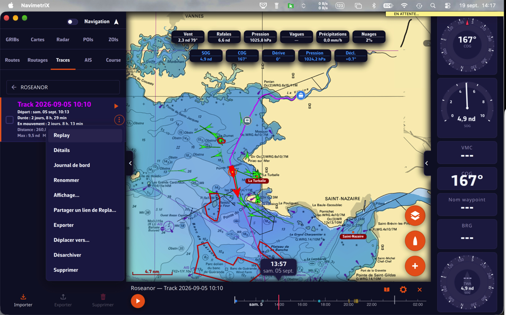
The recorded track with all contextual data can be replayed at will.
-
Logbook in automatic recording with the trace, manual entry of comments (11 input categories) with creation of pictograms on the trace, timestamped and geolocated, exportable in regulatory PDF secured by SHA-256 fingerprint (officially enforceable against third parties).
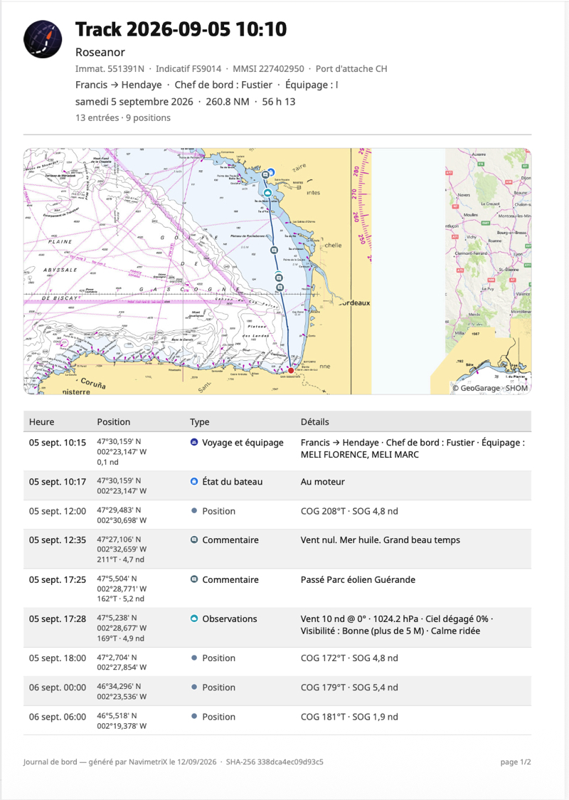
Logbook exported to PDF
-
Saved navigations with the trace, logbook, weather and navigation data on the road, AIS targets encountered, fleece performance, can be fully replayed, shared, exported.
-
Archiving of traces : creation of folders allowing traces to be grouped by navigation categories, by dates, or any other useful classification. All dossiers and their contents are synchronized with your account.
-
Sharing navigations via a web link : by clicking on the URL link received, the recipient opens navigation in the NavimetriX web application without any installation or account. If navigation is in progress, the “LIVE” option then allows you to do follow navigation in real time by the link recipient, with all the information on board (Instruments, weather, AIS targets, aso) as if he were on board.
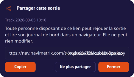
Fleeces and sails
-
Polar workshop : editing/modifications polar manuals, Import fleeces ORC, export compatible with the format of the most used applications.
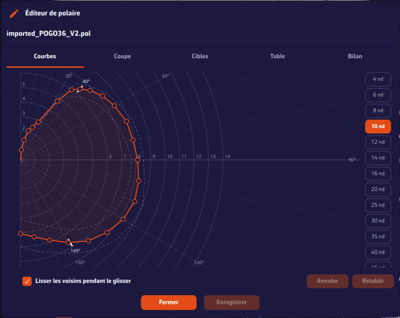
Manual modification of polars
-
Sailchart : advanced management of sail games attached to a fleece, automatic creation of a Sailchart from an iPolar polar, importing an Adrena Sailect crossover. Option to deactivate an unavailable sail “lost sail”.
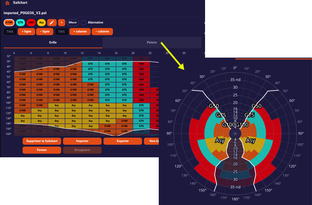
Sailchart in grid or polar, editable cell by cell
-
Display of sails a sailchart by color along a routing allowing changes to be anticipated.
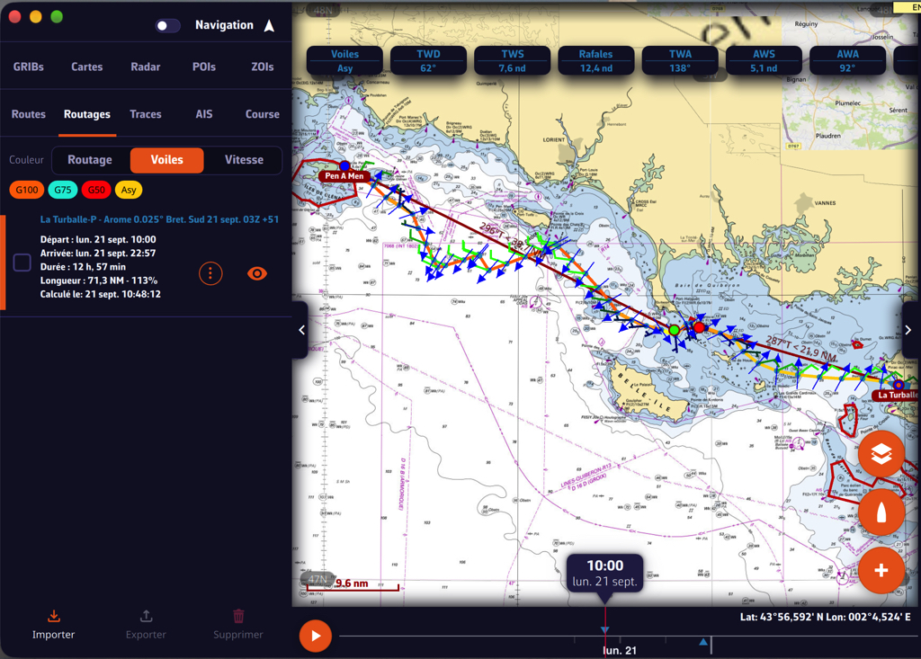
Display of sail colors, or speed, along the route
Navigation and routing
Many other improvements have been made. They are detailed in the last blog article. In bulk : rapid recalculation of a routing, full import/export of routings to another NavimetriX account, new route export formats to ECDIS plotters, additional information to the measurements on the map, improved AI weather briefing, and many more to discover !
And to take on a global dimension, NavimetriX takes the height and displays the Earth shrouded in the atmosphere from space against a starry sky background with the most beautiful effect. Technique does not preclude aesthetics !
For the last gift under the tree… next step : C-Map charts.
–––