
I deliberately title this article in the form of a question. Many users, all countries included, want the visualization of currents in Richard Ray's applications. Indeed, there is no display function of the currents in GPSNavX, MacENC and iNavX. It is a deliberate choice by the developer because there are many data sources and all hydrographic services are unwilling to provide their files in digital format. In addition, Users are likely to take data displayed on their cards as safe and certain, With consequences that could engage the liability of the publisher and legal risks, especially in the USA, too big for the developer.
The position of the opponents
In October 2007, in a discussion on the forum macsailing.net forum, August Hahn (Publisher of Mr Tides and AyeTides) had provided the following arguments: :
"NOAA specifically warns against interpolating currents between stations (¹) :
"Currents varying in space, thus predictions should NOT be extrapolated even to nearby locations. Interpolation between two nearby locations should NOT be attempted. The use of this type of extrapolation would be risky. ”
Unless there is a flow model available that describes mathematically how the currents vary over time, it's impossible to take isolated stations and create a chart that accurately reflects the currents. The programs listed [In this thread] must use very simple templates, or the areas they cover are simple enough (not changing that dynamically over time) hat they can form predictions based upon limited data.For example, up here in the San Juan Islands, Currents are incredibly complex. The Canadian Fisheries service produced a book with about 90 separate images of what the currents do, based upon the tide height at a station and how long ago the high tide occurred. The images show currents that reverse flow in a short space, flows that spiral, and flows that change velocity dramatically over one hour. Modeling something like this requires hours of computer time, not something that we simple users can do.Look at the example below and you will understand that current vectors are something that neither Richard Ray nor I want to approach. ”

Surroundings of San Juan Island – Washington USA
What Richard Ray, Publisher of GPSNavX / MacENC / iNavX, had add :
"MacENC has always avoided data interpolation (i.e.. GRIB forecasts including currents) because this type of linear postulate certainly leads to significant errors. ”
The problem in US is they do not have digital current files for each station, with vectorized hour-by-hour data. Developers should therefore make these files themselves, by linear extrapolations between each current station, which they refuse with a lot of common sense.
And yet…
Major applications offer currents files overlayed on charts. MaxSea in example, integrated current files available for some areas of the world in its Mapmedia charting (²), without worrying about the conditions of use, other than writing warnings exonerating them from liability. These data remain very general, users have to make prudent use, because weather variations can considerably modify the characteristics of the currents.

Common options in Mapmedia
Some of software editors, and also ocean racing actors, are supplied by the Australian company Tidetech, GRIB files offering of tidal currents and ocean currents for many regions of the world, from their own tidal patterns, and from available data from different oceanographic services (NOC and NCOF in the UK, ESEO in Spain, DFMHA in Germany, aso.(³)). Of course, these files are paid for, For individuals, on subscription (about 35€ for a one-month subscription) or are the subject of commercial negotiations for professional publishers.
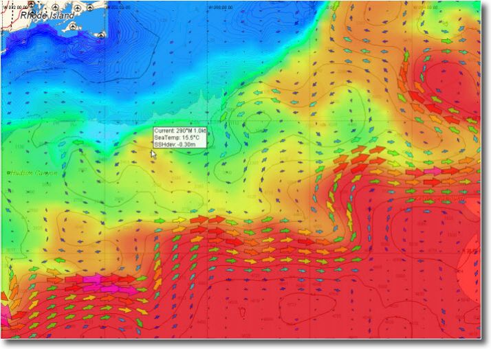
Tidetech Ocean © File Example
Unfortunately, the coasts of France are absent from their zones. And for good reason.
In France
March, the SHOM published to date current data records in paper atlases for many areas covering the coast of France. Well known to mariners for a while, these atlases have been the last two decades a complete overhaul by full digital data integration. From 1995, Indeed, SHOM has undertaken to set up a Bathymetric Database (BDBS) intended to bring together in digital form all the bathymetric data at its disposal. Numerical modeling of currents has benefited greatly from this progress has now achieved the desired resolution in areas where tortured grounds generate highly variable currents.

Currents in the Iroise Sea – SHOM
SHOM also publishes this data in the form of a digital product : Tidal currents of the Côtes de France (Channel – Atlantic) just for professional information systems. Publishers can then use these files to integrate into their navigation applications, and market respecting the distribution contract of this public administration.
Thanks to this, company ScanNav, French publisher of the eponymous software on Windows, offers a a Tide option, Extension of its application, who understands :
- A license to display tidal currents from the SHOM data overlay charts at selected times. The tide data is calculated by the external program WXTide (⁴).
- Currents areas corresponding exactly to the cutting of paper atlases SHOM.

Current atlas in overlay on ScanNav
Other French publishers, dont Eole Informatique with its software Noé, propose SHOM currents files, as an option, with their navigation software.
My opinion
Provide GRIB files of currents, from official hydrographic services, does not seem to me to be more risky than providing GRIB files of weather forecasts. In both cases it is for the mariner to use wisely the information available, and to cross-check them with observation.
A grounding caused by an incorrect tidal calculation can also happen (I write with full knowledge of the facts) than an outing made adventurous by a bad weather forecast. Information is not just about it, but their overlap and their interpretation are the responsibility and competence of the skipper.
Thus, I agree with those calling currents files with their electronic charting, and at least that the software is made compatible with the available files, especially GRIB format files, lightweight and easy to overlay on charts. Unfortunately in France, the Hydrographic and Oceanographic Service of the Navy is not prepared to allow software vendors to deliver their currents files in GRIB format, still less to make available to mariners. This is all the more regrettable that the evolution of yachting to the electronic charting is mostly completed, and tidal streams data are essential to safe navigation.
NCOF- National Centre for Ocean Forecasting
DFMHA – Deutsche Federal Maritime and Hydrographic Agency
ESEO – Establecimiento De Un Sistema Español De Oceanografica Operacional
And yet there is also Navionics on iPhone which gives real-time currents for a certain number of stations …
What about accuracy? ?
Thank you for the always very interesting articles
Frederic Tessier
For Navionics Mobile, I don't know their data sources, I'll investigate.
From Navionics Mobile 1.0 (December 2010) the currents of the French charts are reproduced from the current cartridges available on the SHOM charts. The tidal calculations are mainly derived from the XTide program.