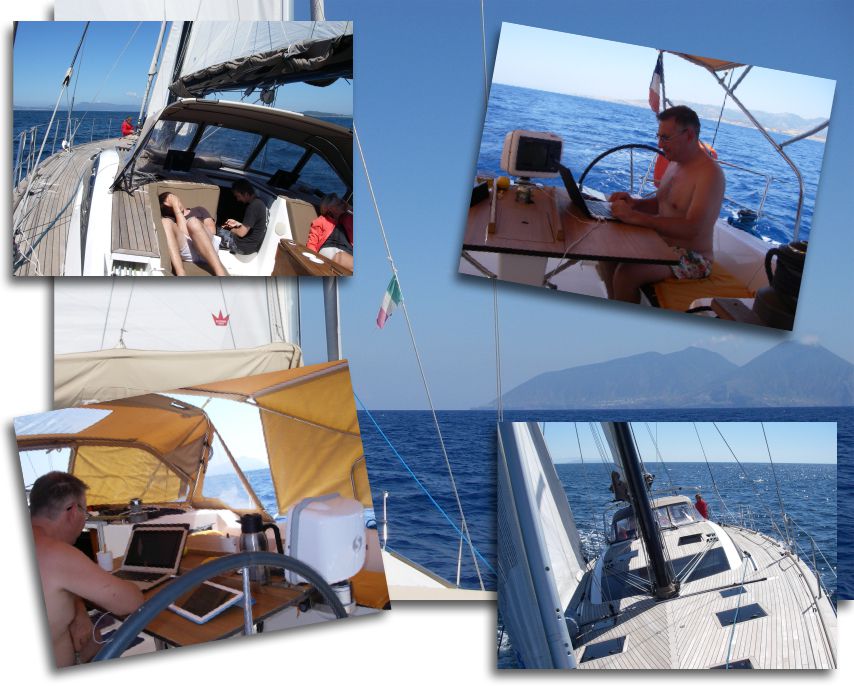
While I spent my summer diligently testing hardware and software in extremely arduous conditions, hard-working developers tirelessly aligned miles of lines of code to improve our navigation applications. What dedication, what self-sacrifice !
Regarding navigation applications, the new features mainly come from Navionics Marine and iSailor Sex. To all lord all honor, let's start with the undisputed leader of our smartphones and tablets, Navionics charts…
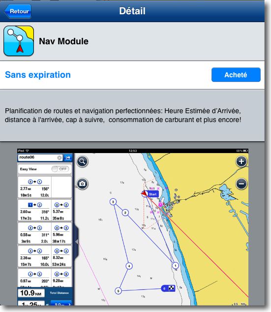
 Navionics Nav Module
March, the 21 August, Navionics has added an in-app module to the iTunes AppStore, i.e. to buy directly from the app, for Navionics Marine charts (iPhone) and Marine HD (iPad ). Sold respectively 1,59 € and 3,99 €, Nav Module finally brings real features for creating and monitoring routes.
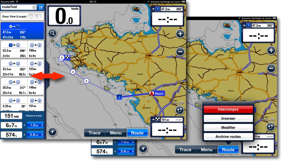
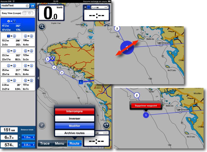
Once installed, the module has a left side drawer, retractable, which provides data for each waypoint on a road : distance, heading, mean time to go, aso. A "Road" menu button, at screen bottom, shows available fonctions.
The "Edit" function allows you to create, move, Remove successive waypoints from a route with simple taps and swipes of the finger, while viewing real-time updating of data in the drawer. In the same mode, a "Go" button activates the first waypoint of the route You can always interrupt, Reverse and modify the current route.
It's well designed and easy to use. I only had a little trouble figuring out how to create a new road when a road is already active, The gait is a bit twisted. I'll let you look for it, and don't rely on Integrated Help to help you !
 iSailor 1.5
March, the 3 th, Transas has put the latest version online on the AppStore 1.5.0 of iSailor. Completely redesigned, The app now has multiple layers (or views) that make it easier to use. A notable improvement for this quality vector mapping, but whose interface was, until this version, more than summary.
A home window provides information about what's new in the release, namely the different icons and their functions.
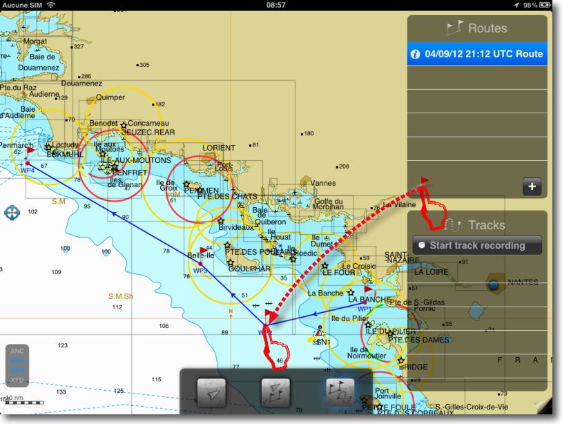
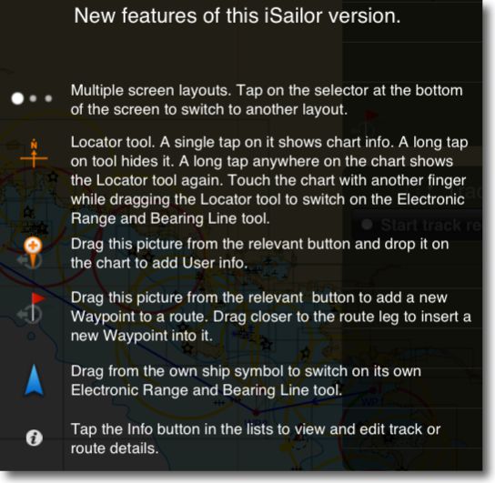 Once the map is displayed, You switch from one view to another by tapping on the 3 White buttons at the bottom of the screen, which brings up the icons of the different views.
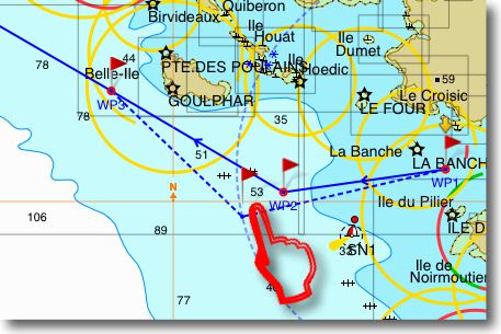
The third icon opens the view of creating and modifying waypoints and routes. In this view, simply drag the waypoint icon from the "Routes" side window onto the map to place the successive points and thus create the route. Pressing the waypoint allows you to rename it, a long support to replace it differently. It requires a bit of tact but you get used to it.
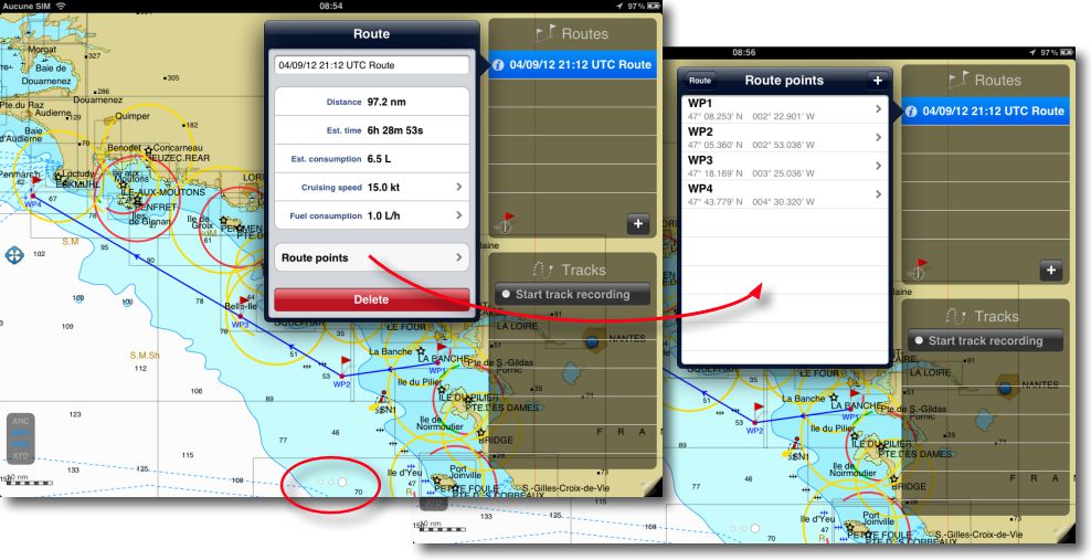
We can then edit the route, Change the position of waypoints by dragging, manually enter their Latitude and Longitude. A simple tap on the second line of the window "Routes" to create a new one which will add waypoints. Side window "Tracks" can start recording tracks.
Several other features have been added to this release :
- Cursor location tool
- ETA and XTE data added to the waypoints
- EBL Tool (Electronic Bearing Line) Referenced to the position
- Support of long track recording for long-distance
- Manually entering coordinates for the waypoint and other personal objects
- Support import / export to GPX format (waypoints, routes)
Here is some good work done during this summer period, which shows the growing interest of the private charting publishers our smartphones and tablets.
—


Bonjour,
Thank you for this very interesting article.
Following your advice and different opinions on the internet, I equipped myself with the infernal trio : iPad , iNavx and Navionics Gold for a navigation of 10 days in Northern Brittany and the English Channel. Accustomed to paper maps and the Cras rule, It is clear that this "trio" is similar to a crew member dedicated to navigation !
For you, which of the three iNavx solutions, Navionics and iSailor app seems the most ergonomic ? From my point of view, I found iNavx rather simple and functional. The only criticisms or ideas for improvement would be to be able to visualize the currents directly on the basemap, to be able to manage the crossing points (waypoints) by folders (Reaching about twenty it becomes difficult to find your way around), improve the ergonomics of the "instrument" view by explicit displays rather than all these abstruse trigrams…
Other question, Do you know a way to have speed polars automatically established ? Assuming of course that the speedo, The weather vane and the anemometer are connected to the app.
My personal choice is iNavX. Concerning currents on nautical charts, I wrote A post on the subject because it is not simple. Management of waypoints by folder (as in GPSNavX and MacENC) was requested for some time to the developer, it's in his "ToDo List". The "abstruse trigrams" you are talking about are unfortunately the English acronyms used in all navigation devices, GPS, Card Readers, chartplotters. Untranslatable and irreplaceable. You can find a list of them in the iNavX Help section. Replacing them with pictograms like in MaxSea would be a real headache and would not be more understandable. You can, in the settings, Delete data you don't want to see on the screen.
The answer to the last question is no. There is no automatic way to generate speed polars. The basic fleeces are provided by the architects, But then it's a long and tedious job to do with your boat, and according to the sailing games, Precise fleeces.