![]() iNavX 4.0.0 greatly improves the display of raster charts : continuous seamless tiled charts (¹) and access to a new Navionics Gold chart : the 50XG covering almost the entire Pacific Ocean.
iNavX 4.0.0 greatly improves the display of raster charts : continuous seamless tiled charts (¹) and access to a new Navionics Gold chart : the 50XG covering almost the entire Pacific Ocean.
Tiled raster charts [Update September 1/10/2014]
iNavX 4.0.0 includes a new entry " "Tiled Charts" " In each raster chart list (NOAA, CHS, NV Charts, aso.) Of course, you must have an active X-Traverse account and subscribe to the desired region. For free NOAA charts, all you need is to have subscribed to the "NOAA USA Seamless Charts" region which is free.

Raster charts are displayed continuously "tiled" that are overlayed depending of zoom level. An internet connection is required to download the tiles, but they are in cache on your device so you can continue to use once offline. To clear the cache, Select the "i"NFO button in the bottom right corner of the map, then the action button in the upper left corner and then "Remove chart" or "Update chart".
Any individual chart can be downloaded with a tap inside a red boundary chart rectangle and selecting from the context menu that appears. The back button in the upper left banner then to return to tiled charts.

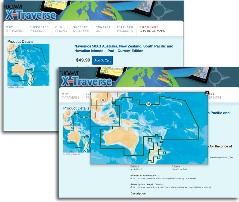
The Navionics 50XG chart

This new chart will please all those who sail in the South Pacific. The 50XG replaces 32, 33 and 34XG region to cover the Pacific from the Hawaiian Islands to, and including, Australia and New Zealand, for the modest amount of $50, thus a little more than 36 €. Will be added Japan when Japanese hydrographic services will have updated and published their shores charting regarding the Tsunami in 2011.
 Unfortunately, the bad news is that it is still not possible to cross the antemeridian continuously in iNavX as you can do with Navionics Marine (or Boating). is truly regrettable.

You have to drag the map through the Greenwich meridian to go from the East to the West Pacific
—
(¹) This is the principle of MapMedia charts in MaxSea.
—