 Strong of 1 million applications sold for mobile devices, announcement end of April 2013, Navionics continues to offer new and more attractive options. However, the term “tempting” could sometimes rhyme with “disillusioning”.
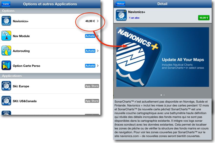
The last option in-app available from 15 August 2013 is called NavionicsPlus. This is the fourth paid option that Navionics has added to its Navionics Marine apps for iPhone and iPad. What is it about ?
NavionicsPlus Includes SonarCharts™ as well as charts update for 12 months. Let's see.
SonarCharts
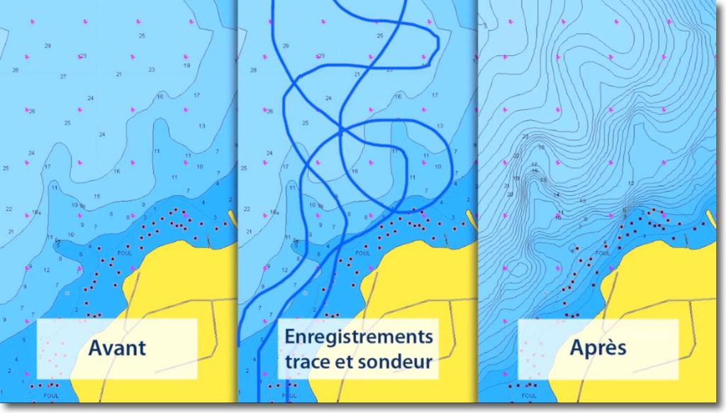
SonarCharts™, registered trademark of Navionics, is a new chart layer with high definition bathymetry showing details of seabed. Here is how Navionics present this module :
"With SonarCharts™, Navionics became the first global company to introduce crowd-sourcing (¹). The SonarCharts™ layer consists of Data from multiple sources and its evolution over time, with the integration of New sonar logs from the nautical community and fishing, is revolutionizing mapping. It's simple and convenient for everyone to record their sonar logs and load them on navionics.com. […] With real-time crowd-sourcing data, Navionics can provide new and updated charts for almost any area for Navionics charts with SonarCharts. SonarCharts has exceptional value for browsers™, because the mapping they have is constantly improving ! ”
When we look at the different screenshots offered to illustrate this option, It does indeed sound appealing. However, Certain notions of discourse question me : " Data from multiple sources ”, " record its sonar logs and load them on navionics.com ”. I can't help but wonder : How reliable is this data ? How can you be sure that a boater's sonar is correct? ? How can you collect hundreds of, even thousands, recordings of depth sounders and use without verification ? This seems surprising to me to say the least, for the most worrying. Unless this community sharing conceals other, more important sources,… Professional ?
Charts updates
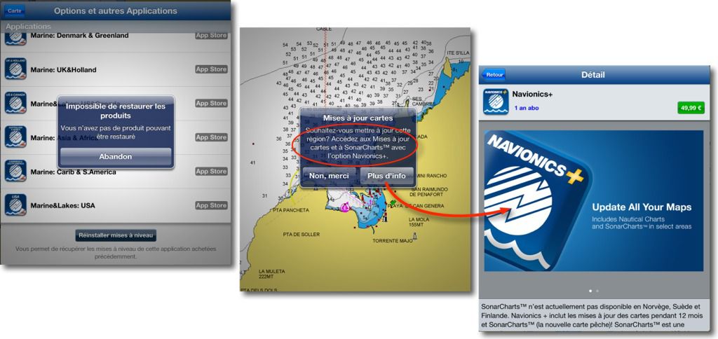
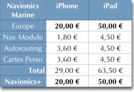
NavionicsPlus includes a yearly subscription to update the Navionics Marine. Previously, updates were free by update sytem AppStore, and sometimes, as in 2010, by a pure and simple renewal of the application. And it is in this regard that we have the right to be disillusioned. It is no longer possible to update the content of the application (charting) without an annual subscription at Navionics for the modest price… 50 € for iPad and 20 € for iPhone.
I mentioned several times in this blog Navionics trade policy for the least versatile (²). This new option is no exception to the rule. The price of the app has not only increased significantly since its launch, but the optional modules (sometimes unavoidable like the Nav Module) have weighed the bill. The Navionics+ subscription for the simple fact of being able to update, even if you are not concerned by SonarChart, is equivalent to buying the app every year ! There is something I am missing.
As I have always said and written, I strongly believes in Navionics real advance for the quality and accuracy of its charting. But regarding Navionics Mobile apps sold directly from online stores, There is the risk of seeing users, Disappointed by constantly increasing prices, divert to competing charts.
—
(¹) Participative charting. See my post Navionics Mobile and Community Sharing.
(²) Navionics is not in crisis.
———


And why not ? If the sonar's reading log is coupled with the NMEA track of the gps, all the information is there : location, hour steps, date. Then, mathematical models will make it possible to rule out calibration errors by certain pollsters, Knowing that most of them are sufficiently well calibrated to provide usable information.
See what Waze has done for traffic information and Open Street Map for mapping… not to mention Wikipedia. Of course, this is disturbing because the information no longer has the seal of a licensed organization. But if the number is there, Precision will also be; It's statistical.
A survey of "community pollsters" seems to me to be a beautiful utopia in our tidal regions. The wind, its management, atmospheric pressure, There are so many elements that come into play that I don't think it's anything other than marketing to generate sales. Perhaps for the positioning of wrecks ?
Unless you have an extremely powerful computer tool that can bring the probe back to the level of the chart datum. I don't think that's the case with Navionics when you see the time taken (often very long months) to include important changes for navigation on its charts such as the port of Roscoff or the breakwater of Port-Louis. Unfortunately, Navionics has no competitors on a global scale.