Boaters and water sports enthusiasts now have two applications helping them to better understand and protect the increasingly fragile marine environment.. DONIA is a private initiative of the company Andromeda Oceanology which received the support of the Rhône-Mediterranean-Corsica Water Agency. Nav&Co (*) is an initiative 100% public composed of SHOM, of the OFB (French Office for Biodiversity), of the State Secretariat for the Sea and DGAMPA, with co-financing from the European Union. If DONIA is dedicated mainly to the western Mediterranean basin, Nav&Co currently covers all metropolitan France, Corsica and Guadeloupe.
DONIA
DONIA is a general public anchoring and navigation application that offers its users a new cartographic universe allowing them to anchor outside of Posidonia seagrass beds (protected marine plant from the Mediterranean). Donia aims to become the “Waze of the sea”, that is to say the community app for all users of the sea, whether they are divers or boaters”.
Here is the presentation made on the designers' website.
First launched in 2014 on Apple Store and Google Play, it has undergone numerous improvements until the version 7 th current version. Claimant 50.000 users (!?) the DONIA application protects Posidonia meadows and coral reefs by providing a precise vision of the seabed for anchorages that respect the marine environment.
Information available
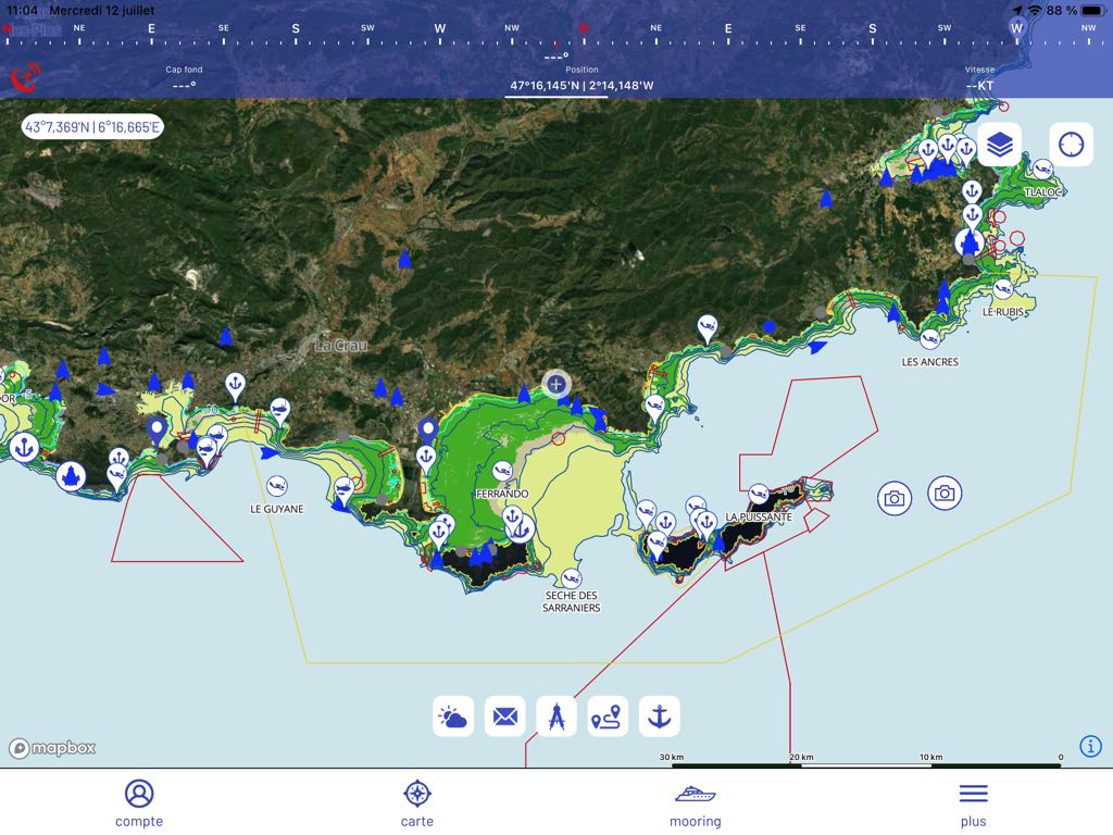
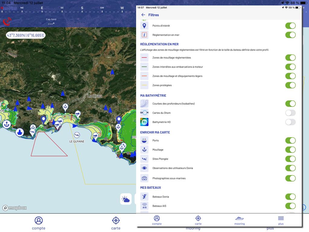
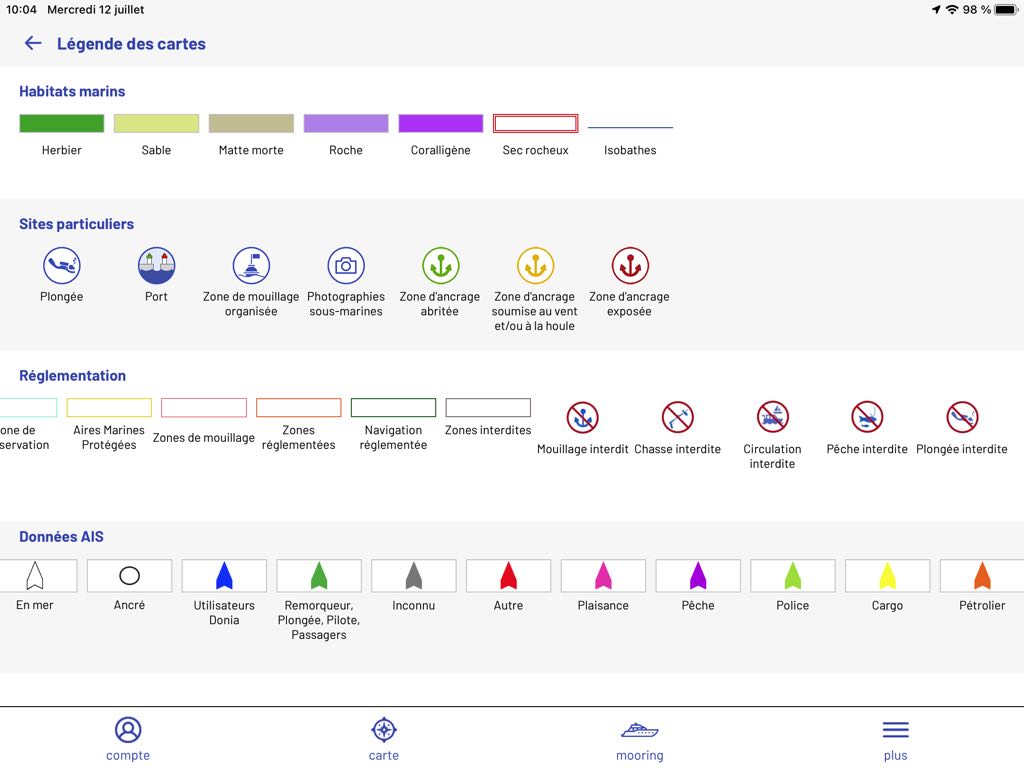
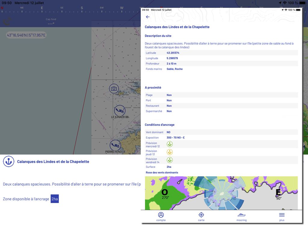
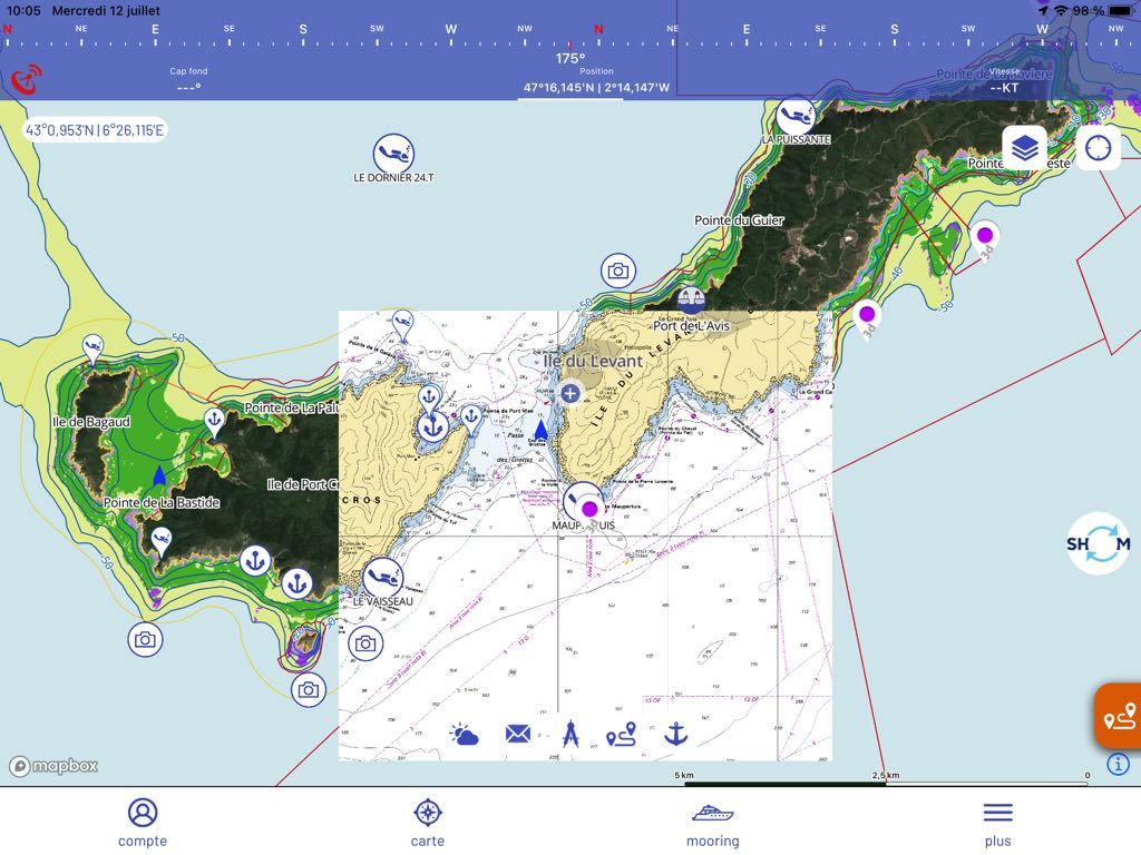
The satellite view presents a large number of pictograms designating points of interest – anchor zones, harbours, dive spots, pictures available, etc – from the database and community sharing. Areas meeting specific regulations are identified. The nature of the grounds (meadows, sable, rocks) is displayed by specific colors.
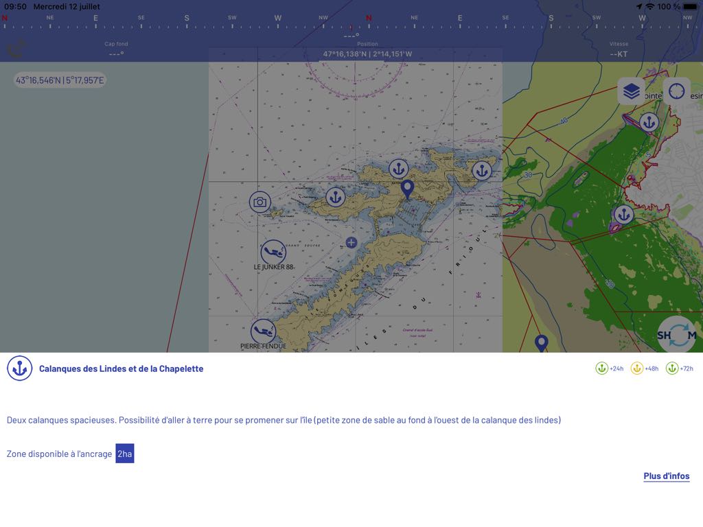
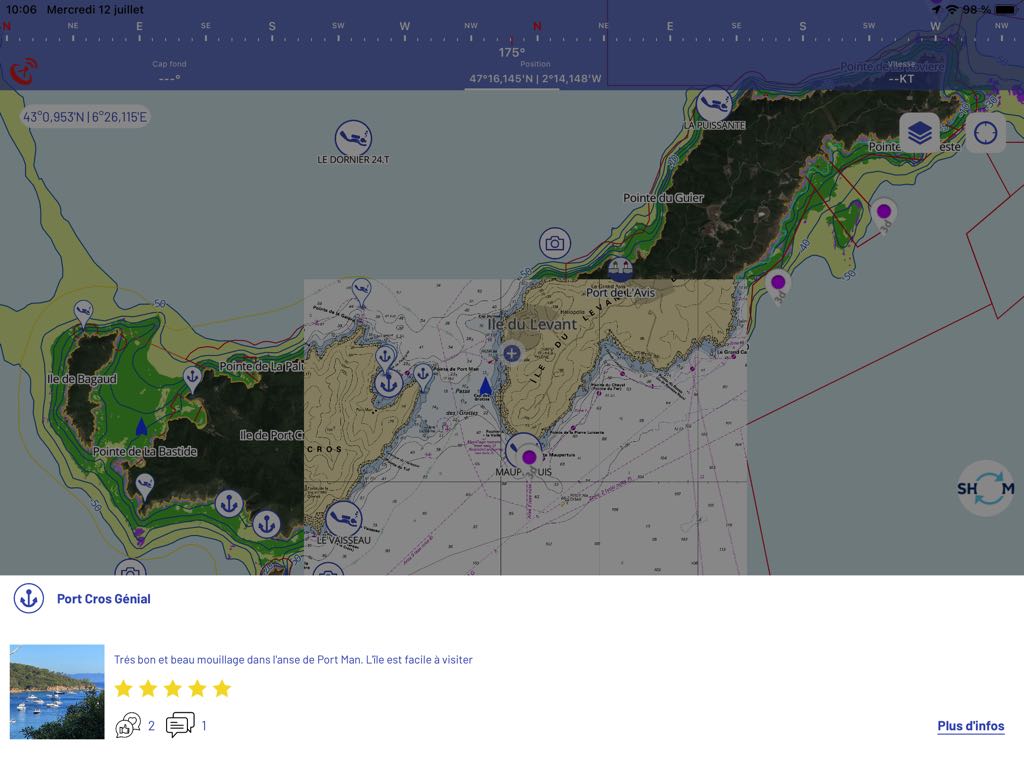
A tap on each pictogram displays a brief description and access to a window with additional detailed information.
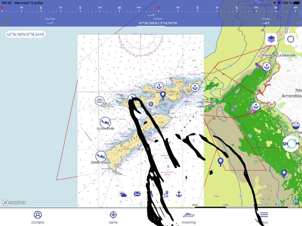
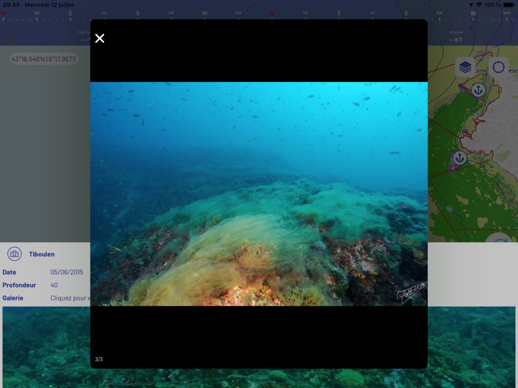
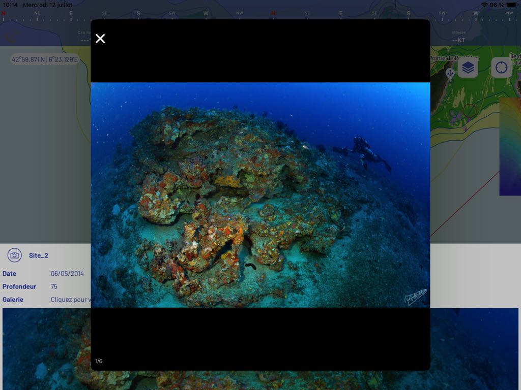
In the same way, superb slideshow pictures of the seabed are available with picture icons :
The function Anchor allows anchorage outside fragile ecosystems. Several icons identify the quality of authorized grounds, and a judicious alarm function – slipping, tangle, collision – helps secure the anchorage.
Navigation
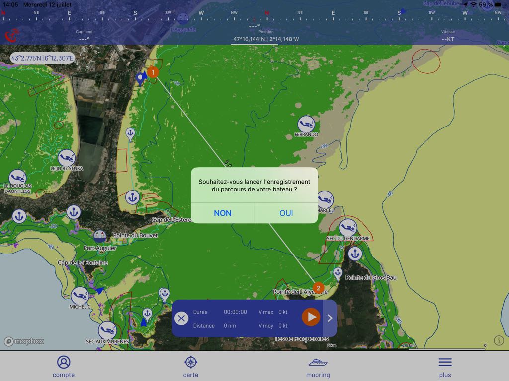
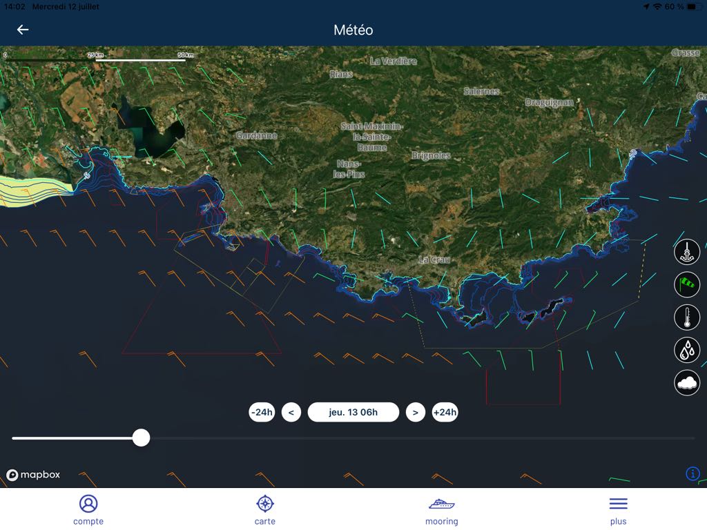
Several basic navigation features are available. The application uses your Integrated GPS to locate you. You can measure a distance to travel, and activate the recording of your track. The duration of the route is displayed according to your average speed. It is mainly useful in motorboating. To complete, it is possible to display some weather data from the ARPEGE Europe 0.1° model from Météo-France, range up to 3 days with 3 hours steps. For mainly coastal navigations, the AROME model would have been more accurate.
You can also display the AIS targets from the network AISHub network (the same as Weather4D and SailGrib) and those of the DONIA user community, or from your own community (friendly boats) with whom you can communicate via internal messages.
Option PREMIUM
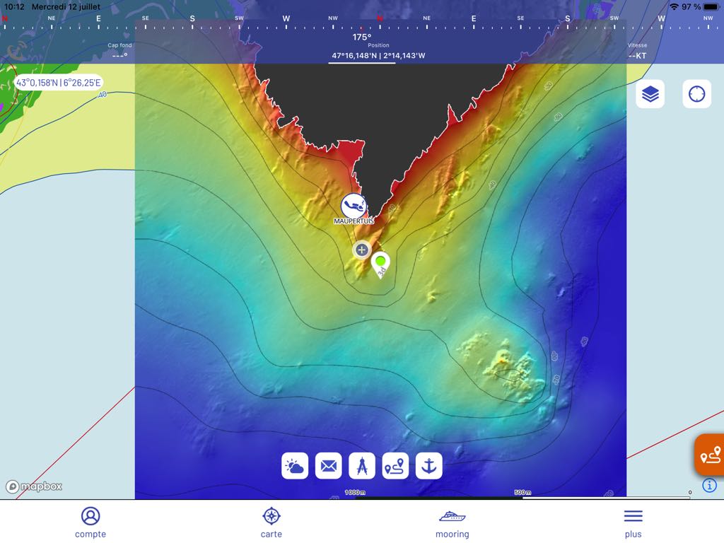
A monthly or annual subscription gives access to download SHOM charts by small geographical areas, useful for landings and short runs, and a number of high-definition 3D Bathymetry slabs (Currently 230 slabs located mainly between Marseille, Nice and Corsica) useful especially for diving.
Community sharing feature allows you to post information, share observations on points of interest, and also send an SOS alert to users of the application connected within a radius of 20 km around your location.
To conclude, temporaly
DONIA is a welcome application for its primary function : inform to encourage boaters to preserve marine biodiversity while practicing their summer navigation in a peaceful manner. The question of anchorages has become crucial in the Mediterranean, regulation is becoming more and more draconian, highly regulated spearfishing, and anything that can contribute to a good consideration of these issues is perfectly commendable..
Concerning the navigation part, apart from the very relevant and contextual anchor alarm function, other functions, distance calculation, tracks management, notoriously insufficient weather data, chart display reduced to very small areas, seem perfectly superfluous to me. It is better to leave this to specialized applications as Navionics Boating and many others whose vocation it is.. Everyone has their own job.
–––
(*) To be continued :
For eco-responsible pleasure. Part 2 – Nav&Co
–––

Hello Francis,
It is a good idea to present these 2 applications.
DONIA is very oriented towards the Mediterranean . For South Brittany, very congested at the moment with many holidaymakers at anchor, there is not much, just 4 small areas
-The Four lighthouse in front of Le Crosic where no one can anchor
-The island of Houat and Hoëdic
-Groix
-A large area in front of Concarneau, but nothing on the Glénan archipelago in the middle of this large area, where many boats tear up our beautiful algae.
There is more information in Nav&Co . In addition, it is a shame to have to pay for SHOM cards with Donia when they are free with Nav.&Co .
With these 2 applications we realize 2 big steps towards the active ecology of sailors. This data will need to be enriched and kept up to date.
Thank you for spreading this information through your always relevant articles.
Francis
Always so well documented, interesting , and when even accessible non-professionals. Bravo
F. Brulport