Numerous AIS tracking networks broadcast over the internet are available. Among the best known : Marine Traffic, Vessel Finder, SiiTech, LocateEverything, and many others. One of these networks particularly stands out, AISHub network, an AIS NMEA data sharing center, which offers developers an API allowing the integration of its network into applications, and therefore display of AIS targets received over the Internet directly into the application. Featured from the beginning in Weather4D Routing & Navigation, this system has made it possible to envisage new and particularly innovative services.
Public sharing of AIS data
The two leaders of weather, routing and navigation apps, SailGrib on Android and Weather4D on iOS, have partnered to provide this service to boaters using mobile devices. Thanks to a New server built as an AISHub network station , Users of both apps can pass by an internet connection, not only their own location, but also those of all the received targets surrounding them, thus multiplying the number of targets in public broadcast by the AISHub network. In addition, This transmission can be carried out via direct satellite connection servers with an Iridium GO!® when requesting a GRIB file in the open sea but only for the boat's own AIS position.

The AISHub server station 2345, administered by APP4NAV, can broadcast all AIS targets received by SailGrib and Weather4D users
In this way, wherever users are located, if they leave their AIS receivers and AIS sharing enabled in their application, even in harbour or at anchor, AIS targets they receive will be broadcast over the network, helping to improve the coverage of regions lacking land-based station.

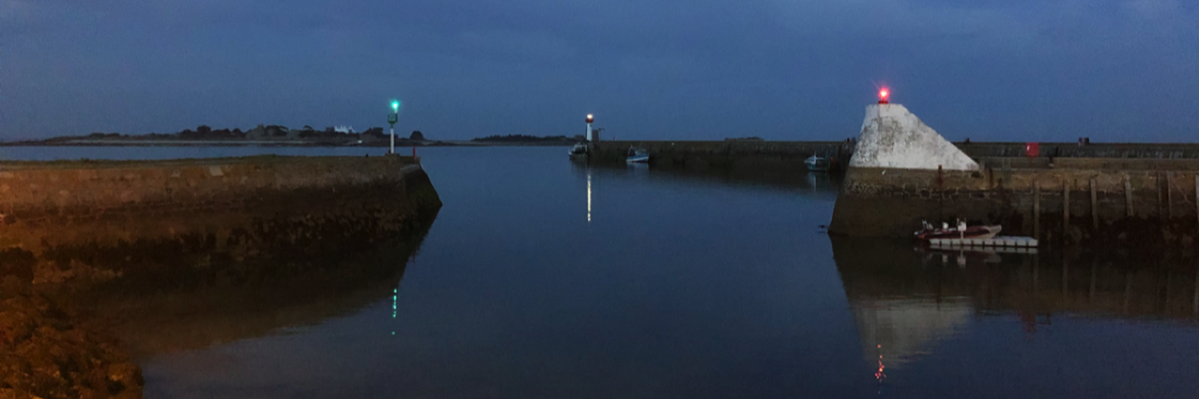
All targets received with SailGrib by the ship (in the center) are broadcasted on AISHub network
Navigational data sharing
 In addition to AIS sharing, applications can share their navigation data. Real-time atmospheric data from the ship : wind speed and direction, pressure, air temperature, and hydrological data : current speed and direction, Sea temperature, depending on the instruments connected to the app.
If all boaters provided with SailGrib or Weather4D enable their data sharing along their cruise, this will create an interesting grid for comparing the actual data recorded with weather and oceanic forecasts. We can even consider adding instant calculation of wave height and period, using internal sensors, for example the accelerometer 3 axes combined with atmospheric pressure sensor in iPad.
Thus pleasure boats become, actually, weather stations sending instant data from their respective positions. It may be of interest, furthermore boaters themselves, Rally organizers, boat owners associations, of the clubs, and even, Why not, Weather Services.

Sending the position and shared data when accessing the Weather4D servers for a GRIB download with an Iridium GO!
Private sharing on a dedicated cloud
From the record of course data, track, Weather & Hydro, a dedicated website is being developed so that boaters can collect their data in private accounts, formatted with specific pages (tracks graphic, logbook, picture icons, texts, aso) that they can share with their loved ones in a secure way.
At a time when social networks have become the norm of communication, SailGrib and Weather4D join forces to create a true nautical network to serve their users, through voluntary sharing of their data, but it remains absolutely optional — while increasing overall security. An initiative that should be welcomed.
–––
Bonjour,
Very satisfied with Weather 4D overall, I have a quick question:
I sail in the Aegean Sea. I am currently near Leros.
AIS targets do not appear on the screen east of 26° East.
On the other hand, they are detected by the alarm.
No problem to see them west of this meridian.
Can you enlighten me ?
Sincerely
Régis Doucet
Weather4D on iPad Air
Hello Francis
I'm a die-hard fan of W4D for the weather, but I have reservations for navigation. I am currently on the island of Povidencia between Cuba and Panama, and apart from offshore navigation which does not require too many details for the charts, as soon as you approach the coast, you have to switch to INavX and navionics charts if you want precision to land.
The UKHO and SHOM cards (Outside French areas) are very imprecise.
Is there anything planned to have access to accurate maps anywhere in the world ?
Because that's really the only thing that's wrong with W4D, but it is essential when travelling the oceans.
Actually, To date, some areas are not covered in detail. This is the case of the eastern Mediterranean basin, parts of Central America, of Chile, and a few others. With more than 2000 International Cards, SHOM and UKHO cover most of the areas frequented by yachting. To this can be added the maps of the hydro services of Brazil, Argentina, Venezuela, Bahamas… Concerning the Mediterranean, Busy, Geogarage is in the process of adapting the S-57 ENC boards for Weather4D (Spain and Croatia coverage in the next version of W4D). But there are still exotic areas not covered, fortunately frequented by a minority of boaters.
Thus, In view of the low price of applications on our mobile devices, it is reasonable to double the coverage with Navionics charts (Navionics Boating or iNavX) which make it possible to complete with details that are more or less correct worldwide.. In addition, the recent integration of the ActiveCaptain database gives Navionics Boating an interesting role as a nautical guide.
For technical and commercial reasons, there are no plans to support Navionics charts in Weather4D.
Hello Francis,
I enjoy it, I am 4 months a year on the water and I follow you, I admit that I don't understand everything but!!!!
So I think that this winter I will come and train with you, to take advantage of the equipment I have on board a little better.
Keep it up it's great.
It will be with pleasure !
Bonjour,
a few years ago I asked you if an AIS transmitter retransmitted the positions it received in addition to its own. You answered me
that it was impossible because of the too large amount of data.
So that's it, and it's effective…
This is indeed still the case for AIS transponders that use VHF wavelengths, while applications use the cellular network, enabling large volumes of data.