This question comes up to me from time to time, and as no one is supposed to ignore the law, I feel obliged to make my contribution to the edification of the crowds (of boaters) by providing a collective response.
Ship security : The official text
[Maj Division 240 from February the 6 May 2019]
By decree of 6 May 2019 replacing the decree of 23 November 1987 relating to ship safety (division 240 of the annexed regulation), Posted in the Official Journal Le 12 May 2019 and Applicable to date from June 1 2019, division D240 entitled "Safety rules applicable to sea navigation at sea on boats of length less than or equal to 24 meters ", is replaced (¹).
Concerning the mandatory ship equipment, and more particularly the documents relating to navigation, I putred Specific texts :
Article 240-2.03 Basic armaments and safety equipment (less than 2 Milles of a shelter)
[…]
7. A way to know the hours and tidal coefficients of the day and the area considered. This document is not required in the Mediterranean.
Article 240-2.04 Armaments and safety equipment coastal (2-6 Milles of a shelter)
1. Basic armaments and safety equipment.
[…]
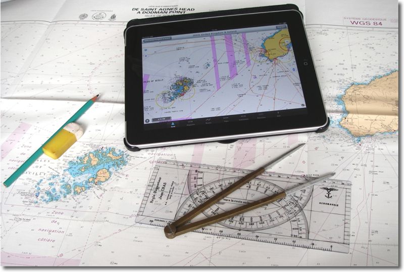
6. The Marine Card (s), or their extracts, officials, developed from information from a national hydrographic service. They cover frequented navigation areas, are placed on paper, or on electronic media and its reading device, and are kept up to date.
7. International regulations to prevent collisions at sea (COLREGS), or a textual and graphic summary, possibly in the form of adhesive liflets, or on electronic media and its reading device.
8. A document describing the marking system of the attended area , possibly in the form of adhesive liflets, or on electronic media and its reading device.
Article 240-2.05 Armaments and safety equipment semi-uprunner (6-60 Milles of a shelter)
1. Security equipment for coastal shipping.
[…]
4. The equipment to make the fix, to trace and follow a road.
5. The book of lights updated or available on electronic support and its reading device.
6. A logbook containing the relevant elements for monitoring the navigation and safety of the ship.
7. A device to receive marine weather forecasts on board.
Article 240-2.06 Armaments and safety equipment deep-sea (+60 Milles of a shelter)
1. Semi-upurning armaments and security equipment provided for in the article 240-2.05.
Analysis
Electronic cartography is therefore, since April 2008, perfectly admitted, and the "material to take stock, to trace and follow a road "is no longer specified. We can therefore just as well use a compass with dry tips, parallel rule and handbearing compass either a chartplotter, iPhone and iPad equipped with appropriate software and charts.
Regarding documents, Some articles call comments :
- A way to know tide hours and coefficients : This article was raised in the navigation section less than 2 minutes from a shelter, Without precision on the format of this "means".
- A document describing the marking system of the attended area and International regulations to prevent collisions at sea (COLREGS) : SHOM documents are no longer explicitly mentioned. This is actually, respectively, General works n ° 3 and n ° 2 of the Shom. But they can as well be replaced by any other equivalent work. On the other hand the work 1D is no longer cited, Yet essential to reading and understanding marine cards (²).
- It is clear that Cards and works can be digital, But that is not specified regarding The logbook. Can we deduce that, in the silence of the texts, It can also be digital ? I'm not so sure. Let’s not forget that the on -board book is a legal document, Opposable to third parties in the event of sea fortune, required by the authorities (Maritime Affairs), Rescue services, and… insurers !
French regulations have gradually aligned, Since the publication of the D240 division in March 2008, On British philosophy consisting in imposing minimum navigation equipment, and to leave the skipper the responsibility to embark the safety and navigation equipment corresponding to his program. It was a hell of a revolution (one another !) after having undergone, Since practically the beginnings of pleasure navigation, a huge list of mandatory and expensive safety equipment , dont, largely, no one used, and who made the fatty cabbage of the French shipchandlers.
—
(¹) Complete text in PDF format is available for download by this link.
(²) For those who have called for a glossary of acronyms found on Navionics charts, among others, I remind you that these symbols are international and that the in -depth reading of the work " 1D – Symbols, Abbreviations and terms used on marine cards ”, Allows you to learn about it.


Hello Francis,
This answer had not escaped me…But it is that of the administration, no legislator. This nuance will surely take on its full meaning the day or the subject will come in judgment.
I think the text must be officially corrected to remove this ambiguity.
Happy New Year anyway.
AJS
Thank you Francis for this didactic comment.
However, I find that the modification of the first sentence of the paragraph 5 article 240-2.06, seems to me to deserve the following commentary:
We went from the editorial staff: "The marine cards (s), or their extracts, officials, or drawn up from information from a national hydrographic service "which grammatically meant that was regulatory : "The marine cards (s), or their extracts, officials, or developed… "That is to say the unofficial cards as long as they were developed from official information.
The removal of "or" is far from neutral: It leads to the affixing of the adjective "developed" to marine cards and their extracts, at the same rank as "official".
It’s either a syntax error, either a considerable retropedage, in that it is possible to read the obligation of official cards there.
To be continued…
Alain, The answer was provided by François Lonchamp in a subject treated on the Hisse and Oh forum :
New division 240 from February the 05/2015] – Marine cards: SUITE 2: The answer
[New division 240 from February the 05/2015] : Marine cards
PDF documents to download for free :
Ripam 2a = edition 1991
Bank 2b = Mars 1993
Book 3C = April 87
Book 1D = edition 2006
books 32 (signals) = edition 1996
as well as the very interesting document on imperfections and the proper use of nautical documents of 2004
Very practical in an iPad, It seems prudent to keep a paper copy on board because unlike the cards, there is no specified the term "electronic" in the official texts concerning the documents.
This is excellent news, Effectively. A découvrir sur le site du SHOM, category Ouvrages numériques. Le téléchargement est libre, but be careful, il faut faire un appui prolongé sur le lien « Ouvrages numériques », sélectionner « Ouvrir dans une nouvelle fenêtre » du menu contextuel, pour pouvoir lire dans iBooks.
Thanks for the info.
Les ouvrages nautiques au format PDF, dont certains gratuits, et les cartes marines sont accessibles via diffusion.shom.fr
Vous me coupez la vague sous l’étrave : je prépare justement un billet (à venir rapidement) sur le sujet 😉