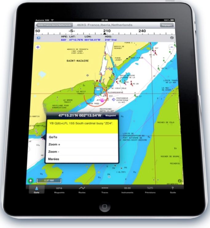
 With iPad 3G finally in hands, featured iNavX and (beta) version AyeTides XL in testing, I'm going to give you my first impression, previously to perform an extended test at sea.
Regardless of the fact that the iPad can be used for many other things than shipping, I am now totally convinced of its utility on board, here are the reasons.
Positive
- Built-in GPS effective even inside the boat, well above the iPhone 3Gs, was the thing to look primarily. Warning, you should check the reception in a steel vessel or aluminum.
- Screen bright, fluid image and excellent resolution, well above the mid-prices chartplotters. The Navionics have a superb sight.
- Minimum space (extra-flat) So easy to install and / or store. On the chart table, it will still provide support, rotating as preference.
- Less fragile than a PC / Mac laptop (no keyboard, no mouse, no trackpad, sturdy glass slab) and certainly more resistant to seawater wet fingers.
- Power consumption ridiculous.
- Easy to embark / disembark.
- Associated iNavX, the iPad offers all the functions of a chartplotter : waypoints, routes, tracks, instruments, File Transfers, and additional functions : TCP / IP, receiving GRIB weather files, link with the "Plans" application, link AyeTides XL (coming soon) for tidal predictions.
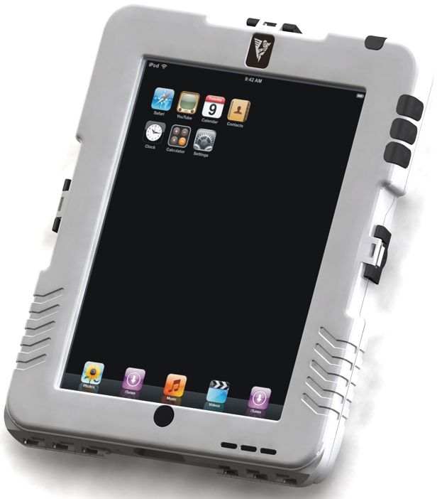
- Non-waterproof device : I do not know how to use it outdoors without putting it in a waterproof case, and so therefore it will also be convenient to use and reading. We would need testing.
- No connectivity provided to date for external instruments. However there is one WiFi solution detailed on this blog.
- The screen is no more or less readable in direct sunlight than any other device when the sun is directly on the screen. I had the opportunity to use a Furuno 8″ recent on helm : unreadable with the sun perpendicular to the screen. Do not dream !
Essential accessories for the boat
-
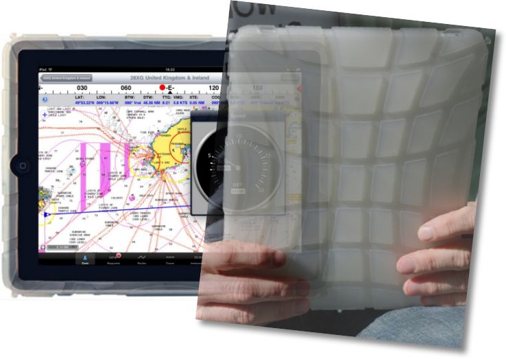
 A shock-absorbing case. Example below by HardCandy Cases. Excellent quality, is the one I use.
- A charger cigarette lighter 12V 2.1A, like the Kensington model opposite. Warning, cylinder model is fairly short, It may not make contact with some female cigarette lighter connector. Model Griffin PowerJolt is more cumbersome but more along.
- A waterproof case if you want to use it on the deck, like Andres Industries.
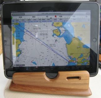
 And of course support, preferably rotary, iPad firmly fixing the above chart table. It remains to be invented, or make your own, like this pretty wooden stand from an American beta tester.
To summarize
For my own opinion, this device is perfectly suited to electronic navigation on small boats : GPS, consumption, dimension, very functional software continuously improved, universal vector charting very cheap, the use of WiFi to receive GRIB weather files by mail with iNavX,
Warning : 3G model essential for built-in GPS and electronic compass. On the other hand SIM card and subscription to the 3G are absolutely not useful for navigation. Finally, if you only load applications and charting, 16 GB model is more than enough.
—
Related Articles :
iPad : new support for iNavX ?
Question of choice


Hello,
Excellent comments and descriptions of the blogger and stakeholders.
I am a novice sailor in Marseilles, and I have a walkaround of 7,50 meters.
During my short trips in the surrounding, My essays are remarkable with Navionics.
But whenever there is a little mistral, Bridge, and the cockpit were soaked.
Do you have solutions for waterproof bags to put the charging socket?
And for media screw (rather than suction cups coming loose in the roll), and which can also allow the association said envelope sealed.
Thank you
Thank you very much for your comments. For outdoor use in the iPad, I merely provided a cover for my iPhone Aquapac (use sea kayaking tidal water), as I do not see a rigid airtight box like the one presented in example. I do not think there is a solution for the tight supply continuously. Anyway, this does not seem useful. The iPad is not intended for continuous operation 24/24, but from time to time to the point, cool track, l’atterrissage, etc,.
As-fixing, as mentioned in article : remains to be invented !
A good point for the GPS, damage ENC … The official U.S. and others are still the very best in my opinion (They are the only ones "authorized" to replace paper) and even pay, they are often much cheaper than private mapping.
From my side I 2 questions :
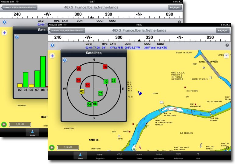
1 – GPS : Offshore far blankets GPRS, is what works : ie is it a real GPS or at'on need an antenna USB-style GPU ?
2 – The official ENC charts : they will be readable ?
Yes, A-GPS chipset Broadcom is totally autonomous and works anywhere on the planet. The cellular connection can only receive assistance (the "A" for A-GPS) which ensures the acquisition of position much faster (TTFF). Without this connection, the acquisition of the constellation takes no more than two minutes to obtain a position.
About charts, only Navionics vector charts are available from the site x-cross, not S-57 ENC used with such MacENC. These cards are present on half of the readers tracer sold worldwide.
Ps: Although ridiculous consumption (I think the charger is 10W), but mostly very good autonomy…
My iPad Fi is more 10 hours overrated in wifi !
Have you an idea of the autonomy of 3G enabled with GPS and Navionics inavx operation ?
Yes. Continuous use, free Wi-Fi, GPS enabled and launched iNavX : 9 hours to descend to 4% Battery charge. Time to recharge 100 % = 3 hours steps.
Hello Francis,
I just returned from a morning of fishing at sea, during which I have tested the boat on the IPAD .
I confirm that the GPS reception is excellent and immediate .
I bought a protective cover in Trendy Digital Marine, is correct, nothing more .
I acknowledge that the use of IPAD is really interesting on a boat : Widescreen, legible, very fluid and can move easily .
I noticed that the calculation of the recorded trace, is done by "suddenly" on iNavX, while it is perfectly smooth on the application Navionics .
Also on InavX, the menu on black band at the bottom of the screen is not visible outside super, and I'm sure I'm wrong, but I couldn't find a man overboard button.
Here, to summarize, I think that IPAD is perfectly suited for use on a boat . I hope that there will one day a navigation application more oriented fishing …
I am available if some questions …
Cordially,
JB
Thank you for this feedback. fully transmitted to the developer, always ready to explore possible improvements.