I relay here, in French, an article published in the British magazine Yachting Monthly (¹) the 30 th. The subject deals with the debate between paper charts and electronic navigation, by stating many truths, but also sometimes one or two untruths. The remarks have the merit of presenting contrasting arguments, and to obtain the opinion of recognized UK's professional boaters. Since the confinement imposes time constraints on us, let's take this opportunity to enjoy this instructive reading.…
Smart navigation – From paper charts to augmented reality
Yachting Monthly 30 th 2020 (¹)
Most of us sailed with MFDs, smartphones and tablets, or even drones. But can electronic systems replace paper-based navigation? ?
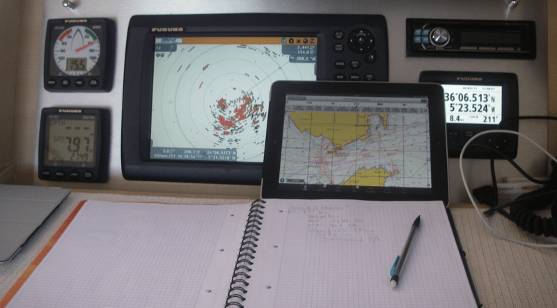
Marine electronics have advanced rapidly over the past decade. Chart tables have shrunk or disappeared completely, and you can no longer find the various equipment that displays the GPS, radar and AIS on separate screens. Nowadays, Most boaters have a marine electronic station with a multi-function central display (MFD) repeated on the boat. And if the battery fails, There are always backup smartphones and tablets, at least for as long as you can keep them charged. Does this mean that paper charts are redundant ?
"It's an interesting subject", says Lucy Wilson, from the nautical editor Imray (²). "Our paper charts are certainly not in decline, But the type of products people want is changing. The sales of large sheets are stable, but we increase the range of small size charts and packs".
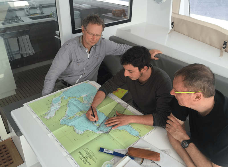
Imray also receives an increasing demand for printed charts on demand, which suggests that people want up-to-date maps without having to correct them by hand. It is clear that the skippers still want paper charts to plan their passage planning - even the most sophisticated chart plotter is limited by the screen size - but at sea, electronic charts are king. Imray produced its first digital charting application for smartphones and tablets in 2009 (now combined into one, Imray Navigator) and sells high season up to 14.000 chart packs. The publisher also produces charts for third parties such as Raymarine, Humminbird and Navionics, although they are always in raster format.
"Unlike vector charts, These are exact copies of the paper versions, which have been the subject of an editorial process", Lucy explains, "There is a level of information that we have removed from the Hydrographic Service (³) to make it more friendly to the skipper. For example, we do not show the wrecks of more than 30 meters deep because they are not relevant. However, The characteristics of the lights are always indicated, regardless of the zoom level, and it is not possible for a sandbank to suddenly disappear". Vector maps, on the other hand, are digitally assembled and presented in layers. As you zoom in, Information changes, which allows you to zoom in at a level that loses important details.
Tom Cunliffe points out that these things are more common than you might think. It tells the story of a boater who ran aground on a reef in the Coral Sea, Who, according to him, was not mapped. Tom looked at the ARCS version of the Pacific Ocean map and the reef was there, in plain sight. The skipper had planned his passage on a vector map of pleasure boating and had not zoomed in tightly enough. "A dozen yachts are said to be wrecked every year on the reefs of the Fiji group," says Tom. It seems reasonable to assume that at least some of them fell into the same trap. Gone are the days when you only had a chartplotter to show your position on an electronic chart.
Electronic Boards, such as Navionics and C-Map, offer automatic route planning using some of your vessel's parameters, and they indicate height or width restrictions. You can also set the tides to spring water or neap tides to increase accuracy. However, as discovered by Duncan Kent of Yachting Monthly, when he put the chartplotters to the test, routes avoid dangerous shallows but ignore the tides, winds, Eddy areas, firing zones and a plethora of essential local information. "I would never have let the autopilot take control, " he concluded. "Passing through the eddies of Portland Bill currents without knowing the tide or the wind ? No thanks ! ”
Of the dozen skippers we spoke to at the beginning of the ARC 2018, however, A single boat — a skiff of the years 1930 — relied on paper maps. The rest used electronic charts as their primary source of navigation.
Smartphones and tablets
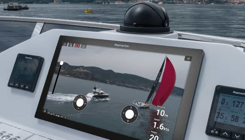
Mobile devices are increasingly taking over functions that were previously the preserve of multifunction devices. With the right app and the right wireless features, You can control complex systems such as chartplotters, pollsters, speed cameras, Autopilots, thermal cameras and even marine engines. But could you get by with a mobile device alone? ?
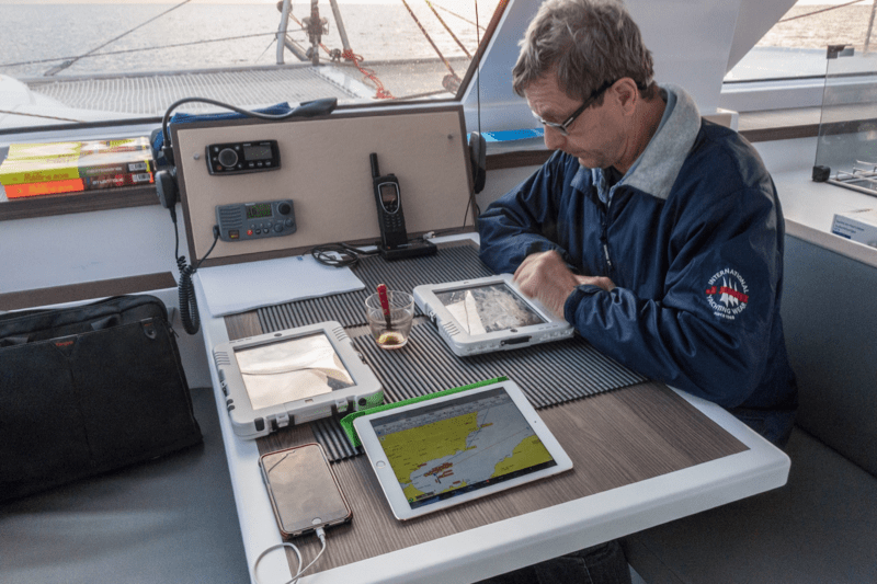
The transition from Linux to Android software has opened the way for new navigation applications on chartplotters as well as on smartphones
A walk through the Raymarine test center doesn't suggest it. This is where you realize which products are used for marinization (and why they cost so much). In an installation straight out of a James Bond set, The vast complex of rooms tests and ages the products using an impressive series of giant pipes, water and salt spray chambers. There are clean rooms, darkrooms, Vacuum rooms, and even oversized ovens that cook all kinds of gadgets.
If you've ever dropped a phone in water or held it in direct sunlight, You will see how quickly it deteriorates (⁴). A multifunctional device, on the other hand, shouldn't, And there are binders filled with European safety guidelines to make sure it doesn't deteriorate.
Power supply, on the other hand, breaks down, as Paralympic skipper Hannah Strodel saw this year at the Tour of Britain and Ireland. "All our electrical appliances have gradually failed as we have progressed around the country", she said. "On the East Coast, we had nothing left except a VHF position, Emergency navigation lights and torches, so the fact of being able to sail the old-fashioned way [with Imray cards] was absolutely life-saving ! ”
In addition to the need for constant recharging, the other limitation of mobile devices is GPS. It is not possible to know, from a product's specifications, whether a smartphone or tablet GPS works offline, and, if this is the case, if it is useful. Indeed, Smartphone tracking system combines GPS with triangulation from mobile phone towers, Wi-Fi and tracking your last known location. Although there are many places where you can navigate within smartphone range, once you are outside of these places, without assisted GPS system, You might find that you need to 15 minutes to an eternity to get that top position (⁵).
The Royal Yacht Association (RYA) advises students not to rely on a single method of location and to constantly check their position with another technique. James Stevens, former RYA Chief Examiner, admits that the universal use of e-navigation means that many skippers are "decidedly grumpy" when it comes to traditional charting. "Examiners are not at all convinced by candidates who can only navigate on a screen and are not able to update their heading and strategy when conditions change", he warns.
Even on a yacht equipped with all the electronic equipment, It is important to understand the principles of navigation, Not least because it allows you to verify that the seemingly accurate display is telling you the truth.
The Great Debate : Do you need a paper backup ?
James Stevens
James Stevens is a former RYA instructor and chief examiner
"The RYA introduced e-navigation into its programs more than a few years ago, 20 years old. Students attending the RYA's shore courses receive specially ordered paper and electronic charts with a chartplotter simulator that can be downloaded to a home computer. The RYA has always maintained that mariners must record their electronic position and verify it by some other means. This verification can be visual, by depth, by radar or at least by an approximate reading on a paper chart to verify that the electronic position is in the right direction and that the number of miles in relation to the previous one is correct.
The RYA, realizing that boaters don't want to spend weeks in the classroom, has introduced a short on-shore training course that can be completed online and provides just enough information on the base charts to make short GPS navigations. At a higher level, Yacht captains are examined on their ability to use paper and electronic charts. They must be able to understand the functions of the tracer and, in example, enter waypoints as well as perform traditional mapping work. An oceanic yachtmaster is known to navigate by GPS but must also be able to obtain positions by sextant. ”
Pete Green
(Yachtmaster Instructor, Ocean Yachtmaster and Managing Director of Halcyon Yachts – International Yacht Delivery)
"In the world of conveyor, We deal with a wide range of boats, some better equipped than others. Our conveyors are used to carrying basic tools, navigation equipment and sometimes even pots and pans. With the considerable technological advances we have seen over the last decade, It is becoming easier and easier to bypass paper maps. Most yachts are equipped with built-in chartplotters, but we also use a backup tablet that works with Navionics, Not to mention the smartphone that each crew inevitably carries with its navigation software. I still have paper cards, but I can't remember the last time I had to use them.
The aviation industry has relied solely on electronic cockpits for more than 10 years now and I think the browser community can easily follow suit. ”
Norman Kean
(Editor-in-Chief of the Irish Cruising Club's Sailing Directions Sailing Guide)
"The concept of a 'map' will become obsolete. The paper map remains the main source of information from which the electronic charts of the yachting market draw their data. But the paper map is on the way out.
I use electronic boards all the time, but when I want to have an overview, I take the paper. It is literally a work of art. Each Name, The sound and symbol on it was chosen by a human expert, clarity is a top priority. Maybe we'll end up using raster maps. But screen size will always be an issue. In the meantime, Vector maps use a "deferred display" , Your plotter does not contain maps, but only data, and he draws the map he thinks you want, On-demand. It's a pretty amazing computer tour de force, but it ends with strangely chosen place names, often in the wrong place, shallow areas without accurate probes, islands and rocks that disappear when you zoom out and details that give a false sense of precision when you zoom in too much. Once again, I'm leaning towards paper.
The decline of paper will eventually make the concept of the "map" obsolete, and the world will be a continuous data field. What an opportunity for a new generation of products perfectly adapted to replace paper. But at the moment, The electronic boards of the yachting market are simply hideous. ”
Duncan Kent
(Experienced sailor and technical writer working for numerous nautical magazines and digital publications worldwide.)
"As ingenious as the modern electronic navigation system is, I don't rely entirely on him yet and I certainly wouldn't let him take control on his own. I have been testing and using navigation instruments for almost 30 years old, I therefore know their capacities and their limits. Nowadays, I wouldn't choose to sail without at least some basic electronics, because it makes life much easier and, in many ways, Safer. But I would never advocate that someone go to sea depending entirely on vulnerable electronics.
Digital mapping has improved significantly over the past few decades, as well as the processing capacity of multifunction displays (MFD). Today, it is common to have data on tidal heights and currents loaded in the database and even a routing function that can suggest a route from A to B, which can be useful as a starting point for planning a crossing.
I often use this feature when preparing, just to see how the recommended route differs from my own version, manually deducted. In most cases, We agree, but when a delicate coastal sail is planned, I often find elements that I don't like. To be fair, there are many things that the MFD does not know and therefore cannot calculate, like the way my boat behaves in certain seas, local knowledge of tidal currents, Eddies and others, and if I have three experienced sailors on board or only a few non-sailor friends. ”
–––
(¹) Smart Navigation: From paper charts to augmented reality
(²) Imray, Laurie, Norie & Wilson Ltd
(³) United Kingdom Hydrographic Office (UKHO) The British Admiralty Maritime Mapping Service.
(⁴) This is to forget a little too quickly the many waterproof and shockproof protections available on the market. (NDT)
(⁵) This argument is totally inaccurate. Most tablets and smartphones are equipped with very high-end miniaturized GPS receivers, able to operate autonomously without cellular assistance. They support GPS networks (USA), GLONASS (Russia) and recently Galileo (HAD). See my post GPS and iPad Wi-Fi + Cellular (
–––
Related articles :
Raster charts... the come back [Update]
Electronic charts : scales and overscale [Update]
About alignments and sextant
———

Hello Alain,
I agree with you in all respects. The article by Patrick Moreau in the magazine "Sauvement" that you cite is indeed particularly edifying. I have always considered that the most important component of seamanship is the indispensable humility that consists in doubting everything, to start from oneself, and therefore to multiply the means of securing one's position. At sea, as in mountains, Neglect, worse the inconstancy, do not often forgive !
Hello Francis,
Thank you for this beautiful translation which feeds a debate that the nautical news revives from time to time!
"Can electronic systems replace paper-based navigation?"
With the nuances imposed by the variety of sailing situations, My answer is no., and for a simple reason: The sufficient reliability of the electronic systems and their necessary power supply cannot be fully and in all circumstances ensured on (small?) yachting.
There are obviously ways to compensate more or less for this structural inadequacy, but none, To the best of my knowledge, guarantees the reliability we should expect from a navigation system that is, All in all, We entrust our lives!
This is the main reason why, Although I have been using electronic navigation systems for a good twenty years now, I keep and regularly use the classic navigation equipment: (chart, compass, probe, almanac, sextant...) and I keep a handwritten logbook, every three hours in normal times and more frequently when flying or when conditions require it.
In coastal navigation, I force myself to spot the landmarks, fires, marking and checking them on the map...
....but I prepare the navigations very often with my iPad, which is very useful for me to recover weather maps and grib files, to do routing on the basis of the elements collected either by iridium Go or by BLU...
....but I regularly put my position on a paper map, crossing once a day, flying at least every three hours.
I totally agree with Duncan Kent, and is found in the common use of the two sources of information that constitute paper and electronic, A great way to remove the doubts of the browser!
In conclusion, I suggest reading the issue of the issue 151 of the SNSM magazine exposing the observation made by the SNS rescuers 147 during the dramatic sinking of the First 51 Roder Mor, in January 2020 on the outskirts of the island of Groix. The article in its entirety can be consulted on the internet. It exposes the chain of events that led the sailboat from a power failure in Portugal to the shipwreck on the island of Groix.
Merci.
On every boat that sails there is probably at least one tracker with its GPS, an AIS with its own GPS, a computer, a tablet, Multiple phones… during my crossing of the Atlantic we were 3 on board, and we had in total 5 GPS, and 4 software with their maps (Raymarine Plotter, Navionics on a phone, iNavx on another phone, W4D on a tablet… No need for paper, if and only if you have the guarantee of having electricity and in my humble opinion it is much more important to make sure you always have electricity.
Merci Francis,
Tu es partisan du « en même temps »; tu as réussi á mettre les deux langues en même temps, bravo!
Dominique
Very interesting article, merci.
A personal reflection on this passage: "The aviation industry has relied solely on electronic cockpits for more than many years. 10 years now and I think the sailing community can easily follow suit." :
In an airplane with several engines, If one of them fails, there is still at least one that continues to power the electronics. And on the way there are solutions for survivors. And even if the electronics are out of order, It seems to me that there are always analog-mechanical dials (on small planes safe, the big ones it seems to me). I don't know if we can make the same parallel with a sailboat . Or on a sailboat that has two engines AND all the electricity/electronics part that is absolutely waterproof …
The debate raised in this very good article dates back a long time. Over time, we try to change THE response when it seems to me more accurate to adapt the response to the situation, to the type of boat, to the geographical area, to the navigation program, aso.
A passage encourages me to think about reviewing my way of doing things on one point : maybe I should make myself another Logbook requiring me to have the information indicated by the electronics AND the same information that I will collect otherwise. On a day or half day coastal navigation in a known and easy place it will probably not be useful (at least it depends on where you place your cursor) but over a longer period of time it could be relevant.
Regarding MDF screens which will always be too small (compared to a large paper map), It would be "fun" if a company worked on a laser pointer on precise engines that would indicate the position on the paper map.