
In a previous entry I presented the SHOM raster charts provided by many publishers on iPad. For several weeks the German nautical chart publisher NV Verlag offers two new areas ending coverage of the coasts of France Atlantic and English Channel. These charts are usable both with iNavX on iPad/iPhone, only with GPSNavX and MacENC on Mac. We can therefore, unlike Navionics, use the two available copies of each region on two different media (iPad , iPhone ou Mac).
 Available on the X-Traverse website, in the catalog NV Chart, they are named France 1 to France 4 and are at the same price regardless of the destination medium, thus 99,90$ (environ 90 € to date). This rate is the result of the high fees charged by SHOM, but the remarkable work of NV Verlag offers us an excellent design and remarkable rendering raster charts.
 Use with iNavX

These raster charts not (encore) the object of tiled display ("Tiled Charts"), the developer provides features to switch fairly easily from a scale to another. It must first activate the function "Show the boundaries" in the settings of the 'Chart ' view..
 To reduce the scale, a tap within a boundary adds the chart name in chart contextual popup menu. A tap on the name opens this chart :
 To go up to a higher scale, a double tap on the button 'Chart' in bottom left banner opens the charts available at the different scales containing the position :
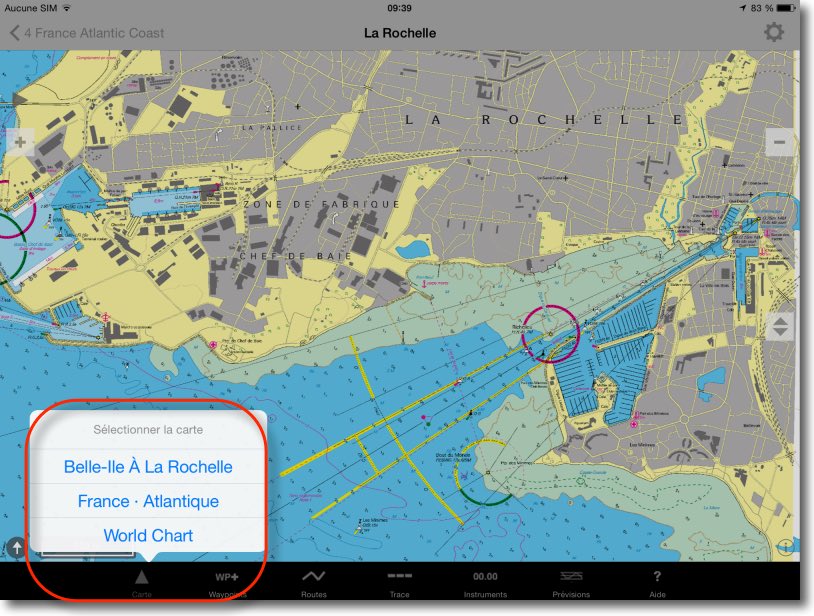
You can also use the buttons +/- to access larger or smaller scale maps :
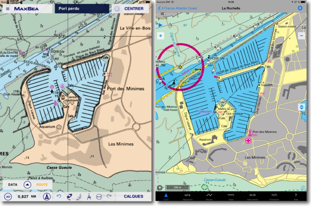
 It's easy and effective. It should be noted that these charts are perfectly up-to-date, and renewed regularly. A simple comparison with MapMedia charts in TimeZero, uploaded on the same date, yet also from SHOM, is enough to demonstrate this.
 GPSNavX

It is important to note that these charts are the only quality raster charts available for France to use with GPSNavX. Users of this first application developed by Richard Ray may finally have updated charts. It is likely that one or two other regions will soon complete the coverage of our Mediterranean coasts.
 —
—
Hello Francis
I bought for 90€ Northern Brittany which is called France 2 , very nice cards really, disadvantage they do not "tile" , and are expensive, this is an improvement compared to Navionics, whose bottom is often blurred by submarine cables .
Thank you for the post on these cards.
Renê
The "Tiled Charts" display is already applied to many of the NV Charts, this should happen for France maps in a future iNavX update.
You're not talking about the use of these cards in Mac ENC. Is there a special protocol? ?
Many thanks for all this information !