 What I've been planning for a while has finally happened. : iNavX lost Navionics mapping ! It seemed obvious that the historic contract which allowed iNavX to have privileged access to Navionics cartography, since the origin of the application designed by Richard Ray in 2009, was threatened. Since then things have changed a lot : repurchase of the application by NavX Studio (¹), acquisition of Navionics by Garmin (²), generalization of the annual chart subscription policy (³)…
For French users still numerous, partly thanks to the French version, but above all thanks to the Navionics charts covering the whole of Europe in great detail, without the need to renew subscriptions, This sounds the death knell. Current iNavX developers just announced the integration of vector charts Global C-Map, but with one major limitation : Live use only, therefore requiring a permanent internet connection :
Coverage includes and is not limited to : USA, North America, Caribbean, South America, Europe, Asia Pacific, Australia and Africa.
C-MAP World Chart delivers high-res vector charts for global coverage in one easy-to-use chart. Delivered as an Online Chart, the C-MAP World Chart is a worldwide vector chart that navigators have benefited for years. The chart sources are based on ENC and additionnal sources published by hydrographic offices. The C-MAP World Chart is updated quarterly and requires a data connection [via Internet].
The result is that, Offline cellular, no more charts are available for Europe (except Germanic coasts and surroundings). And it is highly unlikely that C-Map will allow downloading of the charts., because that would come in competition with their own application which offers this function with an annual "Premium" subscription .
Since, what future for iNavX in Europe for offshore sailors ?
[PS] If you don't want to lose the downloaded maps, The account must be deactivated before any update.
[Update 11 th 2021]
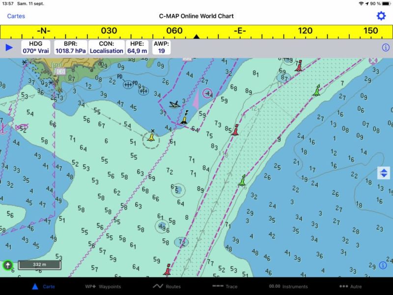
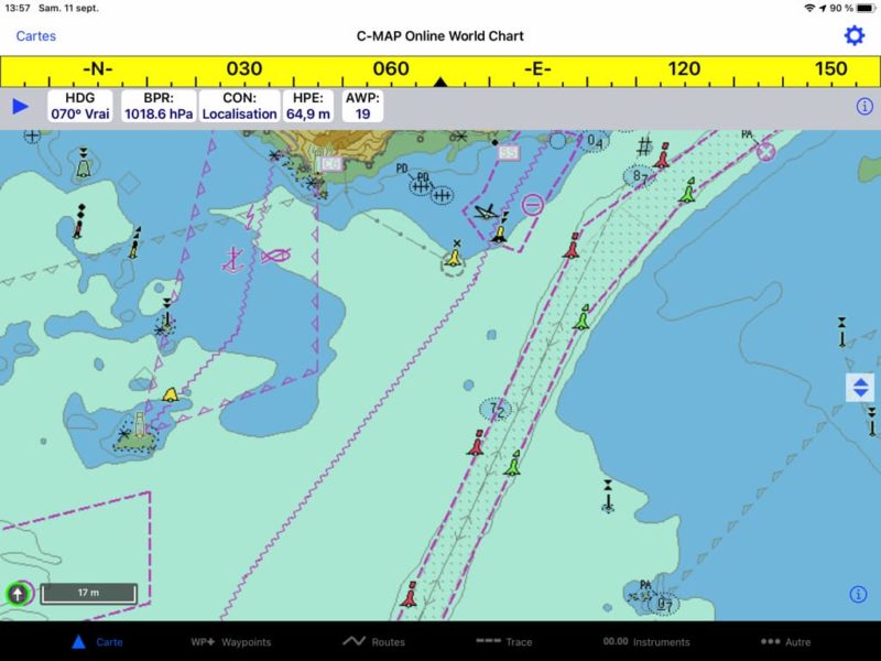
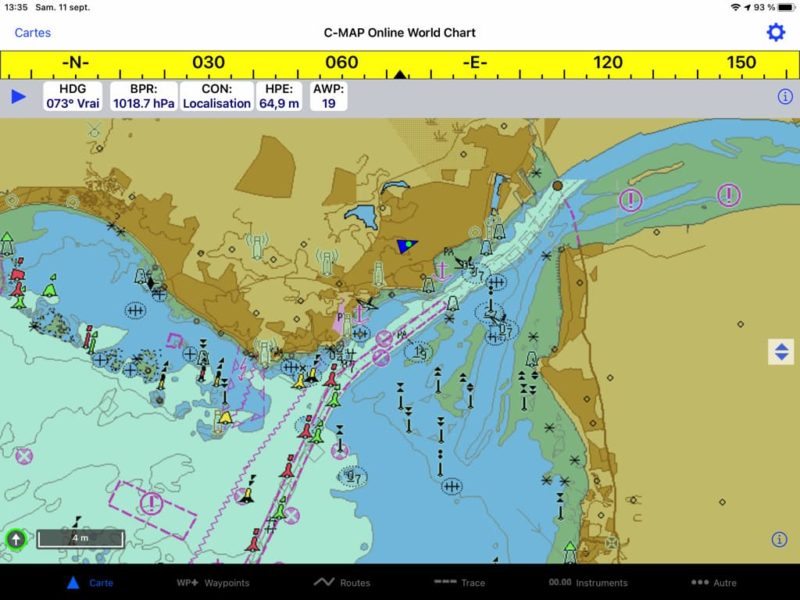
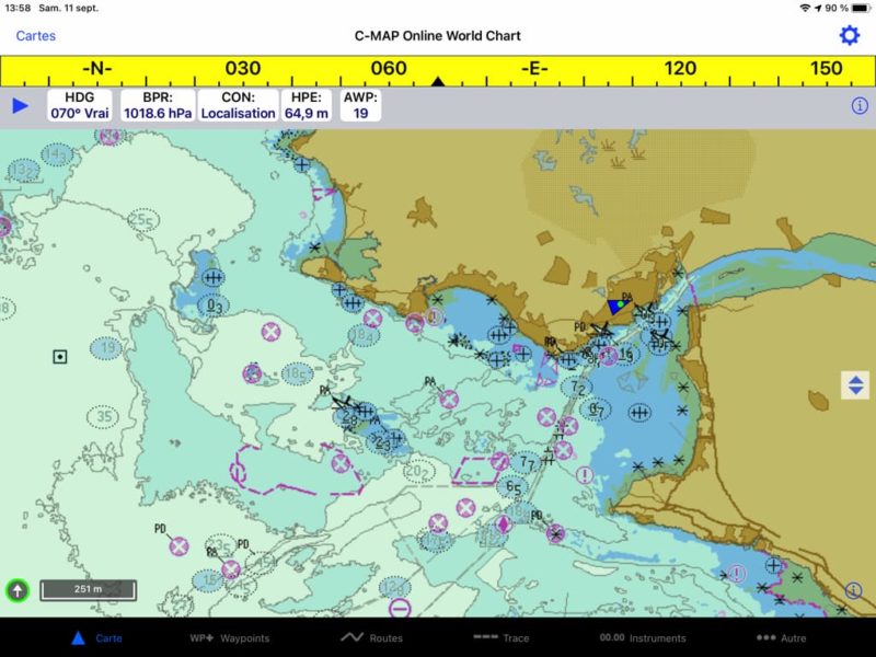
With the sudden price drop (50%) I got the C-Map subscription. I'm glad I did. I could see that in the current state of the display, charts are unusable. No additional information is displayed on the chart : No text (place names and marks, Characteristics of the lights, light sectors,…). In addition, the probes disappear at certain scales by zooming out, as well as most of navaids. No C-Map specific display option for information layers is available in Chart view settings, unlike what was offered with Navionics. It seems that it is a work done in emergency... !
–––
(¹) iNavX undergoes a change of ownership
(²) The stakeholders of electronic charting
(³) Digital nautical charts : purchase or subscription [Update] ?
–––


Apart from the comments on the availability and the choice of applications for me W4D), This reminds us of the urgent need to "download" paper maps in your boat.
Wise remark ! Except that, in the years to come, we're going to cry to find some https://www.navigation-mac.fr/la-norme-s-100-des-cartes-enc-evolue-rapidement/
Which app to replace INavX with seatalk NMEA connection, as INavX ?
The same ones already mentioned in my previous answers : Weather4D, C-Map charts, iSailor, SailGrib, aso…
An example : this summer I was racing in the Four channel, and against the tide, at night and in doubles. Let's imagine that there is no connection between two grains, I lose my mapping ? I'm going to the pebbles because a "decision-maker" to please his shareholders has imposed a connection and no loading of cards ? I understand correctly. For information, This is exactly the situation I experienced this summer …
Most apps allow maps to be downloaded for offline use, fortunately ! (W4D, iSailor, Navionics Boating, aso…
It is certain that this announcement calls into question any browsing offline internet on our iPads. Constant user of this medium, Certainly, we must have on board maps (Loaded) and a reliable GPS position for safe navigation or tactical regattas.
How to do it
Thanks to the Americans once again and at the end of a possibility to go around the world with an Ipad !
This is not quite right, there are many other applications than iNavX to make a world tour Weather4D, C-Map charts, iSailor, SailGrib, aso…
Hello Francis Thank you for this information. I don't really see how to replace INavX. W4D is good for crossings but offers few possibilities for coastal navigation, especially in the Caribbean. What will be the best option with an offline consultation ?
SHOM + UKHO covers the entire Caribbean in detail (Geogarage).
IMRAY too.
Thank you for all these clarifications, Much appreciated!!!!
Oh dear
Indeed, our maps downloaded on iNavx will become precious collectors !
About C-MAP as a replacement, iNavx support described this to me : "We are now offering C-MAP worldwide online charts. In a few weeks we will be adding a feature that will allow these charts to be stored for offline use with certain limitations. ”
Let's see what limitations ?
If this is indeed the case (and why didn't you do it from the beginning ?) C-Map will require the same restrictions as in their own app. It seems difficult to me because in the C-Map app no navigation function is activated without the Premium subscription (no GPS position, Neither WP nor road), and it must be renewed every year.
Thank you for this information, and yes, I ask the same question as above : what solution for the Caribbean ?
For the moment Navionics Boating at the most economical, or SHOM charts in Weather4D Routing & Navigation.
Hello Thank you for these clarifications . What is the solution for long crossings and Caribbean countries ?
Sincerely
Paul
The best : Weather4D Routage & Navigation + SHOM charts / UKHO