New major evolution of the GFS model

NOAA (¹) annouced on 22 March a major upgrade to its weather forecasting model GFS.

For the first time, the Global Forecasting System (GFS), NOAA's flagship weather forecast model (¹) will be coupled with the global wave model Wave Watch III (WW3), produced by the CMNF (Fleet Numerical Meteorology and Oceanography Center), which will extend the current forecast of waves from 7 down to 16 days and improve the prediction of ocean waves forced by the atmosphere. Read more …

Sea state : interpret wave patterns

In Weather4D, as generally in other applications, sea ​​state forecasts are described by ocean models. The most used is the model WW3 (Wave Watch III), published by FNMOC (Fleet Numerical Meteorology and Oceanography Center) of the US Navy, with a global model due to 7 days and resolution 1° (60NM), and a Europe model to 3 days and resolution 0.2° (12NM). Météo-France publish the models MFAUM (Wave Assimilated Model) coupled with the ARPEGE and AROME weather models with three resolutions : Global at 0.5° (30NM), Europe at 0.1° (6NM), France at 0.025° (1,5NM) with variable deadlines (¹). Read more …

Routing : from game to reality (continue)

Friday 13 November will not be a lucky day for the Vendée Globe skippers 2020 (¹). They will have to negotiate the encounter with tropical storm "Theta" which crosses their course with average winds that can reach the 40 nodes and powerful bursts. Above all, the sea will be to be feared because, strongly crossed as they passed the centre of the low pressure system, Waves may exceed 6 meters and break in a chaotic way. Read more …

Routing : from game to reality

On the second day of racing of this Vendée Globe 2020, we can say that the weather conditions that the skippers will experience on the descent towards the Doldrums will be particularly tough. After a departure in a damned weather, A first weak cold front passed without incident, The Solitaires will cross a second, much more violent front during the night and morning from Tuesday to Wednesday, for the group that went to the West, and in the evening for the group passed between the DST (¹) and Gallicia.

But these upcoming conditions are very different for Virtual Regatta players and For sailors… Read more …

ECMWF weather data soon open to public [2rd part]

Source : The Parliament Mag par Umberto Modigliani, ECMWF Deputy Director of Forecasts, responsible, with the department director, continuous production of forecasts and relations with users.

Early October, the European Centre for Medium-Range Weather Forecasts (ECMWF) will take a big step forward by making hundreds of its forecast maps available to everyone free of charge.
The changes are part of a broader European initiative to make public sector data free and open, encourage innovation and support a thriving data-driven digital economy.

Thus far, full access to these forecast maps was restricted to the national meteorological and hydrological services of the Member States and the ECMWF Cooperating States, to members of the World Meteorological Organization and commercial customers. Access was subject to a series of customized licenses and high royalties.

Read more …

ECMWF weather data soon open to public [1st part]

Created in 1975 at the initiative of members of the European Union, the European Center for Medium-Range Weather Forecast is an independent intergovernmental organization whose headquarters, until this day, is located in Reading, England. ECMWF is funded by 22 Member States and 12 Associated states. It employs nearly 350 persons, and its supercomputer equipment is one of the largest in Europe. For the past fifteen years or so, ECMWF forecasts tend to be among the most accurate in the world, according to verification data from the World Meteorological Organization (WMO). ECMWF is currently headed by French meteorologist Florence Rabier, who worked at the local meteorological office of Météo-France.

But, since the advent of Brexit, The situation has changed. The United Kingdom is no longer part of the EU, ECMWF must move to a European country, and this could lead to, For weather data users, consequences rather… Positive ! Read more …

Receive facsimile weather maps with an iPad [Update]

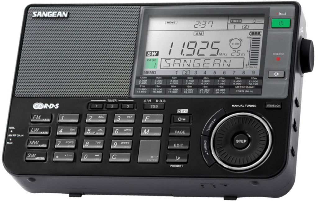
Un récepteur BLU plaisance

An SSB receiver for leasure boating

HF Weather Fax to Black Cat Systems is an application allowing you to decode facsimile weather maps on an iPad, an iPhone or Android device. The analysis and forecast maps are provided by radio stations around the World. Broadcast on shortwave, they can easily be received by BLU receivers as found in boating catalogs.
Read more …

Receive graphic weather maps on iPad [Update]

Weather analysis and forecasting maps developed by the NOAA (USA) and the Met Office (UK) cover vast areas over the Wold. They can be obtained sending a request by email to the weather server of british company MailaSail. With the latter, many maps are available in a listing (¹) in which it suffices to click on the links to load the request in a message ready to send. Read more …