Reading : "Beaufort, l’amiral du vent" by Raymond Reding

It's a long time since I had made a reading note in this category. Lack of time, or lack of discovery ? I once again found a real literary enthusiasm when I read this excellent book by Raymond Reding : " Beaufort, The Admiral of the Wind ”.

Like any sailor that complies, I know the Beaufort scale since my first legs in sailing school, but, shame on me, I had never tried to find out more about this famous Francis Beaufort ! Raymond Reding, went like me through Les Glénans Sailing school, finally fills this lamentable lacuna with the greatest happiness. Read more …

Weather4D makes its (r)evolution

Hear, hear, hardy boaters, new Weather4D applications come up !

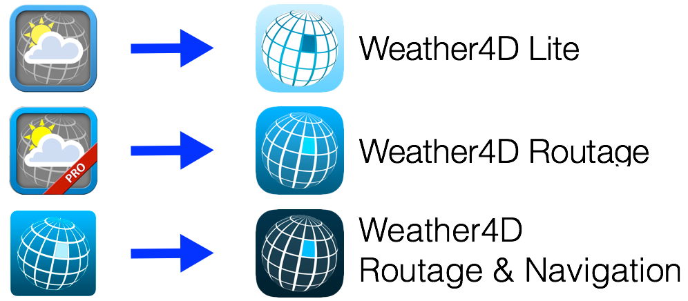
I wrote “the” in the plural. The two historical applications of Sarl APP4NAV, Weather4D (th 2011) and Weather4D Pro (November 2011 ), change to the user interface of the now famous application Weather4D 2.0, which had been the subject of a complete review of its development published in December 2015. In order to make the range more coherent, the names of the three applications are harmonized :

Read more …

Iridium Mail & Web app : GRIB weather files on iPhone and iPad in open sea [Update-2]

[Update 15 February 2019] The recent update of the application Iridium Mail & Web app gives me the opportunity to refresh this post originally written in December 2011.

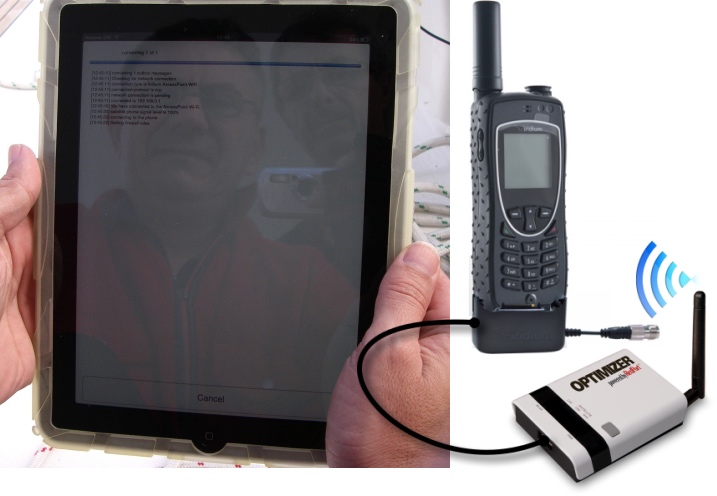
The Wi-Fi Gateway Optimizer from RedPort allows owners of a mobile satellite phone to make requests and receive GRIB weather files from an iPad or iPhone on the high seas, into the wild, anywhere on the world.

After implementing and testing this solution On a long journey, It proved to be perfectly operational. However, it is limited to the receipt of the forecasts of the GFS weather model worldwide, and the wave pattern WW3, obtained by the American server's autoresponder Saildocs.

Read more …

Weather4D 2.0 revisits navigation on iPad [Update]

Weather4D 2.0 is available sur Apple AppStore (*). After the success of the first two versions, APP4NAV company just revisit chart navigation on iPad and iPhone by integrating the timing dimension. With simulations and weather routing, navigation becomes predictive, allowing a constant anticipation of future weather conditions and sea state. This “navigation into the future”, relied on the quality of meteorological and oceanographic predictions today available, was designed in order to bring a new dimension to the safety of boaters. Read more …

Météo-France GRIB files finally for free

A year after my advocacy for free European data (¹) Météo-France finally offers free access to its two famous ARPEGE and AROME models. A welcome development, started in 2014 by the success of MyOcean, since then integrated into Mercator Ocean (²), but a notable change of attitude for a public establishment which has always been asked to self-finance a significant part of its budget. Forecasts from these two models are made available on Météo-France portal in the GRIB version 2 format. Since the 21 July 2015.

Read more …

New GFS grid 0.25° model

By a corrected notification on 23 December 2014 (¹), with NWS (National Weather Service) NOAA announced a major update to its GFS weather prediction model to be effective in mid-January 2015. Actually, This model has been partially available on an experimental basis since the beginning of December.

NOTE

March, the Global Forecast System (GFS) is a weather forecasting model produced by the National Centers for Environmental Prediction (NCEP) dependent on the NWS. Dozens of variables (²) are available through this dataset, from the temperatures, winds and precipitation down to soil moisture and atmospheric ozone concentration. The entire world is covered by the current GFS model with a horizontal resolution of 27 km between grid points up to 10 days. The horizontal resolution is 70 km for forecasts between one week and two weeks. The GFS model is a coupled model, Composed of four distinct models (An atmospheric model, An ocean model, A terrestrial model, and a sea ice model), that compete together to give an accurate picture of weather conditions. Changes are regularly made to the GFS model to improve the performance and accuracy of the forecasts. Mesh data is available for download via NOMADS servers (National Operational Model Archive and Distribution System) and widely used by app developers around the world.

Read more …

Routing and usage precautions

With the advent of powerful weather-routing applications on our tablets and smartphones, as Weather4D and SailGrib WR, at truly affordable prices, routing is becoming more popular for pleasure boating. The quality of these applications is already appealing to amateur sailors, and even some high-seas professional riders, but also a growing number of leisure boaters. Riders use the routing in the essential interests of performance, Achieve the fastest route from one point to another, so leisure boaters are more focused on getting safer and more comfortable routes. For them, The notion of speed is mainly used to avoid periods of bad weather, and the optimized route to escape areas where sea and wind conditions can be dangerous. Routing is also used for this : even in powerboating, you may try to avoid too much wind speeds or wave heights to ensure ypur crew comfortable and serene trip. But what credibility can be given to routing ? Read more …

Weather4D still makes greater finesse

With the basic 1.3.3 and PRO versions 1.3.9 delivered last November, Weather4D had replaced the GRIB files fine grid from Great Circle by its own files based on the U.S. model WRF (¹), computed under his own steam. These files cover Europe, Greece, Canaria, Azores, Greater and Lesser Antilles, offer a resolution of 0.1° (6 NM) up to 96 hours by 1 hour steps. The data provided is the same as the GFS model (¹). At the same time, The annual subscription price has been reduced by 60 down to 30 €.

Thanks to the implementation of new means, the next updates that have just been submitted to Apple Store will provide even more details. Olivier Bouyssou explains :

« FYI, App4Nav uses 6 different servers, 2 for the calculation of WRF model and 4 for distributing GRIBs : 2 for the US+Asia region and 2 for Europe. At this time 8000 GRIBs are distributed per day and triple during the season… ”

This now enables to provide, for the French coasts, including Corsica, ultra-fine grid to 0.04 °, that to say 2,4 NM. It also adds to the GFS and WRF files new data evaluating wind gusts. Read more …

Weather4D PRO 1.3.3 further improves routing

weather4d proImprovements…

No respite for this application : two and a half months after integrating the currents into the routing calculation, this latest version provides significant advances on this function. The improvements bring greater precision to the calculation of the optimized route and new parameters allow for fine-tuning.

… and two pieces of good news :

They concern currents, follow the leader… Read more …