![]() Delivered in AppStore this morning after two weeks of revisions and contre-revisions of Apple services, Always more picky, The new version is finally available. On the menu and in bulk : AIS via internet with AISHub, direct access to Geogarage and cache memory chart management, new model of GRIB weather forecast from Meteo-France AROME HD for inshore races, Full-screen mode, advanced distance calculations, the most visible. Under the hood also a lot of optimization for routing and power consumption. Detailed review to follow…
Delivered in AppStore this morning after two weeks of revisions and contre-revisions of Apple services, Always more picky, The new version is finally available. On the menu and in bulk : AIS via internet with AISHub, direct access to Geogarage and cache memory chart management, new model of GRIB weather forecast from Meteo-France AROME HD for inshore races, Full-screen mode, advanced distance calculations, the most visible. Under the hood also a lot of optimization for routing and power consumption. Detailed review to follow…
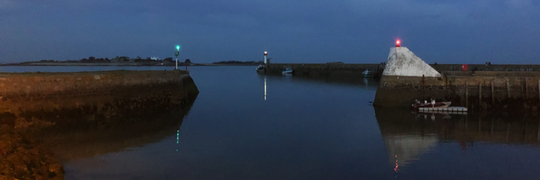
AIS
AISHub network is an AIS tracking service covering most of the northern hemisphere and the busiest navigation regions of the southern hemisphere. It has the particularity of functioning as a center sharing raw data NMEA AIS. This allowed APP4NAV to integrate this real-time service into Weather4D 2.0, in addition to the own vessel AIS reception. This of course requires an internet connection., but the generalization of the 4G cellular network often allows it in coastal navigation.

In green the AIS targets of the receiver on board, in blue the targets via the Internet
Charting
The Geogarage service is now directly accessible from the application, to register and buy the necessary charts. The user manual details the procedure.. We now have the ability to manually clear all of the charts contained in memory cache. The charts loading is done, either by displaying the desired areas and zooming in on all levels, is now more simply by using the function of preloading.
 The memory cache of 1 Go is shared between nautical charts, satellite imagery (Bing) and land maps (OSM). It is allocated in a protected memory area, cannot be deleted only by a user action : exceeding the memory size by loading new tiles or action on "clear cache" button..
Routing
Many improvements in the use of the function, with in addition the weather model AROME HD from Meteo-France, the finest resolution available today on our shores, with a grid of 0,6 NM, wind data only allowing, associated with MyOcean currents , a sharp routing for the small racing course.

A grid of 1100 meters in latitude, 760 meters in length in Quiberon Bay
User Interface
You can switch to full-screen display with a double-tap, same gesture to return to normal display. The direction of the wind, waves and currents were missing from the data labels, this is now fixed. A distance measuring tool, quite sophisticated, also fills this gap. You can perform several distances displayed simultaneously, snap one end on the position, an AIS target, both, or two AIS targets. A single gesture : a long press with two fingers (any fingers, even with two hands). Magic !
 To finish with the apparent improvements, you can now export routes in GPX format with the generic iOS export icon. The import in the same format was already active in the previous version.

The optimized route can be exported in GPX format
The rest can be discovered on the page What's new on Weather4D web site, and of course in the user tutorials in French and in English.
–––
Bonjour,
I just purchased Weather 4D 2.0 and I'm going to sail between Hendaye and San Sebastian. I wonder about the best choice regarding navigation software between iNavx and W4D :
– which map is the most accurate : the Navionics 46XG electronic card (iNavx) or the SHOM Raster map 6786 (Weather 4D) ?
– can we with the new version of Weather 4D 2.0 export routing to iNavx ?
Thank you in advance for your response.
These are two applications that can complement each other perfectly. Due to the low cost of applications and cards, it is not superfluous to wear belt and suspenders. Even if you mainly prepare and follow navigation in Weather4D 2.0, you can always transfer your routes to iNavX (and vice versa in the next update). The SHOM map stops in detail at the Spanish border. The Navionics map then becomes necessary along the coast of Spain. Note in W4D 2.0 that the UKHO provides some details of the coast of Spain, and excellent Bing satellite imagery (delivered as standard) for port plans.
Bonjour
I just purchased Weather 4D 2.0, I am in a learning period ! I don't know if this is the version 11 that I have, I don't see where it's written (no About…). I also acquired iPolar to import the polars from my J88 but the result calculated by iPolar is quite far from the polars that I was able to find on the internet for this boat. I read that you could import polars in csv format but I didn't see how and a priori it is not documented ?
Thank you for your answer
Importing fleece in CSV format is described in my post :
Routing comes to Weather4D Pro 1.3
au §3.
If you have apps to update on your tablet, they are notified by a red dot on the “App Store” icon. Just open App Store > Updates, then tap “Update All”.
If no red dot appears, is that all your applications are up to date.
Bonjour
We are avid Weather4D pro users, currently in version 1.3.4, the update is chargeable, I suppose on AppStore I cannot find an update offer. Do you understand that the full license must be purchased ?
Thank you and have a nice day
Weather4D 2.0 is not an update, but a new map navigation application, completely rewritten, integrating weather and routing. An iNavX handset + Weather4D PRO only better ! As a result, the two applications continue to coexist.
See the comparison on the site Weather4D.
And why leave with full loads of water when you will find some once you arrive at the port? ?
All this is just a question of personal philosophy and choice of navigation method.. The evolution of IT capabilities means that you can carry all your cards without “excess weight” so why deprive yourself of it ?
PS: For the tour of Ireland it is Navionics UK without Germany, Corsica and the Canaries.
Agree with previous comments. I don't even understand how we can imagine relying on a system that requires an Internet connection at sea. Perhaps the system works better than we imagine.. But totally agree to support and encourage this nice development. I use W4D for the weather. Simply awesome.
Weather4D 2.0 absolutely does not need internet at sea ! Only at stopovers. There is 20 years I went to Ireland with SHOM road maps and one or two English landing maps bought at a high price. Once in Ireland, I went to the local distributor to buy the cards for the rest of my cruise. It was out of the question to buy a hundred maps to tour Ireland.
Today I go to an internet café or the local yacht club to download over Wi-Fi 1 Go for up-to-date nautical charts while sipping a Guinness, enough to tour Ireland in detail, and for only a handful of euros.
Why tour Ireland with a Navionics map going from Germany to Corsica via the Canaries ?
Bonjour,
Lots of improvements, with the two screens and variable zoom levels and the possibility of two types of mapping it’s really the best !
Note medium graphics resolution cards for UKHO (127 dpi) while SHOM is in 300 dpi. Some card overlay issues in common areas (Pas de Calais) being resolved by Geogarage which are responsive !
In my opinion the only problem to date with this application is the cache., its too small size and its management. As long as this is not resolved like on a Navionics HD where we load a total zone (as for the weather zone and the choice of models but in this case with the choice of UKHO map editors, SHOM, aso. and resulting size indicated…) I will keep another app in parallel … Security redundancy does not harm.
Finally with the listening and responsiveness of the designer I am not too worried that this “made in France” app will be at the top in the future!
Bonjour,
Number of improvements that go into the (very) common sense. Bravo to the responsiveness of the developer. I would almost consider using it as my main application although …
… I regret that the memory cache is so small, not allowing me to have all the maps necessary for longer navigation than a day trip.
Not everyone has good internet access while at sea. Even more so as we get closer to the coast, you need to be able to be sure that you have the right card quickly.
I hope that the cache of 1 giga will allow me to free myself from a permanent internet connection but this is unfortunately not the case so I am always obliged to have iNavX or paper maps.
So I'm going to have triple the map data for a year then next year, I will have to stop paying for one of the solutions. It now remains to decide which
small precision, merci
Can W4D work with cards purchased from X traverses or do you have to buy other cards through geogarage ?
To date only maps downloaded from Geogarage are accepted.
The new version brings significant improvements, AIS Internet. Weather4D 2.0 will make iPads essential for navigation. In terms of improvement, using a cloud to manage weather zones, the roads, the targets would allow better integration of uses between iPad and iPhone without having to configure everything 2 time.
Message recorded. Subscriptions are already synced, the rest will come.
Bonjour,
We have been impatiently awaiting these significant developments from Weather4D 2.0. Which bring major improvements.
However, I would like to make a remark which was already relevant on the first version..
Target management is quite difficult to understand. Each weather zone has targets. Which in itself is not very practical, but still acceptable to use. Where it gets annoying, is that it is the last open weather zone which defines the targets available for the creation and management of routes. It seems to me that a database specific to roads would be much easier to manage. Or even better in my opinion, a single common base of targets accessible to areas and routes. Associated with icons of your choice in order to organize them according to each person's needs.
Congratulations again for this application and its very well designed tutorial.
Cdt
Bonjour,
Thank you for your encouragement !
I am well aware that this part needs to be improved. I have planned a management of places by category (Epaves, Ports etc.…) and with the possibility of associating them with a zone or not. Displaying places with a specific icon and/or label will also be possible..
For the moment I am working on displaying the instrumentation by screen. Subsequently I would attack the management of the premises as described above and the management of traces. ETA planned for end of April…