Update Weather4D 2.0.94 Fixing potential crashes of the application in certain conditions of use.
Updated also Weather4D Routage 2.0.59
–––
The blog
All applications
Update Weather4D 2.0.94 Fixing potential crashes of the application in certain conditions of use.
Updated also Weather4D Routage 2.0.59
–––
Posted on3 comments
 [January update 2025] This great app, not updated for several years, no longer works and has been removed from the Apple Store. It's a shame because I had made the French version. A similar alternative could be Celestial Nav whose latest version 3.3 September date 2025, at the price of €30 for the PRO lifetime license. Compatible iOS 26.
`I haven't had the chance to test it yet.
___
Posted onOne comment
This important Updating the app mainly concerns the cartographic rendering of the user interface.
In addition, The model IFS increase up to 15 days and is augmented by the " Gusts ”
Addition of the Argentina charting available at Geogarage.
–––
 Two years after its launch for the Route du Rhum 2022, the cross-platform routing application dedicated to gaming Virtual Regatta Offshore has been the subject of an essential update in the run-up to the Vendée Globe. It has been available since September 29 th (¹), in order to support the latest Virtual Regatta 7.0. Read more …
 With the latest version 5.6.35 from February the 25 th last September, iNavX integrates Imray offered by its supplier SiiTech (¹). NavX Studios does not hesitate to announce in its communication :
As the leading publisher of nautical information for leisure sailors, Imray joins iNavX, making us the first mobile navigation platform to offer and support these trusted charts..”
Posted on3 comments
 It is now effective, with the latest update powered on September 27 th, Navionics Boating app becomes Garmin Boating. The Navionics® brand is now only about charting, but for how long ? However, it would seem risky to delete such a well-known trademark ! And as users have been able to see : A new logo has been imposed to clearly identify the owner of the application. Read more …
Posted on3 comments
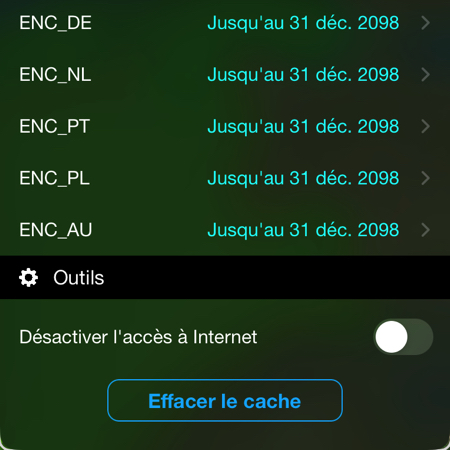 As part of the gradual conversion of raster charts to vector charts ENC (¹) on the platform Geogarage, Weather4D Routage & Navigation now includes the following ENC catalogs :
These ENC catalogs are added to the previous ones already available (Spain, Croatia, Germany, Netherland). Others are under negotiation such as Greece and Sweden.
–––
(¹) Geogarage to introduce ENC charts for Weather4D
–––
Posted on5 comments
 Latest releases Lite, Routing, Routing & Navigation arrive with a full renewed list of weather and ocean models in order to allow users to benefit from the evolution of the offer of international forecasting models. At the same time, all GRIB files go to format GRIB-2, this allows for a reduction in their size and a better compression ratio. Read more …
Posted on3 comments
 As you might expect, Garmin cleaned up the offer and pricing of Navionics Boating charts at the beginning of the year 2024.
No more large areas (like the Mediterranean) down to 35 € ! Several zones are redefined and subscription prices are aligned uniformly with 50 € for most, with two exceptions. Read more …
