Appeared in spring 2017, the Nomad to Digital Yacht was the first, and the only one, portable AIS transponder. I carried out a detailed test the following summer, reported on this blog (¹). We feared that this excellent device would be abandoned, because it has been unavailable for several months, but not at all ! Right now it is reborn in a new and improved version : Nomad-2. Read more …
Category : Material
MacENCx64 finally offers global charting
Since taking over MacENC at the end of the year 2020, become MacENCx64 (¹), it took three painstaking years for the company NavStation LLC to finalize the implementation of a global charting. Since January 1 2024 it is now done. A long negotiation with the ENC charting distributor ChartWorld (²) has enabled the creation of a range of vector charts in ENC S-57/S-63 format (³) as in-app purchase. Read more …
R-Mode, future alternative to Positioning System
Global navigation satellite systems GNSS (Global Navigation Satellite System), have become the primary source of Positioning, Navigation and Timing (PNT1) for ships and marine operations. GNSS is also used for the automatic identification system (AIS2). Unfortunately, GNSS is recognized to be vulnerable to jamming and spoofing, intentional or not, that may result in the loss of positioning information, or, still worse, inaccurate positioning information. Read more …
Major evolution of the MiniPlex-3Wi-N2K
 ShipModul company informs us of an important change in the design of the MiniPlex-3 all versions (Wi/N2K/E). Its founder explains : Read more …
Connecting USB/Bluetooth GPS with Mac M1 [Update-2]
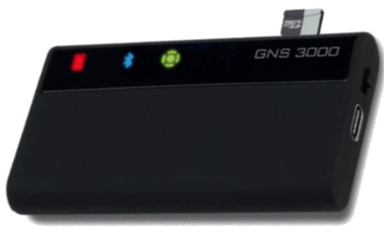
 The arrival of Macs with Apple M1 processors and macOS systems 11 “Big Sur” and macOS 12 “Monterey” caused disappointment among GPS users connected via USB and/or Bluetooth for their navigation applications.
In USB, latest driver Prolific V.2.2.2 is now universal for GPS BU-353xx from GlobalSat. As for the GNS3000 (¹) in Bluetooth it always suffers from an instability of the interface for the connection of multiple devices, instability that unfortunately does not yet seem to be fully fixed. Read more …
XB-8000 new WiFi AIS transponder for mobile devices [Update]
 Vesper Marine, company established in 2007 in Auckland (New Zealand), specializes in the design of devices for AIS data broadcasting. Their latest product, XB-8000, is a Class B AIS transponder certified NMEA2000® compact, low consumption, responding to the yachting market and small professional units. It was essentially designed with WiFi transmission in mind to navigation applications developed on tablets and smartphones.
[Update] After the acquisition of Vesper Marine by Garmin, this device is discontinued since February 2023. The brand name is also removed.
MiniPlex-3 new firmware 3.14.0
Since the firmware release 3.6.0, Several updates have been released, until the latest one 3.14.0. It is to be implemented with the latest version of the utility MPX-Config 3.10.0, only available for PC/Windows. Both is to download from ShipModul website, section Downloads. Here is a summary of the main new features… Read more …
MiniPlex-3 new firmware 3.6.0 [Update]
Warning : This article is for advanced users only. ShipModul has just released a new MiniPlex-3 firmware (V.3.6.0) and an updated version of the utility MPXConfig3 (V.3.6.0) PC/Windows. This is an update for improvements and bug fixes. Beginners abstain Read more …
MiniPlex-3 new firmware 3.4.0
The MiniPlex-3 multiplexer has been experiencing since November 2021 numerous software improvements and changes with the Firmwares (Firmware) Versions 3.x.x. The latest version 3.4.0 Date of 13 January 2022. These firmwares are closely associated with the MPXConfig3 utility, the latest version of which 3.5.0 is required to perform the latest device update. To date, this utility can only be used with PC/Windows, the macOS version probably not being available until late February. Read more …
Garmin offers Vesper Marine
![]()
![]() Obviously Garmin® has long teeth ! After Active Captain and Navionics charts, Garmin® has just announced the purchase of Vesper Marine, specialized in high-end AIS transponders (¹). Read more …
Obviously Garmin® has long teeth ! After Active Captain and Navionics charts, Garmin® has just announced the purchase of Vesper Marine, specialized in high-end AIS transponders (¹). Read more …