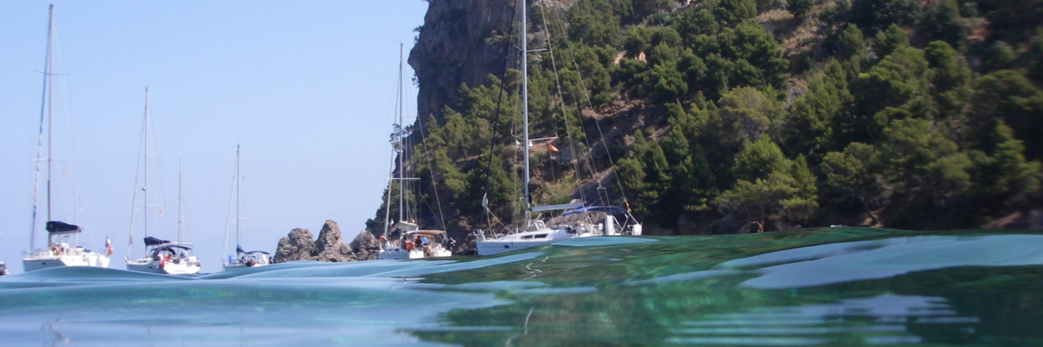
 A few days before the opening of the Nautic Paris boat show where, I remind him, I will be present on the stand iTabNav (Hall 2.1 – D31), An overview is in order. And precisely, in our immediate horizon we shall have, like every year, proximity to marine electronics manufacturers and their representatives.
At the previous edition of the boat show, I had noticed the reluctance – not to say hostility – of manufacturers towards the growing phenomenon of tablets and other smartphones on the navigation market. By dint of promoting these devices and their applications, I probably didn't just make friends in this business. However, Strong pressure from boat buyers, and therefore navigation electronics, has forced those manufacturers to integrate a minimum of interactivity between their own hardware and the mobile devices now owned by a majority of browsers.
This prompts me to take a quick look at the status of the applications provided and the progress of the proposed functions.
The first observation concerns the integration of a WiFi access point on practically all recent models of plotters and multi-function displays.. This allows smartphones and tablets to connect to these devices, either for a remote display, is better for remote control functions. Let's see this in detail. To avoid offending anyone, the brands are presented in alphabetical order.
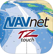 FURUNO
NavNet-Remote / NavNet Viewer (iOS / Android)
NavNet Viewer displays on all mobile devices an image offset from the screens of the TZtouch series and NavNet-Remote also allows tablets to remotely control these multifunction displays. Used with a smartphone or iPhone/iPod Touch, NavNet-Remote only works in Viewer mode. TZtouch multifunction devices equipped with firmware version TZT9/14 or higher allow connection up to 5 simultaneous mobile devices at WiFi hotspot.
 Latest versions at 22/11/2014 :
Version : 1.0.5 (iOS) Update : 25 January 2013
Version : 1.0.5.8 (Android) Update : 2 th 2014
LANGUAGES : English, Japanese
Editor : FURUNO ELECTRIC CO. LTD.
 GARMIN
Garmin Helm (iOS / Android)
This application allows you to view and control a compatible Garmin chartplotter from an iPhone, an iPad, an Android smartphone or tablet. Compatible with GPSMAP® plotters 527, 721, 820, 1020, 74xx series, and serial MFDs 8000, with built-in Garmin Wi-Fi. When pairing with a serial GPSMAP plotter 8000, use of a Garmin Marine Wi-Fi adapter is required.
Features :
- Viewing and controlling plotter information
- Improved situation visibility
- Seamless integration with SmartMode™ to group plotter thumbnails by station when using a GPSMAP system 8000 Glass Helm
- Easy switching between plotters using thumbnail preview
- Allows you to connect up to 5 devices simultaneously and define the authorization level
 Latest versions at 22/11/2014 :
Version : 1.2.0 (iOS/Android) Update : 30 June 2014
LANGUAGES : French, German, Spanish, Italian, Portuguese
Editor : Garmin International
 NAVICO (B&G / Simrad / Lowrance)
GoFree (iOS / Android)
The same application for the three brands of marine instruments belonging to Navico. Also the same functions. GoFree Controller & Viewer allows you to connect mobiles to the company's compatible multifunction display screens. Smartphones function as a simple remote screen repeater, tablets also allow take control of the display multifunction to perform different actions, including the entry des waypoints, setting parameters to Radar and even control Sonic Hub audio directly from the tablet. However, the application does not allow control of the autopilot.
 The WIFI-1 hotspot must be integrated into each brand's network to activate the WiFi connection. Compatible devices are :
- B&G – Zeus Touch. Zeus2 W (iOS only).
- Simrad – NSS7, NSS8, NSS12, NSO evo2. NSS7 evo2, NSS9 evo2, NSS12 evo2, NSS16 evo2 (iOS only).
- Lowrance – HDS Gen2 Touch, HDS Gen2 (view mode only).
Simrad devices must be equipped with the most recent firmware NSS software V.2.5.42.77 and above.
Latest versions at 22/11/2014 :
Version : 2.1 (iOS) Update : 29 May 2014
Version : 1.3 (Android) Update : 8 November 2013
Language : English
Editor : Navico Auckland Ltd
[Update 28 November 2014] Navico announced at METS in Amsterdam that the newest MFDs (evo2 Simrad NSO, NSS evo2, B&G Zeus2 and Lowrance HDS Gen2 touch) will receive a software update next January which will allow users with’acheter new maps and to make software updates directly since their devices via the Internet. GoFree will become a cloud service, GBFree Shop, accessible to multifunction devices of the current generation for acheter the own cards to Navico and also those of partners who will participate in programme.
 OF
OF
of Display (iOS / Android) of Display pro (iOS)
of display allows you to display all the information from a navigation center from a NMEA interface connected via WiFi, and works on both smartphones and tablets. With this application dedicated to regattas and cruising, the mobile device becomes a repeater offering 8 predefined pages displaying data. Default, WIFI communication settings are pre-recorded to work with the nke interface. However, the user can modify them to work with other NMEA/WIFI interfaces. Pre-programmed sources eliminate the need to configure the iPhone's WIFI connection. Several display settings allow you to personalize the application (choice of units, display themes, aso).
of display pro (iPhone / iPad ) not only allows you to view all the boat information, but also to control the installation and send orders to the autopilot. The application connects to the boat using the onboard WiFi network. The box WiFi of allows the application to have bidirectional communication and therefore to send commands on the Topline bus, to control the driver for example. Advanced functions such as Multifunction and Driver control require the application to be connected to an up-to-date nke WiFi box.
 By working in conjunction with the nke WiFi box, you can perform a diagnosis of the instruments present on the Topline bus and check whether the instrument software is up to date. You can customize the screens by selecting the data to display. nke Display Pro is a universal application, that is to say it works on iPad and iPhone with a dedicated interface. With iCloud synchronization, Preferences and in-app purchases are shared across all devices.
Latest versions at 22/11/2014 :
of display
Version : 1.1 (iOS) Update : 18 October 2012
Version : 1.0.1 (Android) Update : 5 June 2013
of display pro
Version : 1.1 (iOS) Update : 8 sept. 2014
LANGUAGES : French, English
Editor : OF MARINE ELECTRONICS
 RAYMARINE
RayControl (iOS / Android)
RayControl allows you to visualize and control a multi displayfunction Raymarine Series and or C Series from a tablet or smartphone. RayControl emulate multifunction devices Raymarine with an interaction of the touch screen and a virtual keyboard sliding. March, the sliding keyboard allows you to control all functions of the display and The’uni-controller virtual allows to rotate the menus and settings sans effort. Control and display of electronic cartography, sonar, Radar, and the vision thermal, same at night, from the tablet. The control of autopilot n’is not possible via a mobile device.
 For use this app with Raymarine C-series series or e-series, the software version of these devices needs to be updated version 3.15 or later. Compatible devices : e7, e7D, e95, e97, e125, e127, c95, c97, c125, c127.
Latest versions at 22/11/2014 :
Version: 1.3 (iOS) Update : 15 January 2013
Version : 01.06 (Android) Update : 27 August 2013
Language: English
Editor: Raymarine Belgium BVBA
To conclude
As seen in this quick inventory, manufacturers were content to satisfy the demands of their customers by creating a bridge between mobile devices and their multifunction displays. Apart from the nke display which can be used with devices other than those of the brand, all applications remain proprietary, “companions” solely dedicated to the instruments of each manufacturer.
It is curious that only Furuno and nke have developed an autopilot control function, a function which seems to me to be of major importance for safety because it allows the boat to avoid an obstacle from anywhere on board, from the bow, in example.
Positive, the generalization of application porting in the two most widespread operating systems, iOS and Android, is a great thing for users who can freely choose the mobile devices that suit them.
It seems to me, however, that these small developments, easy to make, only delay an inevitable evolution of marine electronics towards more mobility and universality. I am betting that within five years new players will have produced "black boxes" to which the multiple sensors will be connected (probe, speed, wind, AIS, Radar, Cameras, aso) that will stream their data wirelessly. With a simple tablet in his sea bag, the browser will be able to connect to it and its multifunctional applications will provide much more than the current heavy and static MFDs, internet connectivity via cellular and satellite networks, the weather, security and port information, instructions on protected areas, regulated anchorages, and many other things besides cartography, routing calculations, and other I forget . All this already exists, but still very scattered. Once all these services are unified in applications costing only a few tens of euros (or dollars) installed on universal-use tablets ten times cheaper than current marine multifunctions, what will be the choice of boaters ?
I'll leave it to you to guess.
—
Bonjour,
I have been using INavX on my Ipad2 for two years. Superbe application.
After sailing this fall in the mist, I chose to install Navionics cartography as a backup on my Android smartphone : The mapping is identical to that in INavX, more oh surprise, the currents (speed and heading) are displayed on the map, which is rather interesting in Brittany ! When will the same thing happen on INavx? ?
The currents displayed in Navionics Marine/Boating are more than approximate, readings on SHOM card cartridges but dependent on tide calculations from the American XTide program based on imprecise harmonic predictions.
The only reliable current predictions are those provided by Weather4D, developed four times a day by the European organization MyOcean. These predictions, distributed as GRIB files, combine tidal currents, ocean currents, and surface currents due to wind.
Bonjour,
Thank you for this complete inventory.
But I don’t entirely share your analysis on the future of embedded electronics.
While it is certain that the tablet will soon be omnipresent on board, in my opinion, it will always be supported by dedicated electronics. Without doubt, the latter will not have the same form as today, with current operating systems, with wireless connections between devices which can therefore be mobile.
Today a tablet meets all the browser's needs in terms of software (charting, weather, info…). But it remains poor in terms of readability in direct sunlight., in terms of protection against humidity and shock.
In addition, at sea, the touch screen is not a panacea. Input and precision with boat movements (especially in motorboating) is often laborious. Marine electronics manufacturers have understood this well by offering mixed devices : Touch and keyboard.
Of course, there is still the question of price. On this the tablet+software seems unbeatable. This performance is largely due to sales volume.
I see the future more as a fusion of the best of both worlds. A bit like the Garmin Monterra portable GPS which runs on Android and accepts all applications.
You may be right. In any case, it is very likely that the future lies somewhere between our two opinions !
Merci
Other question (unrelated to my previous comment) :
When you say that the future will undoubtedly be “black boxes” which will receive information from different sensors…
Does this mean that over a period of 5-10 years you imagine that the external plotters and displays of the big brands will all have disappeared to be replaced by an “iPad + iPhone » ?
If they don't fit, oui ! Start by installing ergonomic operating systems like Android, generalize touch, reduce the exorbitant prices charged.
Stunning. A sincere big thank you for these tickets always + interesting than each other. A real pleasure, merci.
More generally, and slightly off topic (though), one thing appeals to me and we don't talk about it often : overall electricity consumption.
Let's not forget that + it consumes, + This requires battery weight and/or solar panel surface area (or other).
Let's imagine an entire installation B&G (WiFi-1, Zeus2, two H5000 displays, aso), all expertly linked in NME2000 and available on iPad at any time, How much does it consume compared to a small, simpler installation?, oldest, colorless, sans wifi (in example: Simrad CP33 + 2 IS20 + AP16) ?
The contribution of colors, d’inter-communication, computing power, I tell myself that this necessarily leads to a loss of autonomy (or gain weight).
Peut-on dire que toutes ces « smart » évolutions font gagner en confort mais perdre en vitesse/autonomie ? Ou est-ce que les technologies ayant évolué, ça consomme au contraire moins qu’avant et du coup ce gain en plus faible consommation a profité pour augmenter les fonctionnalités tout ayant une même autonomie qu’avant ?
Les plus énergivores sont les MFDs (Multifonction Displays) avec leurs rétro-éclairages puissants et leur technologie peu soucieuse d’économie. A bord de bateaux sur lesquels on installe aujourd’hui frigo, congélateur et four à micro-onde, pourquoi se soucier ? Par comparaison, combien consomment les tablettes ?
En réponse à votre réponse 😉 :
Pour notre part, on board no microwave or freezer. Without electricity production or engine ignition, we are counting on an autonomy of 6 to 7 days in navigation 24 hours a day (with 2 batteries 110Ah au gel).
Subject to budget, given the comfort provided, a set B is very tempting&G which I explained before AND with WiFi AND with iPad, but I wonder how much the autonomy would drop (or how much would the number of Ah consumed in 24 offshore sailing hours).
Once again thank you, for this blog which I never tire of. This update on current events and developments in on-board equipment is very interesting on the eve of Nautic. Yet the conclusion surprises me:
It's been four years since I had a black box (WiFi router) which feeds my old Pad2 with all the information from my instruments (apart from the radar). It was also at this time while reading this blog that I discovered nav software on tablets and in particular iNavx which combined with Weather 4D became essential to my navigations.. As long as nautical equipment suppliers continue to charge exorbitant prices for locked products, I think boaters will shun them more and more.
When I talk about “black box” I don’t mean a simple WiFi router, but a sort of “super beacon” allowing anyone boarding a boat (tenant, teammate, skipper, aso) equipped with a code, not only to receive all navigation data on your mobile, but also to download weather files, via WiFi connection, Cellular or satellite, receive port navigation or security information, tourist information, aso. In a nutshell, intelligent “navigation beacons” that are self-connected to the internet, auto-connectables en WiFi ou Bluetooth, allowing anyone to board any boat equipped with a mobile phone and an appropriate application without having to worry about the electronic equipment on board. It is already perfectly achievable today., at an extremely low cost, which explains why no one has tackled it, especially not the traditional players in pleasure boating.