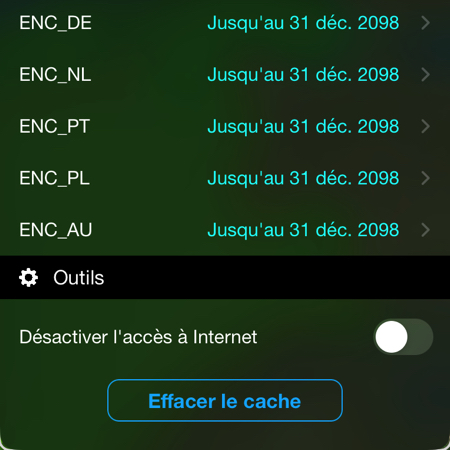
Weather4D renews its GRIB model offering

Latest releases Lite, Routing, Routing & Navigation arrive with a full renewed list of weather and ocean models in order to allow users to benefit from the evolution of the offer of international forecasting models. At the same time, all GRIB files go to format GRIB-2, this allows for a reduction in their size and a better compression ratio. Read more …

Weather4D R&N and distance calculations

Since the arrival of ARM-based Mac (M1… M3…) and the system macOS 11 Big Sur, Weather4D Routage & Navigation works natively on our favorite computers (¹). But this happy event did not go, since then, without some small restrictions. The most annoying for users was, until this day, loss of distance calculation. This is carried out on touch devices by a two-finger long press, no function allowed the translation of this gesture on Mac. The mouse only has one pointer, not two ! Read more …

Weather4D Routing Update & Navigation

Updated 2.0.87 of the application Weather4D Routage & Navigation :

  • Correction of OSM map display
  • Adding maps ENC Germany (BSH) and ENC Netherlands (NLHO)
  • Minor fixes

The new ENC derived cards are available for subscription at Geogarage. The ENC Germany dossier includes general maps of the entire Baltic Sea, but without the details outside the German coast.

–––

Weather4D with Mac M1

We've been talking about it since 2020 in the Facebook group of Weather4D users, the messaging app Weather4D Routage & Navigation (¹) now works on Mac with ARM processors : Mac M1 and later, from the system macOS 11.x (“Big Sur” et seq.). Simply connect the Mac to a GPS receiver or NMEA gateway via Wi-Fi to receive the position and navigation data of the instruments. Read more …