The update 1.4.60 to NavimetriX was just published, available on all stores Windows / Android / macOS / iOS.
This version mainly contains corrections and improvements : Read more …
The blog

The update 1.4.60 to NavimetriX was just published, available on all stores Windows / Android / macOS / iOS.
This version mainly contains corrections and improvements : Read more …
![]() From iOS 11 until iPadOS 18.7.x you could use the “SplitView” function (¹) to view two apps running simultaneously on an iPad. It was particularly interesting in “landscape” mode for, in example, use Weather4D at the same time as consulting the User Manual and watching its videos, or even activate two different applications. Since version 26.x has arrived the multitasking mode (²), or multiwindow, macOS style, which consigns SplitView to oblivion. Latest update 26.2 further improves operation by correcting some minor flaws. Read more …
From iOS 11 until iPadOS 18.7.x you could use the “SplitView” function (¹) to view two apps running simultaneously on an iPad. It was particularly interesting in “landscape” mode for, in example, use Weather4D at the same time as consulting the User Manual and watching its videos, or even activate two different applications. Since version 26.x has arrived the multitasking mode (²), or multiwindow, macOS style, which consigns SplitView to oblivion. Latest update 26.2 further improves operation by correcting some minor flaws. Read more …
Catalog update SHOM charts France / DOM-TOM and dependencies by Geogarage for NavimetriX, Weather4D Routage & Navigation, SailGrib WR
The catalog includes 866 charts (1432 with the inserts)
All international cards have been removed and will not be replaced by SHOM (See the information of the GeoGarage blog). However, they continue to be present in the database (but will no longer be updated from their last version).
Weather and ocean data In-situ are observational data broadcast in real time, or quasi-real, from different sources : semaphores, ships at sea, fixed or drifting buoys, airports, and also specialized satellites. This data is available as open data to the general public and also for reuse by the economic sphere.. The new NavimetriX application allows you to display this data to complete the forecasts of models distributed in GRIB format. Read more …
The update 1.3.55 to NavimetriX was just published, available on all stores Windows / Android / macOS / iOS.
All features announced for this quarter in the roadmap have been added and many fixes made. All details on the FaceBook group users.
–––
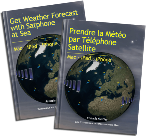 Update 2.3 (November 2025) of the guide Get Weather Forecast with Satphone at Sea French version.
[ADDENDUM] After a long and bitter battle with Apple, the process of updating works has finally been corrected in iTunes Connect and the version 2.3 is finally available for download. However the version number is still not implemented (except on the pages of the book).
In the age of AI, dual-band GNSS and inertial units, the U. S. Navy returns to good old fundamentals by encouraging its sailors to practice celestial navigation. To prevent jamming, spoofing, or even a hypothetical total electronic blackout, US Navy commanding officers and navigators must master the dead reckoning and handling of the sextant. Excerpt from an article from U.S. Naval Institute freely translated and adapted (¹). Read more …
![]() A new NavimetriX update is available on all media Windows / Android / macOS / iOS
A new NavimetriX update is available on all media Windows / Android / macOS / iOS
All details on the FaceBook group users.
–––
![]() NavimetriX is the world's first navigation application featuring a unified, cross-system 3D GUI, synchronized in real time across all devices.
NavimetriX is the world's first navigation application featuring a unified, cross-system 3D GUI, synchronized in real time across all devices.
The new navigation and weather-routing application NavimetriX was just published. Result of long development work, this application revolutionizes navigation on mobile as well as fixed devices with its universality. It indeed offers a unique user interface, with elaborate graphics, for all operating systems : macOS, iOS/iPadOS, Android and Windows. In addition, regardless of the devices used, a single account allows full settings and data synchronization . Read more …
Reading the latest Starlink service conditions For the unlimited roaming package, it appears that the “Maritime” option (formerly “Priority Data”) is formalized for use beyond the coastal zone of 12 nautical miles. It can therefore still be activated as in the past for offshore use.. Read more …