![]() Yachtmen my friends, Many of you still encounter difficulties with the subtleties of the routing function in Weather4D, despite the pages dedicated to routing errors in both user manuals (¹), which are accessible from the application by tapping on the symbol “ ? » located in the upper right ribbon. But don't panic ! Read more …
Yachtmen my friends, Many of you still encounter difficulties with the subtleties of the routing function in Weather4D, despite the pages dedicated to routing errors in both user manuals (¹), which are accessible from the application by tapping on the symbol “ ? » located in the upper right ribbon. But don't panic ! Read more …
Connecting USB/Bluetooth GPS with Mac M1 [Update-2]
 The arrival of Macs with Apple M1 processors and macOS systems 11 “Big Sur” and macOS 12 “Monterey” caused disappointment among GPS users connected via USB and/or Bluetooth for their navigation applications.
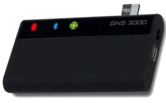
In USB, latest driver Prolific V.2.2.2 is now universal for GPS BU-353xx from GlobalSat. As for the GNS3000 (¹) in Bluetooth it always suffers from an instability of the interface for the connection of multiple devices, instability that unfortunately does not yet seem to be fully fixed. Read more …
El Niño is back
![]() After three years of La Niña phenomenon (¹) in the tropical Pacific Ocean (from mid-2020 to mid-2023) having brought a fairly calm meteorological situation to Polynesia : regular trade winds, lack of hurricane, mainly dry weather, this idyllic situation will be reversed with the announced return (²) of the El Niño phase of the ENSO climate phenomenon (El Niño Southern Oscillation). Finally, idyllic, it wasn't for Southeast Asia, Indonesia, Melanesia and western Australia, which experienced episodes of intense rainfall well above normal and an upsurge in hurricanes during the same period. Read more …
After three years of La Niña phenomenon (¹) in the tropical Pacific Ocean (from mid-2020 to mid-2023) having brought a fairly calm meteorological situation to Polynesia : regular trade winds, lack of hurricane, mainly dry weather, this idyllic situation will be reversed with the announced return (²) of the El Niño phase of the ENSO climate phenomenon (El Niño Southern Oscillation). Finally, idyllic, it wasn't for Southeast Asia, Indonesia, Melanesia and western Australia, which experienced episodes of intense rainfall well above normal and an upsurge in hurricanes during the same period. Read more …
Updated rasterized Spain and Croatia maps
Updating charts IHM (Spain) and HHI (Croatia) rasterized for Weather4D Routing & Navigation and SailGrib WR by Geogarage.
- Spain
101 Maps updated on a total of 316 charts available
- Croatia
27 updated maps and 11 cards added out of a total of 311 charts available
–––
eSail4VR V.1.20 Update
 Update version 1.20 :
- Choosing the weather forecast loading mode : world (standard scheme) or optimized : local coverage of a race.
- Button to force the refresh of the weather forecasts.
- Improved management of exclusion zones.
Internet par satellites : Riffifi in the firmament
 In space, in an area called LEO (Low Earth Orbit) located at a distance of approximately 200 to 1.000 km above our heads, several hundred, even thousands, satellites are already flying. They are mainly dedicated to communications and observations of all kinds, civil and military.
But for a short decade a fratricidal war has been declared, a frantic race between several private and semi-public companies to offer high-speed internet to all humans, wherever they live on the globe. The thing is important, because this market, beyond the altruism and generosity displayed by these ambitious programs, promises several billion dollars in earnings in the coming years. Read more …
ECMWF, major forecasts update in 2023
![]() Florence Rabier, Director General of ECMWF, has developed February the 13 th European Centre for Medium-Range Weather Forecast for 2023 (¹). She announced a major update to the forecasting model. IFS (²) scheduled for June 2023. Read more …
Florence Rabier, Director General of ECMWF, has developed February the 13 th European Centre for Medium-Range Weather Forecast for 2023 (¹). She announced a major update to the forecasting model. IFS (²) scheduled for June 2023. Read more …
UKHO delays removal of Admiralty paper charts
 British backpedaling : UKHO postpones phasing out of Admiralty paper charts until at least 2030 ! Six months after setting the goal of 2026 for the complete withdrawal from production of all paper navigation charts (¹), UKHO (United Kingdom Hydrographic Office) said the 2 February only in response to user feedback, It now plans to continue to provide a paper map service until 2030 at least (²).
XB-8000 new WiFi AIS transponder for mobile devices [Update]
 Vesper Marine, company established in 2007 in Auckland (New Zealand), specializes in the design of devices for AIS data broadcasting. Their latest product, XB-8000, is a Class B AIS transponder certified NMEA2000® compact, low consumption, responding to the yachting market and small professional units. It was essentially designed with WiFi transmission in mind to navigation applications developed on tablets and smartphones.
[Update] After the acquisition of Vesper Marine by Garmin, this device is discontinued since February 2023. The brand name is also removed.
eSail4VR V.1.14 Update
A new version of eSail4VR just released in Windows Store online stores, Google Play, App Store (macOS), AppStore (iOS/iPadOS). It brings the following improvements since the major version 1.11 (¹) :
- Setting of the “VMG max tolerance” option increased from 0° to 20° (5° previously).
- Improved routing algorithms.
- Improved stability.
- Correction of the passage of the antimeridian.
- Correction de divers bugs
–––
(¹) eSail4VR 1.11 available on platforms [Update]
–––