
It is more and more common to see an AIS receiver, Automatic Identification System (*), receiver above yacht's chart tables. Although only merchant vessels of over 300 tons and passenger ships are required to fit onboard an AIS Class A transponder, small commercial vessels are increasingly fitted with cheaper standard AIS Class B transponders. Read more …
Category : Tutorials
How to…
GRIB files in GPSNavX and MacENC
The menu Weather in these two applications allows you to request a GRIB weather forecast file and then view it on the open map. The function Request GRIB send a request to the server Saildocs.com returning to the mailbox file requested. You can then get the file in attachment and store it to the location of your choice (²).
The function Show GRIB will then allow you to view the file on the map and scroll through the forecasts. You can usefully refer to MacENC Video Tutorial No. 3 on the website.
Here is a short technical summary of the weather module integrated in these two apps. Read more …
iNavX 3.0.2 – highly expected new feature
INavX 3.0.2, available soon on the AppStore, comes with a much anticipated feature and welcome improvements :
Course Up / North Up
This feature, although criticized by some purists (of which I am part), was implemented to respond to numerous requests from users visiting the forum iphonesailing.net. Read more …
Dead reckoning navigation with GPSnavX/MacENC
As discussed in the GPSNavX and MacENC help pages, under the “Simulator” section, you can use the function Simulator to carry out dead reckoning navigation. The simulator, Indeed, can be practical in the case where we do not have – or more – a connected GPS. Read more …
Get a route from a drawing in MacENC (continue)

Choice of route
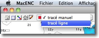
Since my article from 20 November about the subject, the version 7.40 by MacENC brought the possibility of drawing straight lines on the map with the “Annotation” tool.
This now makes it easier to create routes than freehand., by creating fewer waypoints.
The principle is the same as explained in the previous article, the procedure remaining the same. Read more …
Connect a Furuno GP32 to your Mac
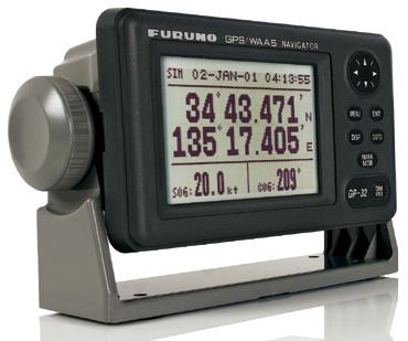
To connect a GP32 (31 or 30) with a Mac or PC, you must first strip the free end of the connector cable to 6 pin contains the data wires, in addition to positive and negative power wires. The diagram below shows you the principles of wiring.Print charts with GPSNavX / MacENC
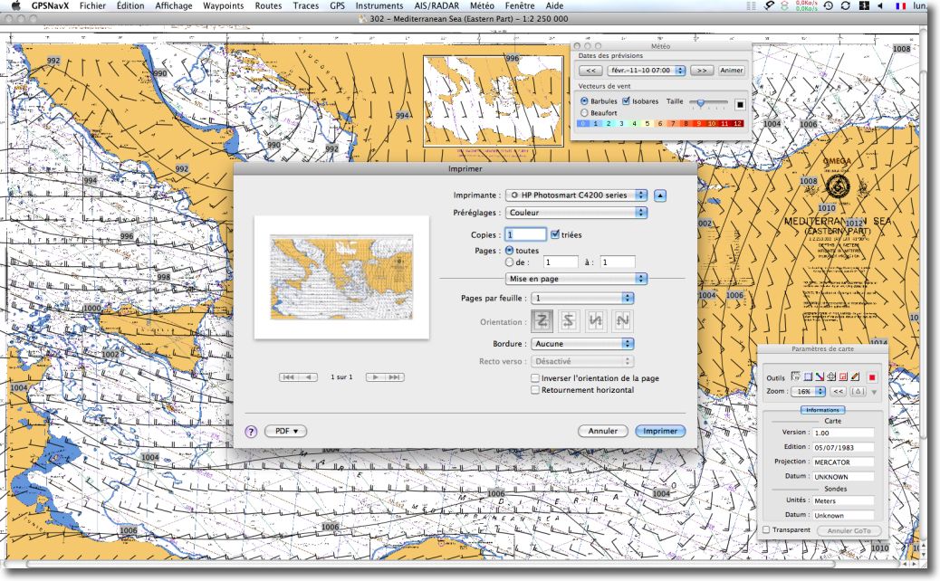
These two applications offer direct printing of screen content. It is very convenient to print a chart, regardless of the scale used on the screen. Indeed, Print this concerns only the chart content visible on screen, excluding pop-up windows. As a general rule, you should first choose a landscape print format, and then use the menu File > Print.
Install the GPS BU-353 with GPSNavX/MacENC
You have to follow the steps below, in order :
Get a route from a drawing in MacENC
MacENC 7.30 brings a very interesting function allowing you to create a route, composed of a succession of waypoints, from a plot made with the mouse on the map using the “Annotation” mode of the toolbar.
How to go about it ?
1 – Select menu Routes > Open.
2 – Create a new route or choose an existing route.
ENC User Permit, what is ?
The "user permit" of ENC charts is a unique identifying number attached to a device, or to an application, able to read encrypted ENC chart data (format S-63). This “User Permit” is required to register a system (chartplotter, MFD, software) and thus make it possible to generate, for charts purchased, a single authentication code to use these charts to the referenced system. User Permit (User Permit) consists of a chain of 28 digits hexadecimal code.
Let's take the example of a purchase on the site Chartworld. Read more …