In a very next post, I will explain in detail the implementation of a multiplexer (¹) Miniplex-2USB ShipModul's website. But before dismantling the electrical panel and taking out the toolbox, it is better to understand the subtleties of a connection that, at first glance, seems very simple, and yet can quickly become… a real headache. Read more …
Category : Tutorials
How to…
iSailor : Transas maps on iPhone and iPad
In France, mariners know little, or not at all, about Transas company of Russian origin. The Transas Group is nevertheless one of the world's leading professional of navigation software . Founded in 1990 in St Petersburgh, it opens its first office in England in Southampton (UK). Application developer for maritime and aeronautical training simulators, leading ECDIS certified designer, AIS network installer, the company has provided its electronic charting systems to prestigious customers, as the Russian space station MIR in 1996. There are countless marine simulator and flight simulators equipped with Transas technology in training centers worldwide. Several major commercial harbours are also equipped with VTS (*) and VTM (*) from Transas.
With 200 million turnover, the now international group, majority run by Russians, has its headquarters in Cork, Ireland.
All this to tell you that, when the very serious Transas company decides to launch a marine charting application on the iPhone and iPad, does not hesitate to rely on a communication, let’s say… particularly impactful. See instead… Read more …
iNavX and SiiTech AIS server
iNavX allows you to connect, since version 3.1.7 from February the 11 October 2010, to the data server AIS SiiTech which I talked about in a previous post (¹). The interest of this service remained questionable in France because of the poor coverage of our coasts. That could change.
Indeed, the number of SiiTech ground stations is increasing, the Channel coasts are now well covered, and the Atlantic coast should be gradually equipped (²).
In addition, The version 3.2.4 of iNavX comes with an improvement that makes a revival of interest for this feature : it is now available to select the origin point of AIS data from SiiTech server, or the position of the ship (that of the iPhone/iPad used), or a previously created waypoint. The reception radius being about 30 nautical miles around place of origin, this allows for a significant increase in the coverage of AIS data reception.
Receive NMEA 2000 data with iNavX
It is now possible to connect a N2K system (¹) at iNavX, on iPhone or iPad.
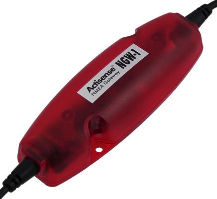
Indeed, Actisense company, well known for its NMEA interfaces (multiplexers and gateways), designed the NGW-1 ISO, an NMEA 2000 gateway converter to NMEA 0183 and vice versa. Connected to a Miniplex-2Wi by ShipModul ou un WLN10 device, the data thus converted will be sent via WiFi to iNavX. Read more …
GRIB files with iNavX
With the versions 3.1.6 and 3.1.7, iNavX improved GRIB files request by proposing a new window settings.
As for MacENC, can now choose several settings for required files, in order to optimize the file size according to the navigation area. Read more …
Connect GPSNavX/MacENC with an AIS
It is more and more common to see an AIS receiver, Automatic Identification System (*), receiver above yacht's chart tables. Although only merchant vessels of over 300 tons and passenger ships are required to fit onboard an AIS Class A transponder, small commercial vessels are increasingly fitted with cheaper standard AIS Class B transponders. Read more …
GRIB files in GPSNavX and MacENC
The menu Weather report in these two applications allows you to request a GRIB weather forecast file and then view it on the open map. The function Request GRIB send a request to the server Saildocs.com returning to the mailbox file requested. You can then get the file in attachment and store it to the location of your choice (²).
The function Show GRIB will then allow you to view the file on the map and scroll through the forecasts. You can usefully refer to MacENC Video Tutorial No. 3 on the website.
Here is a short technical summary of the weather module integrated in these two apps. Read more …
iNavX 3.0.2 – highly expected new feature
INavX 3.0.2, available soon on the AppStore, comes with a much anticipated feature and welcome improvements :
Course Up / North Up
This feature, although criticized by some purists (of which I am part), was implemented to respond to numerous requests from users visiting the forum iphonesailing.net. Read more …
Dead reckoning navigation with GPSnavX/MacENC
As discussed in the GPSNavX and MacENC help pages, under the “Simulator” section, you can use the function Simulator to carry out dead reckoning navigation. The simulator, Indeed, can be practical in the case where we do not have – or more – a connected GPS. Read more …
Get a route from a drawing in MacENC (continue)

Choice of route
Since my article from 20 November about the subject, the version 7.40 by MacENC brought the possibility of drawing straight lines on the map with the “Annotation” tool.
This now makes it easier to create routes than freehand., by creating fewer waypoints.
The principle is the same as explained in the previous article, the procedure remaining the same. Read more …