![]() Weather4D Routage & Navigation offers a choice of raster charts from many international hydrographic services . Charts folders are available for application on the French web server Geogarage. Charts are subject to an annual subscription by Publisher directly on Geogarage website after creating an account there. After subscribing to a publisher, the entry in Weather4D 2.0 credentials created in Geogarage activate display of subscribed folder , ready to download. Procedure step-by-step :
Weather4D Routage & Navigation offers a choice of raster charts from many international hydrographic services . Charts folders are available for application on the French web server Geogarage. Charts are subject to an annual subscription by Publisher directly on Geogarage website after creating an account there. After subscribing to a publisher, the entry in Weather4D 2.0 credentials created in Geogarage activate display of subscribed folder , ready to download. Procedure step-by-step :
Category : Navigation
Articles related to maritime navigation
Weather4D 2.0 revisits navigation on iPad [Update]
![]() Weather4D 2.0 is available sur Apple AppStore (*). After the success of the first two versions, APP4NAV company just revisit chart navigation on iPad and iPhone by integrating the timing dimension. With simulations and weather routing, navigation becomes predictive, allowing a constant anticipation of future weather conditions and sea state. This “navigation into the future”, relied on the quality of meteorological and oceanographic predictions today available, was designed in order to bring a new dimension to the safety of boaters. Read more …
Weather4D 2.0 is available sur Apple AppStore (*). After the success of the first two versions, APP4NAV company just revisit chart navigation on iPad and iPhone by integrating the timing dimension. With simulations and weather routing, navigation becomes predictive, allowing a constant anticipation of future weather conditions and sea state. This “navigation into the future”, relied on the quality of meteorological and oceanographic predictions today available, was designed in order to bring a new dimension to the safety of boaters. Read more …
AIS reception on the web [Update]
 In recent years, websites allowing the visualization of maritime traffic have developed on the web.. They continuously transmit via the internet the positions received from the ships' AIS transmitters, received by reception bases on land, all along the coasts. Two of them caught my attention because they present very different options : Marine Traffic et SiiTech. Read more …
The American GPS in full evolution
 As the number of GPS receiver devices increases significantly, so does our dependency on the GPS, but satellites are subject to wear out and age.
THE U.S. Air Force has since launched 2010 the second constellation of GPS satellites, named GPS Block IIF, or GPS IIF, built by Boeing. These satellites will replace the GPS IIA satellites of the first constellation, launched between 1990 and 1997, with lifespan design about 7,5 years.
Read more …
Compass Eye et SeaNav, good surprises from Pocket Mariner
During a search on the App Store for my previous post, I found out under the term "Simrad" an application that furiously reminds me of something. From research to research, I discover the company Electric Pocket. This British applications publisher Develops the Mobile Apps from 1997, andrecently the applications Nautical under the name Pocket Mariner. That Company is based in Wales, United Kingdom, and deals with partners from all over the world.
Read more …
Marine electronics manufacturers and the tablet phenomenon
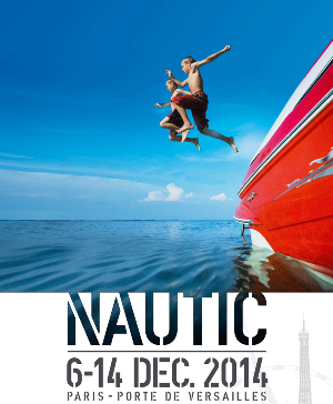 A few days before the opening of the Nautic Paris boat show where, I remind him, I will be present on the stand iTabNav (Hall 2.1 – D31), An overview is in order. And precisely, in our immediate horizon we shall have, like every year, proximity to marine electronics manufacturers and their representatives.
At the previous edition of the boat show, I had noticed the reluctance – not to say hostility – of manufacturers towards the growing phenomenon of tablets and other smartphones on the navigation market. By dint of promoting these devices and their applications, I probably didn't just make friends in this business. However, Strong pressure from boat buyers, and therefore navigation electronics, has forced those manufacturers to integrate a minimum of interactivity between their own hardware and the mobile devices now owned by a majority of browsers.
This prompts me to take a quick look at the status of the applications provided and the progress of the proposed functions.
Routing and usage precautions
With the advent of powerful weather-routing applications on our tablets and smartphones, as Weather4D and SailGrib WR, at truly affordable prices, routing is becoming more popular for pleasure boating. The quality of these applications is already appealing to amateur sailors, and even some high-seas professional riders, but also a growing number of leisure boaters. Riders use the routing in the essential interests of performance, Achieve the fastest route from one point to another, so leisure boaters are more focused on getting safer and more comfortable routes. For them, The notion of speed is mainly used to avoid periods of bad weather, and the optimized route to escape areas where sea and wind conditions can be dangerous. Routing is also used for this : even in powerboating, you may try to avoid too much wind speeds or wave heights to ensure ypur crew comfortable and serene trip. But what credibility can be given to routing ? Read more …
ZenLoch, The boat loch of the 3rd millennium
After the sextant of the future (¹), presented at the Paris Boat Show last December, here is the loch of the future revisited by a "Professor Calculus", an electronics engineer and genius inventor from Nantes.
The oldest among us will certainly remember this venerable and inexpensive instrument of the old sailing navy : The "boat loch". Quote (²):
The "boat" is a wooden plank, weighted to float vertically and connected to the log line by a crow's foot. On the line we tie knots, spaced in principle 7m72 (or 1/240th of a nautical mile). We put the "boat" in the water and let the line go. we then count, from the first node, how many knots pass through the hand in 15 seconds, which gives the speed in knots.
Charting, the game of 7 errors
A recent Thread on the Hisse Et Oh forum, I salute by the way, I challenged the accuracy of the chart data provided on the electronic charts. The subject concerns the observation that, in some location, existing information on the Navionics Marine HD application, or on some chartplotters, are missing on Navionics charts available on the website x-traverse.com used with iNavX (and MacENC). Quote :
"So the question is : Is there a difference between the 46XG map and the Europe map or is the difference due to the software that makes the cards tick?. ”
Damned ! It seemed useful to make comparisons closing electronic charts from various sources. As far as I know particularly well geographic location used in example, since it is the approach to the port of Concarneau, near the beacon tower Le Cochon, passage I borrowed hundreds of times over the years I was working with Glenans Nautical Centre. Read more …
G-Stell le sextant du futur
 Amazing ! At a time when GPS networks are multiplying (GPS, GLONASS, Beidou-2, and soon Galileo) a genius engineer, sailing enthusiast, creates a company and invents the replacement for dad's sextant : an electronic sextant requiring no knowledge, with a claimed accuracy of less than one nautical mile, the G-Stell. Read more …