
 Navigation apps are full of acronyms. This coded and abstruse language was originally developed for electronic navigation instruments, GPS mapping and other chartplotters. These acronyms, in the form of three letters most often, are the contraction of terms defining specific navigation data and according functions. This facilitates on-screen display taking few space. If some of these acronyms are relatively well assimilated by the boater, as SOG for Speed Over Ground (speed over the bottom), you can quickly access subtleties that are not always mastered as COG for Course Over Ground, meaning "route runned on the ground", that the word "Course" in English can mean "Route" or "Heading" according to the context. Read more …
Category : Navigation
Articles related to maritime navigation
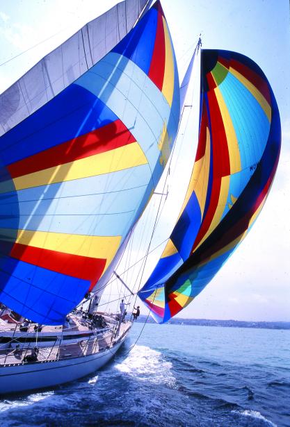
Man Over Board
Credit: SNSM Bandol
Sailors have always been haunted by falling into the sea. Even with a trained crew, the operation of recovering a crew water fallen is risky, Already with the engine, even more with the sail. During my training years in Glénans Sailing School, Each boarding was an opportunity to systematically practice this maneuver, under sail, striving to come "die" heave to windward of the unfortunate, fortunately materialized by a buoy moored in a bucket as drift anchor. But that was not the real problem. It was above all not to lose sight of the crew, because come back to its fall position "reckoning" was virtually mission impossible. And still today, with our sophisticated electronic means, It's not as easy as you might think… Read more …
Guide Escales 2018 – Red card ! [Update-2]
![]() It saddens me to end the year with a critical article, but the subject deserves it. I wrote in December 2016 (*) a sincerely positive appreciation of the evolution of the application Guides Escales 2017 - Bloc Marine digital version by Figaro Nautisme editions - compared to 2016. But for edition 2018, is unfortunately go back, supply regress and severe rate increase.
It saddens me to end the year with a critical article, but the subject deserves it. I wrote in December 2016 (*) a sincerely positive appreciation of the evolution of the application Guides Escales 2017 - Bloc Marine digital version by Figaro Nautisme editions - compared to 2016. But for edition 2018, is unfortunately go back, supply regress and severe rate increase.
Unlike the print edition you can keep several years in your boat library, the annual update of the application Guides Escales clears all purchased regions the previous year. It is therefore not a purchase but an annual subscription, nuance!. And that's not all…
[Update 2022] The Escales Guide has been withdrawn from sale.
BeiDou-3 China rushes its Global GPS
To date, the constellation of Chinese GPS satellites BeiDou-2 covers only part of East Asia and the Western Pacific. With the commissioning of GALILEO European GPS late 2016, the replacement scheduled of U.S. 2nd generation GPSII by the 3rd generation GPSIII, the launch into orbit of the 3rd generation of Russian GLONASS-M satellites, China intends to catch up with global coverage forced march. Read more …
Guide Escales 2017
![]() I have mentioned last July the "Stopovers" Guide, digital version of Bloc Marine published by the Figaro Group. It seems that the remarks I made on the excessively fragmented division of these guides were heard : The version 2017 has the number of modules reduced by 17 to 12 for the Channel-Atlantic coast, and 13 to 10 for the Mediterranean. It is a welcome initiative !
I have mentioned last July the "Stopovers" Guide, digital version of Bloc Marine published by the Figaro Group. It seems that the remarks I made on the excessively fragmented division of these guides were heard : The version 2017 has the number of modules reduced by 17 to 12 for the Channel-Atlantic coast, and 13 to 10 for the Mediterranean. It is a welcome initiative !
stairs – the digital version of Bloc Marine
![]() At the beginning of this year I wrote the greatest good I thought of the Digital Almanac, the digitized version of Reed’s Nautical Almanac. The Figaro group, Publisher of the website www.figaronautisme.fr, owner of Météo-Consult / The Weather Channel and Logbook – Marine Block, Published since the end 2014 "Stopover Guides", the digitized version of the Marine Block on the iBook Store. Read more …
At the beginning of this year I wrote the greatest good I thought of the Digital Almanac, the digitized version of Reed’s Nautical Almanac. The Figaro group, Publisher of the website www.figaronautisme.fr, owner of Météo-Consult / The Weather Channel and Logbook – Marine Block, Published since the end 2014 "Stopover Guides", the digitized version of the Marine Block on the iBook Store. Read more …
Roseanor, 2000 nautical miles against the grain around Europe
Conveying a boat from Corsica to Normandy in May, it's a bit like going around the world upside down from East to West, but more modest. Two thousands nautical miles on the water against winds and tides, four and a half weeks at sea, with thirteen days forced stopover awaiting for good weather conditions, three hundreds and fifty hours of engine to support the sails, 1000 litres of diesel oil, multiple Corsican, Spanish and Portuguese wines bibs, to calm our nerves, A few packs of water to quench thirst, and hundreds of hours of testing the new features in development of… Weather4D Routage & Navigation !

2016 Year of GALILEO
![]() Since my first post on GALILEO end 2011 (¹), space Europe has made significant progress. Despite economic uncertainties and numerous budgetary restrictions, Course and schedule have been maintained thanks to a community political flawless. This is to be welcomed because many other areas of European action didn't have the scoop.
Since my first post on GALILEO end 2011 (¹), space Europe has made significant progress. Despite economic uncertainties and numerous budgetary restrictions, Course and schedule have been maintained thanks to a community political flawless. This is to be welcomed because many other areas of European action didn't have the scoop.
The year 2016 has already been dubbed "the year of GALILEO".. This was the clear message of the Munich Satellite Navigation Summit (²) early March. The Munich summit covered all GNSS systems, but the focus this year was squarely on Galileo. Read more …
Weather4D 2.0.11 A bunch of new features and improvements
![]() Delivered in AppStore this morning after two weeks of revisions and contre-revisions of Apple services, Always more picky, The new version is finally available. On the menu and in bulk : AIS via internet with AISHub, direct access to Geogarage and cache memory chart management, new model of GRIB weather forecast from Meteo-France AROME HD for inshore races, Full-screen mode, advanced distance calculations, the most visible. Under the hood also a lot of optimization for routing and power consumption. Detailed review to follow… Read more …
Delivered in AppStore this morning after two weeks of revisions and contre-revisions of Apple services, Always more picky, The new version is finally available. On the menu and in bulk : AIS via internet with AISHub, direct access to Geogarage and cache memory chart management, new model of GRIB weather forecast from Meteo-France AROME HD for inshore races, Full-screen mode, advanced distance calculations, the most visible. Under the hood also a lot of optimization for routing and power consumption. Detailed review to follow… Read more …
Navily makes stopovers easier in just a few taps
![]() In recent years, French startups have flourished in the world of recreational boating. Their common denominator is to use digital technology to implement an idea which intends to provide a unique service to boaters.. How many will survive ? Hard to say, but they all have the merit of dusting off dad's boating by addressing the younger generation of water sports enthusiasts.. Community sharing of information, co-location, « bla-bla-boat », so many responses to new attitudes in the practice of pleasure boating.
In recent years, French startups have flourished in the world of recreational boating. Their common denominator is to use digital technology to implement an idea which intends to provide a unique service to boaters.. How many will survive ? Hard to say, but they all have the merit of dusting off dad's boating by addressing the younger generation of water sports enthusiasts.. Community sharing of information, co-location, « bla-bla-boat », so many responses to new attitudes in the practice of pleasure boating.
Among them, one particularly appealed to me, Deviated.