Print charts with GPSNavX / MacENC

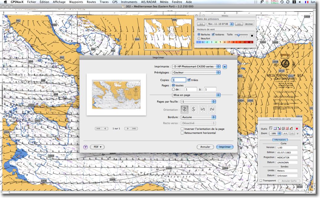
These two applications offer direct printing of screen content. It is very convenient to print a chart, regardless of the scale used on the screen. Indeed, Print this concerns only the chart content visible on screen, excluding pop-up windows. As a general rule, you should first choose a landscape print format, and then use the menu File > Print.

imprimer avec gpsnavx

Direct printing with GPSNavX

Read more …

The voice of marine weather

Marine weather, or rather I should write : Marine Weather, with capital letters, is for modern mariners as ancient gods was for our oldest ancestors : a permanent reference to the conduct of our life.

The Long Waves

Not so long ago, this divinity was speaking to us, sailors to trade, fishermen or boaters, by a celestial voice carried by the waves. Our high priestess, Marie-Pierre Planchon, informing us twice a day of the destinies, happy or terrible, that we risked experiencing by venturing out on the waves. In those days the weather had a name and a voice, recognizable at a glance. Read more …

iPad : new support for iNavX ?

Can not join the chorus of comments about’iPad that Apple presented yesterday. As far as we are concerned, for us yachtsmen, this new touch pad does not seem to represent anything other than an iPod Touch bigger screen, and yet that is its whole interest !

The model we are interested with, equipped with the WiFi and the 3G, and with a Integrated GPS, should be available in France in June. However, We will have to wait until this time to know the operators' offers, Knowing that unlimited 3G connection is included in some iPhone plans, but not in all, how much will it cost ? Read more …

iPhone : my favorite navigation apps

My Navigation Apps

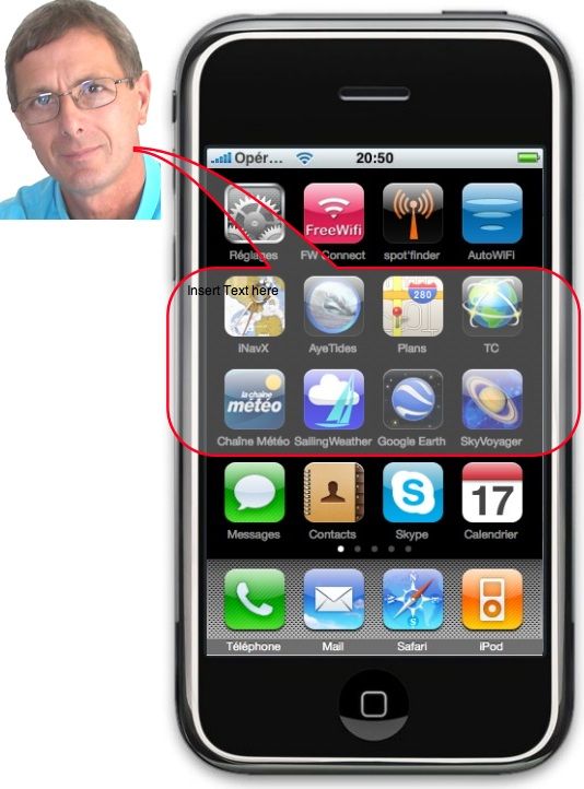
People often ask me advice on navigation apps for iPhone. Which ones to choose ? Here is a selection, of course not exhaustive. These are the ones I kept, after having tested and “trashed” more than one, and that I use fluently. You will first find the essentials : iNavX and AyeTides Of course, then the essentials, finally the complementary. Follow your guide… Read more …

About alignments and sextant

This holiday season, during which we happily return for a few days to the traditions, inspires me to rethink the traditions of an activity that is dear to us : navigation.
Not that of our illustrious predecessors, royal navies, discoverers of distant lands, corsairs, pirates or honest merchants, isn't it. I want to talk about the one that has concerned us for more than half a century : yachting. Especially to the attention of our friends who are sailors born in 70-80, who discovered navigation from the years 90, period of the appearance of GPS on board our pleasure boats.
I, who is constantly adding a website and a blog on the intricacies of computing onboard, of all these tools which bring us our position a few meters away, what the weather will be like in eight days, the height of water under the keel, the time at which it will be necessary to tack to take advantage of the favorable wind shift, and how much additional information is available in three mouse clicks, I don’t forget how I learned to sail.

This holiday season, during which we happily return for a few days to the traditions, inspires me to rethink the traditions of an activity that is dear to us : navigation.

Not that of our illustrious predecessors, royal navies, discoverers of distant lands, corsairs, pirates or honest merchants, isn't it. I want to talk about the one that has concerned us for more than half a century : yachting. Especially to the attention of our friends who are sailors born in 1970-80, who discovered navigation from the years 1990, period of the appearance of GPS on board our pleasure boats. Read more …

Install the GPS BU-353 with GPSNavX/MacENC

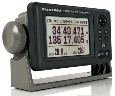
bu-353

The BU-353 GPS connected to the MacBook via USB

You have to follow the steps below, in order :

1) Quit GPSNavX or MacENC before proceed.
2) Install the Prolific PL2303 driver.
http://www.francis-fustier.fr/media/Telecharge/PL2303_1.2.1.sit
3) Connect the BU-353 USB GPS antenna to a USB port on your Mac.
4) Launch GPSNavX or MacENC, select the menu "GPS > Connect ". Open the "Settings" drawer, then select :
– Type : "SiRF USB"
– Port : "usbserial"
– Rate : " 4800 ”

Read more …

ENC User Permit, what is ?

The "user permit" of ENC charts is a unique identifying number attached to a device, or to an application, able to read encrypted ENC chart data (format S-63). This “User Permit” is required to register a system (chartplotter, MFD, software) and thus make it possible to generate, for charts purchased, a single authentication code to use these charts to the referenced system. User Permit (User Permit) consists of a chain of 28 digits hexadecimal code.

Let's take the example of a purchase on the site Chartworld. Read more …