 In recent years, websites allowing the visualization of maritime traffic have developed on the web.. They continuously transmit via the internet the positions received from the ships' AIS transmitters, received by reception bases on land, all along the coasts. Two of them caught my attention because they present very different options : Marine Traffic et SiiTech. Read more …
Label : AIS
AIS for dummies
With the progressive generalization of the AIS (transceivers) aboard our pleasure boats (¹), and their obligatory presence on board a large proportion of commercial ships, capacities for display and processing of targets (surrounding vessels equipped with a transceiver) have significantly improved our security. Still need to know how to interpret this information that, in high-traffic areas, can quickly become a real headache.
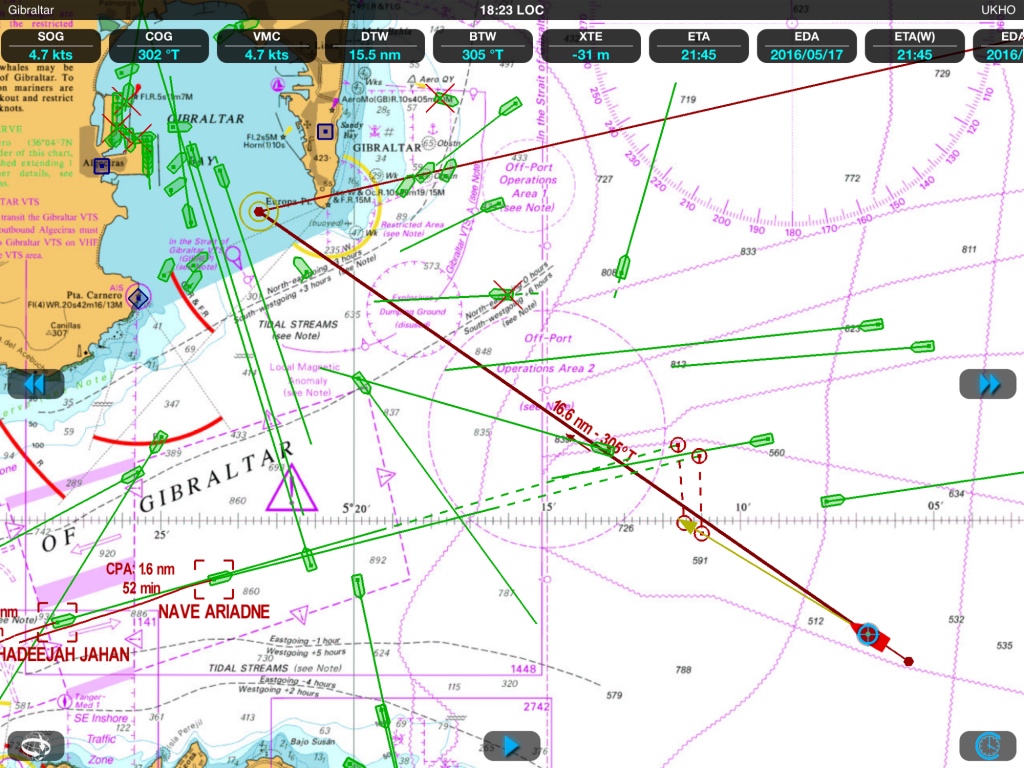
In such a situation, better have a quick diagnosis of the risk of collision ! (Weather4D 2.0)
AIS, VHF/DSC radio and LEDs lights
 The Department of Ecology, Sustainable Development and Energy, published on 4 August a Boating Safety Alert about LEDs bulbs (¹). The text warns boaters on the risks of radio interference found where the VHF antennas are close to navigation lights or bridge lamps equipped with LEDs bulbs. Read more …
The new TimeZero arrived
You remember the launch of TimeZero in June 2013 and the interest aroused among the many users of MaxSea on PC. I then wrote :
MaxSea is already planning future developments of its application. A future major release will likely see connection to external instruments over WiFi, File transfers (waypoints, routes and tracks files) with other applications, perhaps openness to other charting editors
We waited, hoped, and then Pschiiitt ! No more evolution since that date except for a few cosmetic improvements in November 2013 before the Paris Boat Show. No more contact for me with the developers (I was a tester for the beta versions). No more news for a year until rumors reported from the last METS in Amsterdam reporting an ongoing development integrating (finally) AIS, and also WiFi radar DRS4W by Furuno. This has now been done since the 23 th. Read more …
AIS-Wi-Fi transponder less then 590 euros
 Taiwanese society Alltek Marine Electronics, also known by the acronym AMEC, was specialized since 2006 in the design and device manufacturing AIS. In his presentation, AMEC Announcement to have was founded with the aim to provide the best Marine electronics for navigation, communication and Safety. In the pursuit of this goal, AMEC committed to provide AIS solutions to meet customer expectations for the quality, the Performance, values and Services. His solutions are aimed at to commercial vessels, fishing vessels and Pleasure boats. Read more …
When AIS becomes Virtual Aid to Navigation
The acronym " VAtoN " means in English Virtual Aid to Navigation. In French : Virtual assistance to navigation (¹).
This concept is an extension of the AIS system. It allows, by means of a spacific AIS transponder located onshore, managed by an administration software, reporting virtually unreported hazard. The position of these hazards is plotted by an AIS target as an appropriate icon. For example, a buoy indicating a flush rock may have been temporarily destroyed by a storm. The VAtoN compensates for the absence of this mark while the maritime services put it back in place. Another example, creating an exclusion area of prohibited anchorage has not yet been an update on ENC charts. Read more …
ADS-B, aviator's AIS
As I already wrote, in the word “aeronautics” there is “nautical”. This is no coincidence. So much so that for several years the world of aviation has been developing a concept similar to maritime AIS : ADS-B. I also would not be able to say which of the two is the first , it doesn't matter !
As the news that concerns us is a little flat these days – normal in July – I became interested in air navigation when I discovered an iPad application, which I will talk about a little further down.
ADS-B, Automatic Dependent Surveillance-Broadcast, which can be translated as “Diffusion Dependent Automatic Surveillance” is generally based on the same principle as AIS. Only the technical means differ. Read more …
AIS, the second maritime revolution after the GPS
AIS takes a growing place, for two or three years, in the concerns of leisure boaters. Several articles refer to it in this blog, as for equipment as for applications available for our Mac, iPad or iPhone.
Note to neophytes in this subject, or to confirm the knowledge of the most informed of you, it seemed useful to clarify what the AIS means, while just held in Hamburg, the 15 and 16 of June, the international conference AIS Summit. Read more …
iNavX and SiiTech AIS server
![]() iNavX allows you to connect, since version 3.1.7 from February the 11 October 2010, to the data server AIS SiiTech which I talked about in a previous post (¹). The interest of this service remained questionable in France because of the poor coverage of our coasts. That could change.
iNavX allows you to connect, since version 3.1.7 from February the 11 October 2010, to the data server AIS SiiTech which I talked about in a previous post (¹). The interest of this service remained questionable in France because of the poor coverage of our coasts. That could change.
Indeed, the number of SiiTech ground stations is increasing, the Channel coasts are now well covered, and the Atlantic coast should be gradually equipped (²).
In addition, The version 3.2.4 of iNavX comes with an improvement that makes a revival of interest for this feature : it is now available to select the origin point of AIS data from SiiTech server, or the position of the ship (that of the iPhone/iPad used), or a previously created waypoint. The reception radius being about 30 nautical miles around place of origin, this allows for a significant increase in the coverage of AIS data reception.
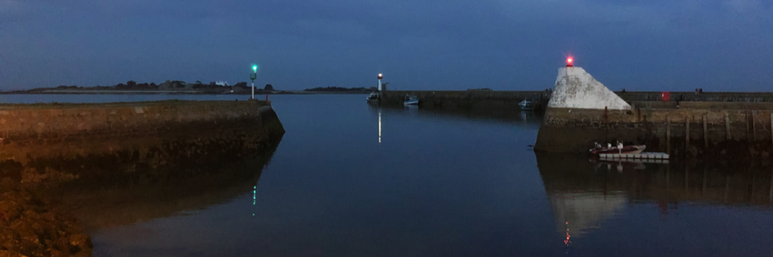
A test onboard with Navigation Mac
During a somewhat sad weekend in January, we joined the port of L'Herbaudière, Isle of Noirmoutier, via the picturesque Gois passage at low tide.
We, that is to say, a boating journalist, my wife and myself.
Welcomed by two “naturals” of the country, Henri and Jean-Etienne. The latter putting his superb Océanis at our disposal 347 for the first on-board test, In France, navigation applications on Mac, iPad and iPhone. A great first, somehow. Read more …