
![]() You dreamed of it since Weather4D Pro has featured its powerful routing module. He did it !
You dreamed of it since Weather4D Pro has featured its powerful routing module. He did it !
Our Toulousian crazy developer, Olivier Bouyssou, just sent Apple a new app : iPolar.
Developed in collaboration with — and on behalf of — KND SailingPerformance, iPolar calculates the performance polars of a sailboat based on specific parameters, Easy to identify : Read more …


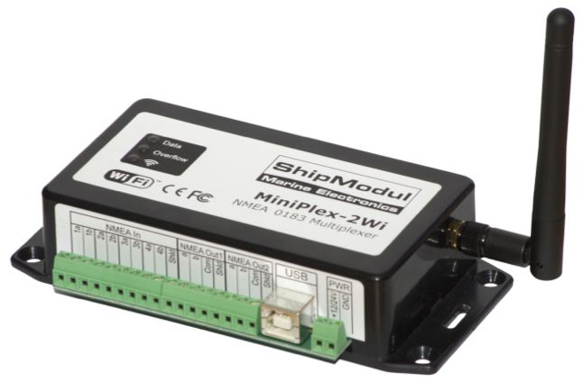 The company ShipModul website has just presented on its website its brand new