During a search on the App Store for my previous post, I found out under the term "Simrad" an application that furiously reminds me of something. From research to research, I discover the company Electric Pocket. This British applications publisher Develops the Mobile Apps from 1997, andrecently the applications Nautical under the name Pocket Mariner. That Company is based in Wales, United Kingdom, and deals with partners from all over the world.
Read more …
Author : Francis
Marine electronics manufacturers and the tablet phenomenon
 A few days before the opening of the Nautic Paris boat show where, I remind him, I will be present on the stand iTabNav (Hall 2.1 – D31), An overview is in order. And precisely, in our immediate horizon we shall have, like every year, proximity to marine electronics manufacturers and their representatives.
At the previous edition of the boat show, I had noticed the reluctance – not to say hostility – of manufacturers towards the growing phenomenon of tablets and other smartphones on the navigation market. By dint of promoting these devices and their applications, I probably didn't just make friends in this business. However, Strong pressure from boat buyers, and therefore navigation electronics, has forced those manufacturers to integrate a minimum of interactivity between their own hardware and the mobile devices now owned by a majority of browsers.
This prompts me to take a quick look at the status of the applications provided and the progress of the proposed functions.
Miniplex-2Wi and Setup Utility for Mac OS X [Update-2]
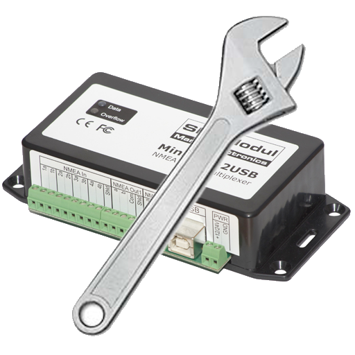 The company ShipModul website has made a Mac OS X version of the configuration utility MPX-Config configuration utility for the multiplexer Miniplex-2Wi
 (¹). It is now available in Downloads section of their website. This utility allows you to make the settings of the multiplexer without going through Windows.
[Update 2/11/2014] MPX-Config V.3.70.0 is compatible with OS 10.10 "Yosemite". He manages the firmware 3.30 and sup. of Miniplex-2Wi. You'll need to connect your Miniplex to a Mac (as Windows PC) with USB cord, after downloading and installing the latest version beforehand, as well as the latest USB driver provided on the ShipModul website (²). You must be connected to the Internet, or in WiFi, either in 3G/4G, in cellular connection sharing if necessary.
iPolar 2.0 and new Weather4D have arrived
 iPolar 2.0 arrives with several improvements, including one expected from the beginning : the possibility of exporting fleeces by email. Done, and moreover the export of fleeces (single or multi-sail) is systematically done in 3 file formats : CSV, TXT and POL. Enough to reuse the fleeces with any application on Mac, PC or other mobile devices.
The dream !
How to update charts with iNavX [Update]
With iNavX, with iPhone like iPad, charts update goes through two processes. It is necessary to distinguish individual charts update, and update full charts folders with a new edition. Read more …
Iridium unifies the use of its mobile devices
 Since the release of Iridium GO! (¹) There were two different pages of subscription (for free) to messaging service, and two applications (iOS/Android) to connect to Iridium devices. Now there is only one application : Iridium Mail & Web app to connect to either the router Optimizer, or to Iridium GO! Read more …
Iridium GO! keeps its promises [Update]
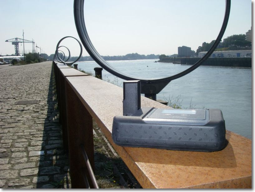
Since its announcement last February, and GO! took a long time to arrive at retailers until the beginning of this month. The company E-SAT gave me one to conduct some tests. Although too late to carry out these tests at sea, the Quai des Antilles on the Ile de Nantes offers a wide sky clearance also than the deck of a boat, enough to connect satellites of all-round. Two types of tests were carried out : requests and receipts of GRIB weather files from an iPad featured with Weather4D PRO app, functions related to telephony from an iPhone.
Routing and usage precautions
With the advent of powerful weather-routing applications on our tablets and smartphones, as Weather4D and SailGrib WR, at truly affordable prices, routing is becoming more popular for pleasure boating. The quality of these applications is already appealing to amateur sailors, and even some high-seas professional riders, but also a growing number of leisure boaters. Riders use the routing in the essential interests of performance, Achieve the fastest route from one point to another, so leisure boaters are more focused on getting safer and more comfortable routes. For them, The notion of speed is mainly used to avoid periods of bad weather, and the optimized route to escape areas where sea and wind conditions can be dangerous. Routing is also used for this : even in powerboating, you may try to avoid too much wind speeds or wave heights to ensure ypur crew comfortable and serene trip. But what credibility can be given to routing ? Read more …
IsatPhone 2 the new satellite phone from Inmarsat [Update-2]
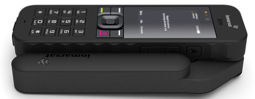 The war is open between the two leading operators worldwide satellite phone. After the announcement of the GO! by Iridium (¹), here is IsatPhone 2 by Inmarsat.
Inmarsat will deliver its new mobile satellite phone on March 24 next. IsatPhone 2 Targets the high-end of the satellite telephony market. Described as "a fine device combined with a feeling of high quality", it has additional options and more features than the previous IsatPhone Pro model (²), such as GPS tracking, an emergency button or the reception of calls with the antenna folded. Read more …
Plea for free European data
This could be a subject of the Baccalaureate in Economic Sciences, and although I never took this exam (because of post-68 incompatibility and Cancerism chronic) The subject seems to me sufficiently imminent and serious to attempt to deal with it, from my modest point of view. Read more …


