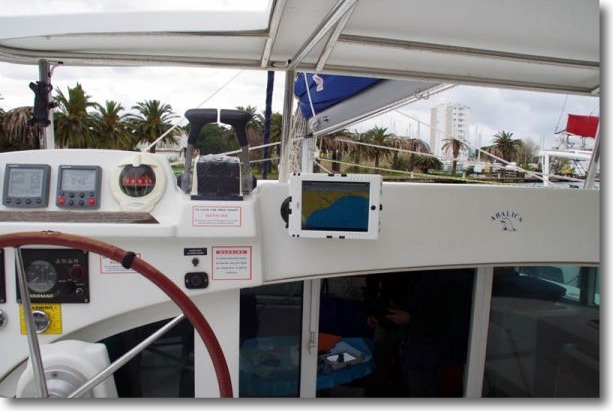
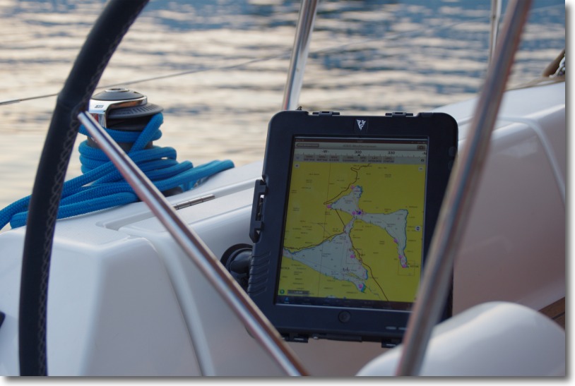
Testimony : Transquadra and Navigation Mac

BluestairsAfter Jean Debèze, avid supporter of Navigation Mac, made me the pleasure of a detailed tutorial about installing a multiplexer aboard his sailboat, here's a ticket by Jacques Vermeulen, who testifies in a very didactic way to his experience during the recent Transquadra, on board "Bluestairs", with the owner and friend Marc Bolla.

Placed at the Transquadra 2011/2012, We met, during the first stage of the Mediterranean Barcelona-Porto Santo (Madeira), problems receiving and sending GRIB and data files via the Iridium network. Email was impossible to use with the Iridium Airtime cards we used. All we were left with was the possibility of calling with the Iridium.

Back after this first stage, I decided to deepen the subject and educate myself with Francis Fustier whom I had knowledge, Until now, than through his blog, really comprehensive. Read more …

Simple and original mount for iPad

Serge Rousseau, A Canadian navigator, sent me some pictures of the installation of his iPad on his sailboat. He wrote me :

"I'm sending you some photos of the support. I fixed an industrial Velcro on the stainless steel tube and I maintain waterproof case (+or- 50 €) with reusable fasteners (Tie Wrap). You can also use a waterproof envelope used to protect the maps in kayaks and secure it with velcro and reustable ties. ”

For a particularly economical solution, I find it simple, clever and aesthetic enough for my own opinion. It's up to you to judge…

NMEA 2000, a network standard of the future

nmea2000NMEA 2000® (¹) is a standard for electronic communication network specifically designed for pleasure boats, according to an industry standard published by the National Marine Electronics Association (NMEA). It aims to meet many needs, arising from the considerable increase of electronic devices onboard, the widespread use of computers and MFDs (²) with control and navigation application more sophisticated. It also aims to interconnect equipment provided by various manufacturers and brands, allowing boat builders and users great freedom in the choice of their navigation instruments. Read more …

Search for charts information data with iNavX

leisureNavionics vector charts contain a number of detailed information for each marina, and sometimes certain anchorages. These places are marked on charts by the symbol shown against.

This data is called "Navaids" when the information relates to navigation, and "POIs" when dealing with practical and interesting information (Point Of Interest, The "s" is the plural). Read more …

Seasmart WiFi connects NMEA network 2000 to your iPad

SeaSmart WiFiMarch, the SeaSmart WiFi, presented by iTabNav.fr at the Nautic de Paris last week, allows a WiFi connection to iPad , iPhone or other computer over WiFi to a NMEA network 2000.

Designed by Chetco Digital Instruments, Brookings, Oregon (USA), SeaSmart is a wireless transmitter NMEA2000 and NMEA0183 compatible consists of an USB/serial gateway, a WiFi transmitter 802.11 b/g and an embedded CGI/AJAX web server. Compatible with web browsers on most smartphones, like iPhone, iPad or Android, SeaSmart.Net translates NMEA 2000 (PGNs) messages through an open protocol in HTML pages updated in real time and sent streaming to web server. The transfer is bi-directional. In addition, NMEA 0183 connector allows to interface instruments that use this protocol, like an AIS, their data being multiplexed and added to the flow of data powered by SeaSmart.net. Read more …

iOS 5 can erase your Navionics charts without warning

Good surprise during the ARC transatlantic 2011.

After transferring photos from my device to my iPad, for an unknown reason the storage memory was full. I had 9GB free and I only transferred the contents of a 2GB SD-Card. Mystery !

Anyway, after two or three system messages warning me of the upcoming saturation, iOS 5 has simply deleted all my Navionics map used by iNavX !

When asked by e-mail, Rich Ray confirmed the fact possible :

"This is an unfortunate change in iOS5, the iOS will and can clear any apps downloaded data without notice if another app needs more space.. iOS doesn't give any notification to the app if this happens".

Olivier Bouyssou told me it was possible for developers to store application data in a folder reserved unerasable, but that this was rarely allowed by Apple. This was a big problem because no one knew how iOS selected which apps it cleared from.

Yachtmen my friends, be prudent : if you do not want to lose your charting during the cruise, away from any network allowing you to download them again, monitor the available space of your iPad and iPhone.

Navigation with iPad trainings : a complete solution

With Weather4D PRO and Iridium Mail, associated with a satellite phone Iridium, we now have a complete solution, reliable and low cost to receive, display and manage GRIB files in open seas with iPad.
iNavX and Navionics cartography also provide a complete navigation solution, supporting files transfers with Weather4D PRO : GRIB, routes, tracks, that allows simultaneous display in both applications.

These solutions, perfectly complementary and consistent with each other, have been tested on more than 2800 NM in the automn during a crossing from Canaria to the Caribbean, on board Catana 47 "Burst", token place in ARC rally 2011. In addition, Olivier Bouyssou was able to improve his Weather4D Pro application "over time", correcting, adding and optimizing daily development onboard. Read more …