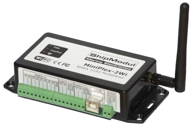
 The company ShipModul website has just presented on its website its brand new WiFi multiplexer, Miniplex-2Wi. The Miniples-2Wi only regards boats owners with NMEA 0183 and/or RAYMARINE SeaTalk instruments. For boats with NMEA 2000, network, refer to the excellent SeaSmart WiFi Recently featured on this blog.
Label : iNavX
Search for charts information data with iNavX
![]() Navionics vector charts contain a number of detailed information for each marina, and sometimes certain anchorages. These places are marked on charts by the symbol shown against.
Navionics vector charts contain a number of detailed information for each marina, and sometimes certain anchorages. These places are marked on charts by the symbol shown against.
This data is called "Navaids" when the information relates to navigation, and "POIs" when dealing with practical and interesting information (Point Of Interest, The "s" is the plural). Read more …
iOS 5 can erase your Navionics charts without warning
Good surprise during the ARC transatlantic 2011.
After transferring photos from my device to my iPad, for an unknown reason the storage memory was full. I had 9GB free and I only transferred the contents of a 2GB SD-Card. Mystery !
Anyway, after two or three system messages warning me of the upcoming saturation, iOS 5 has simply deleted all my Navionics map used by iNavX !
When asked by e-mail, Rich Ray confirmed the fact possible :
"This is an unfortunate change in iOS5, the iOS will and can clear any apps downloaded data without notice if another app needs more space.. iOS doesn't give any notification to the app if this happens".
Olivier Bouyssou told me it was possible for developers to store application data in a folder reserved unerasable, but that this was rarely allowed by Apple. This was a big problem because no one knew how iOS selected which apps it cleared from.
Yachtmen my friends, be prudent : if you do not want to lose your charting during the cruise, away from any network allowing you to download them again, monitor the available space of your iPad and iPhone.
iOS5 and iNavX update
Richard Ray informs us :
I noticed after updating to iOS 5 that all my maps downloaded in iNavX were gone. This happened because the iOS update 5 update requires a full restore of the device and the charts are not stored in the iOS backup (because of iCloud). Let me know if you experience any different operation.
To restore any NOAA charts, Select any NOAA region, then select the Recent filter (looks like a clock), then select "Update Maps".
To restore any charts from X-Traverse (Navionics charts, NV-Verlag, Solteknik, aso.) : Select the folio you want, select "Update Map List", select a map and then "Download all".
If you have any problem with your X-Traverse account, Contact support@x-traverse.com
I am writing from Bourbon Island
S21°20′,64 E55°28′,27 Read more …
Anchorage alarm with iNavX
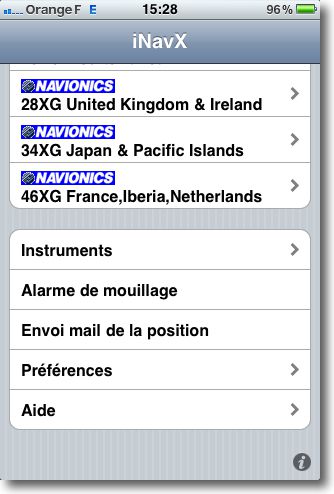
 iNavX offers for a while an "anchor alarm" feature, currently available at the bottom of the application Home page.
This function was frequently criticized as impractical.. iNavX 3.3.0 rectifies the failure in an improvement that makes it particularly clever now fully operational.
The "Anchor Alarm" function allows you to set the radius of a drift circle, with an adjustment from 0,01 NM (19 meters high) down to 0,30 NM (556 meters high) beyond which an alarm (Buzzer) Fires. Read more …
iNavX and the “Man Overboard” function
For a while Rich Ray was asked to add a feature button "Man overboard" in its applications. Recently, following a new topic on the website macsailing.net forum, He gave the following reasons for his refusal :
- Such a button would take up limited/valuable screen real-estate on every screen..
- Such a button , with expected behavior, would be in violation of the " Developer Program License Agreement " :
- 3.3.8 For Applications that use location-based APIs, such Applications may not be designed or marketed for automatic or autonmous control of vehicles, aircraft, or other mechanical devices; dispatch or fleet management; or emergency or life saving purposes. Translation : Concernant les applications utilisant les API basées sur la localisation, ces applications ne doivent pas être conçues ou commercialisées pour le contrôle automatique ou autonome des véhicules, avions, ou tout autre appareil mécanique; la gestion d’envoi ou de flotte; ou dans un but d’urgence ou de sauvegarde de la vie humaine.
An emails exchange between us allowed him to find a compromise respecting the rules imposed by Apple. Read more …
Curious price changes at Navionics
Bad news : changes in the price of Navionics charts for iNavX on iPad have appeared on the site x-traverse.com, and unfortunately for the regions that directly concern us : Region 46XG Europe and 43XG Mediterranean (replacing the previous 23XG 2011) for iPad increase by +13% to $54 down to $61 (either daily exchange 38 € up to 43 € environ).
At the same time, however, Region 28XG British Isles lose -18% to $84 down to $69 (59 € up to 48 € environ). Good news for English browsers, and our fellow citizens who travel the beautiful coastline of the "Perfide Albion".
It remains nonetheless that, after a significant increase in early May with the arrival of editions 2011, it is surprising to see such rapid changes just at the start of the summer season, you'd think the stock rates !
Crossing the Pacific with an iPad
After my first post Crossing the Atlantic with an iPad here are some screenshots provided by Christophe Mahé between Panama and the Marquesas Islands, during his crossing last month. Just to dream a little, and to convince the last recalcitrant about the ability of an iPad to provide a position and trace a route anywhere on the globe. Read more …
iNavX, application steadily increasing
 Since the beginning of the year 2011, not less than six iNavX updates were made by Rich Ray, either one monthly !
If we don't find anything revolutionary there, many “invisible” improvements have been made, as optimizing objects display (waypoints, Icons, tracks, routes, aso), tracks resolution, convenient improvements on measures of distance, waypoints display, chart available information, alarm management (anchor, TCP/IP disconnect), instrument display (Choice of analog or digital). Read more …

