Marine electronics manufacturers and the tablet phenomenon

A few days before the opening of the Nautic Paris boat show where, I remind him, I will be present on the stand iTabNav (Hall 2.1 – D31), An overview is in order. And precisely, in our immediate horizon we shall have, like every year, proximity to marine electronics manufacturers and their representatives.

At the previous edition of the boat show, I had noticed the reluctance – not to say hostility – of manufacturers towards the growing phenomenon of tablets and other smartphones on the navigation market. By dint of promoting these devices and their applications, I probably didn't just make friends in this business. However, Strong pressure from boat buyers, and therefore navigation electronics, has forced those manufacturers to integrate a minimum of interactivity between their own hardware and the mobile devices now owned by a majority of browsers.

This prompts me to take a quick look at the status of the applications provided and the progress of the proposed functions.


Read more …

iPolar 2.0 and new Weather4D have arrived

iPolar 2.0 arrives with several improvements, including one expected from the beginning : the possibility of exporting fleeces by email. Done, and moreover the export of fleeces (single or multi-sail) is systematically done in 3 file formats : CSV, TXT and POL. Enough to reuse the fleeces with any application on Mac, PC or other mobile devices.

The dream !

Read more …

Iridium unifies the use of its mobile devices

Since the release of Iridium GO! (¹) There were two different pages of subscription (for free) to messaging service, and two applications (iOS/Android) to connect to Iridium devices. Now there is only one application : Iridium Mail & Web app to connect to either the router Optimizer, or to Iridium GO! Read more …

A RADAR screen finally on iPad

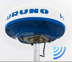
Done ! Furuno annouced on 7 th 2014 until Stockholm Boatshow his new radar DRS4WW comes for WiFi – allowing display on iPad and iPhone. Would be available in May in France. The relevant application DRS4W is available for free on all AppStores.

DRS4W is the first radar that features WiFi to, finally, change iPhone and iPad in a real radar display. After satphones connection, Here are the last bastion of marine electronics that falls. More exactly, a leader in marine electronics finally takes into account the irreversible evolution of consumer technology. Read more …

Apps de navigation : the (rares) new products in Spring 2014

The least I can say, it’s that the new things don’t jostle. After the frenzy of announcements of 2013, the developers seem to be marking time. It is likely that the proliferation of navigation apps should not promote their profitability, and that the financial return on investment in development and maintenance time should not be obtained by everyone. Navionics charts remains the undisputed leader. By creating its new “Boating” formula to complement and/or replace “Marine” (¹) it revives sales which were probably starting to run out of steam. iNavX remains the best-selling independent application in the USA, and the rest of the world through combination with Navionics cartography, and particularly in France thanks… to the strong promotion to which I contribute. Its developer multiplies very regular updates, which ensures good positioning on the AppStore and user satisfaction, despite the questionable ergonomics of certain functions. Read more …

Navionics Boating : Italian at the top of business [Update]

How make the new with the old ? Navionics knows it ! After publishing geographic areas including a navigation application, here is now an application, but without charting. Italian are too much !
Navionics Boating Complements, since January 2014, The App Collection Navy (iPhone) and Marine HD (iPad ). Also available as standard version for iPhone and HD for iPad, Navionics Boating has the same version number 6.0 than others. Navionics point, on the dedicated website page of its website, that Navionics "Boating" does not replace Navionics "Marine" which will continue to be updated. However, it is permissible to wonder for how long, because this new application provides a very bad surprise. Read more …

Weather4D still makes greater finesse

With the basic 1.3.3 and PRO versions 1.3.9 delivered last November, Weather4D had replaced the GRIB files fine grid from Great Circle by its own files based on the U.S. model WRF (¹), computed under his own steam. These files cover Europe, Greece, Canaria, Azores, Greater and Lesser Antilles, offer a resolution of 0.1° (6 NM) up to 96 hours by 1 hour steps. The data provided is the same as the GFS model (¹). At the same time, The annual subscription price has been reduced by 60 down to 30 €.

Thanks to the implementation of new means, the next updates that have just been submitted to Apple Store will provide even more details. Olivier Bouyssou explains :

« FYI, App4Nav uses 6 different servers, 2 for the calculation of WRF model and 4 for distributing GRIBs : 2 for the US+Asia region and 2 for Europe. At this time 8000 GRIBs are distributed per day and triple during the season… ”

This now enables to provide, for the French coasts, including Corsica, ultra-fine grid to 0.04 °, that to say 2,4 NM. It also adds to the GFS and WRF files new data evaluating wind gusts. Read more …

Charting, the game of 7 errors

A recent Thread on the Hisse Et Oh forum, I salute by the way, I challenged the accuracy of the chart data provided on the electronic charts. The subject concerns the observation that, in some location, existing information on the Navionics Marine HD application, or on some chartplotters, are missing on Navionics charts available on the website x-traverse.com used with iNavX (and MacENC). Quote :

"So the question is : Is there a difference between the 46XG map and the Europe map or is the difference due to the software that makes the cards tick?. ”

Damned ! It seemed useful to make comparisons closing electronic charts from various sources. As far as I know particularly well geographic location used in example, since it is the approach to the port of Concarneau, near the beacon tower Le Cochon, passage I borrowed hundreds of times over the years I was working with Glenans Nautical Centre. Read more …

SEAiq professional navigation on iPad

SEAiqA few days before going on a long trip from Toulon to Noumea, my friend Christophe Mahé introduced me to this application which had gone completely unnoticed by me. I sincerely thank him ! As it is never too late to do well, a few discussions with the developer allowed me to install this application on my iPad with all its options. SEAiq went live on the AppStore in April 2012. Its developer, Mark Hayden, is a Californian computer engineer living a good part of his time with his family or alone around the world aboard his Super Maramu, the happy man.

SEAiq Open (¹) is the only application on iPad / iPhone for using vector charts ENC IHO official standards S-52, S-57 and S-63. With information database included in these charts, and update systems , SEAiq transforms the iPad into a real ECDIS (²) professionnal. Read more …